
Looking west to the peaks of Great Basin National Park as part of the Snake Range from a road side stop along US 50--"The loneliest highway in America."

Last weekend I went on a road trip west into the Great Basin. My primary destination was Great Basin National Park with the plan to camp and hike.
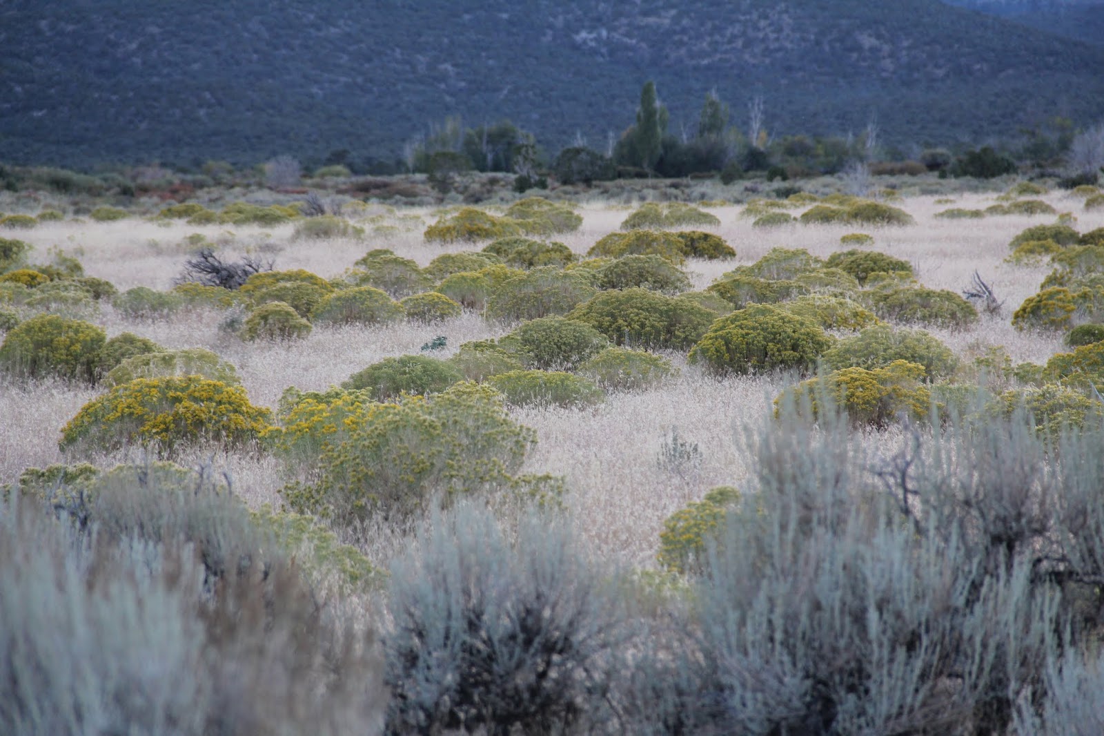
I had just taught about the Great Basin in my world geography class so perhaps that is what inspired my destination choice. None of the rivers in the Great Basin flow to an ocean. They all peter out and disappear in basins or flow into lakes like the Great Salt Lake. The region is also referred to as the Basin and Range region because its landscape is dominated by parallel north-south flowing mountain ranges with dry, sage brush covered basins/valleys in between. To drive the loneliest highway is to drive up and over ranges and through basins over and over again.
Looking east from part way up Wheeler Peak across Snake Valley to the Confusion Range (right) and House Range (left) with Notch Peak.
Aspens provided the only fall color amid all of the evergreens.
Wheeler Peak (right rear)
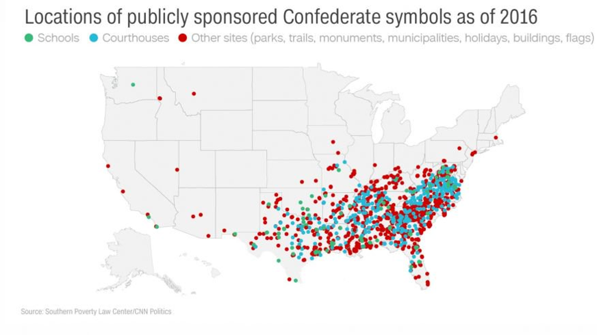
Wheeler Peak on the right and Doso Doyabi (Shoshone for White Mountain) on the left. Up until January of this year Doso Doyabi was know as Jeff Davis Peak. The Nevada State Board of Geographic Names voted to change the name because of its association with the Confederacy and slavery. Learn more here:
https://www.rgj.com/story/life/outdoors/2019/01/07/shoshone-phrase-could-replace-confederate-jeff-davis-name-nevada-peak/2487379002/
That change will render this and the next map in need of updating. Interestingly in both my political geography class and world geography class I have recently referred to the above map in my lectures. I even commented at the time that I was curious to know what confederate symbol was located in eastern Nevada. A few weeks later as I was researching a hike up Wheeler Peak I came across Jeff Davis Peak. I wondered, is that the president of the Confederacy? I googled Jeff Davis Peak and low and behold it was (see the linked article above). Good for Nevada.
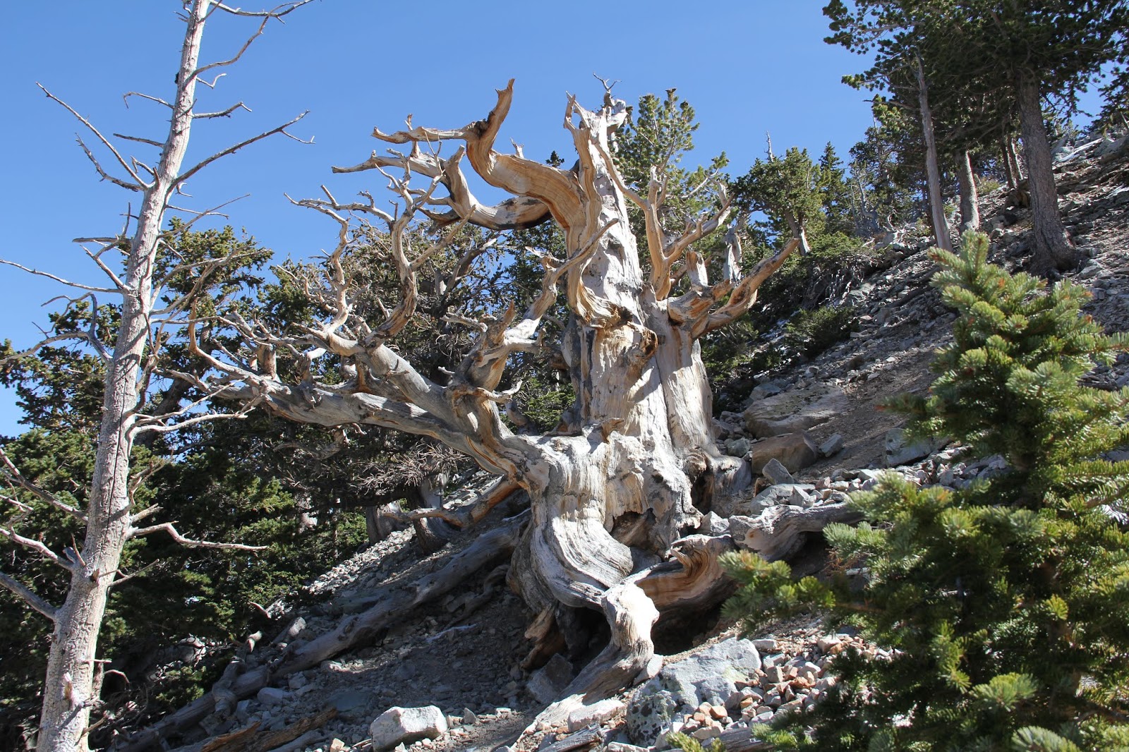
I found a camping spot in Wheeler Peak campground, ate some lunch and then headed out to hike up to the Bristlecone Pine Grove and then up to Rock Glacier. It was a beautiful, sunny, brisk afternoon.
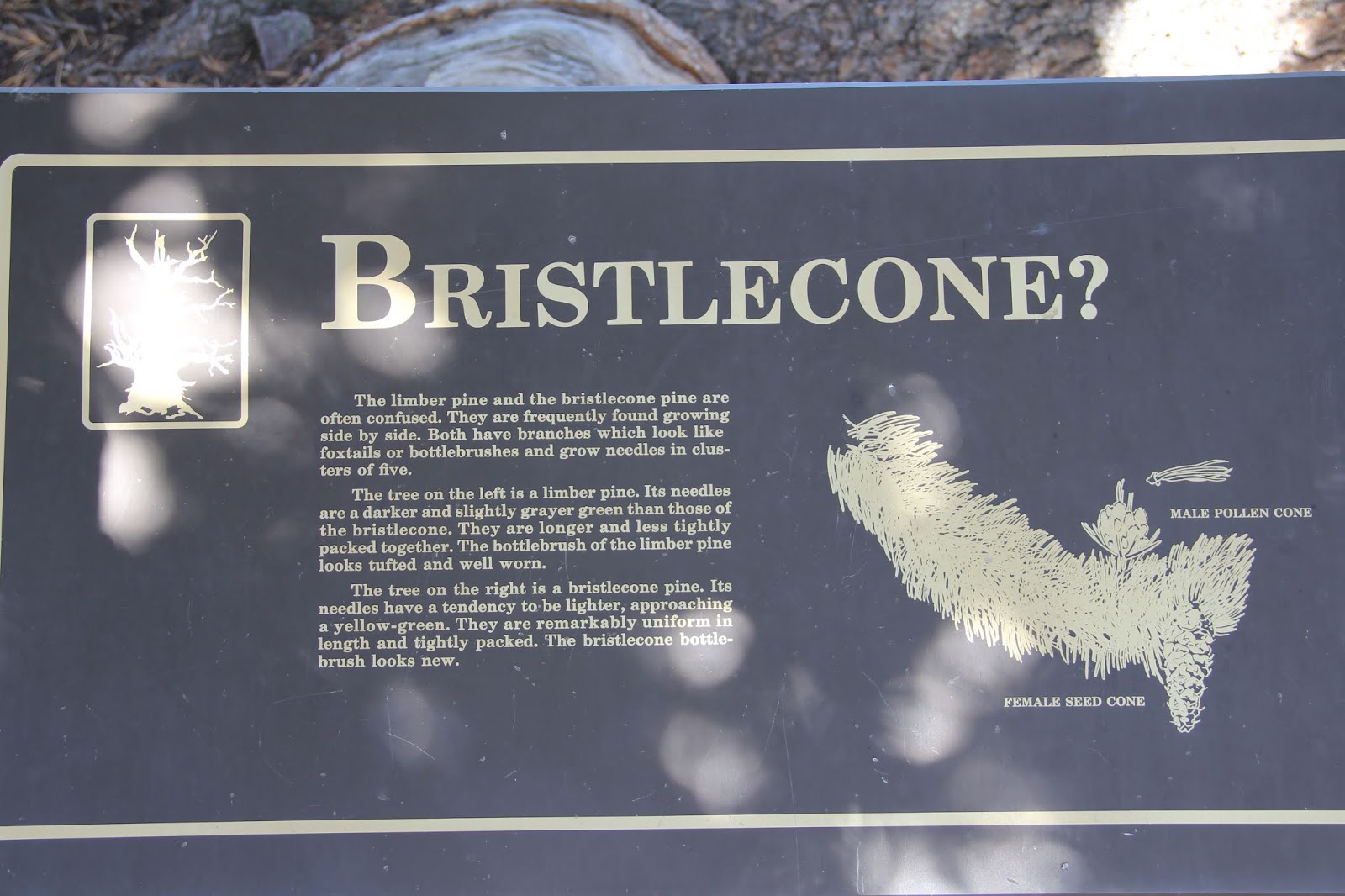
I was intrigued by the resilient bristlecones that over the centuries and millennia have survived, sometimes with just one strip of living bark bringing nourishment to one living branch.
Limber pine of the left and bristlecone pine of the right.
One living branch (on the left)
Dead portions of an ancient trunk on a still living tree.
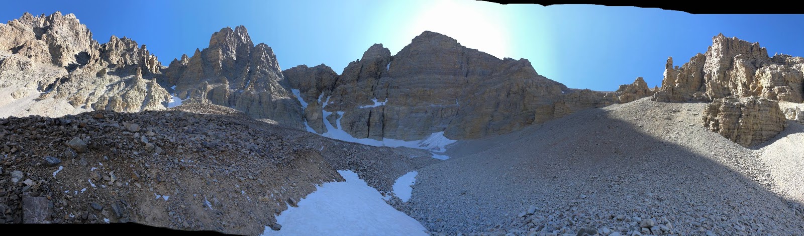
Hiking up through the rocky moraine deposited by a once much larger glacier.
End of the trail.
Only red leaves of this fall day.
Bristlecone cones.
Bristlecone cones.
Took a detour to see Teresa Lake. By now my hiking headache was making me nauseous. I took a second extra stretch Excedrin and headed back to camp.
The view from my campsite.
Turkeys in the Campground.
It was now 6:00 and cold winds were coming in. I had planned for the
cold and had a freeze worthy sleeping bag and a good supply of fire wood in the back of my car, but the
thought of sleeping at 10,000 feet in the freezing cold to then get up early (to
avoid winds that rise later in the day) to climb Wheeler Peak not
knowing if I was up to a second high altitude hike with a significant
gain in elevation just did not seem fun. So I opted for a plan B that had been formulating in my mind on the last segment of the hike. Drive to Ely while drinking a Dr. Pepper (it helped), get some dinner (Subway veggie delight), get a hotel (a new Holiday Inn Express) and then figure out what to do on Sunday and that is what I did.
Notch Peak in the distance and irrigated crop circles on the outskirts of Baker Nevada. I climbed most of Notch Peak a few years ago.
http://beitemmett.blogspot.com/2011/11/notch-peak.html
Looking south towards Wheeler Peak from US 50 climbing up and over the Snake Range.
Spring Valley and Schell Creek Range
Spring Valley south
Spring Valley north.
Wheeler Peak from the west.
Sunset on the Snake Range and Wheeler Peak.

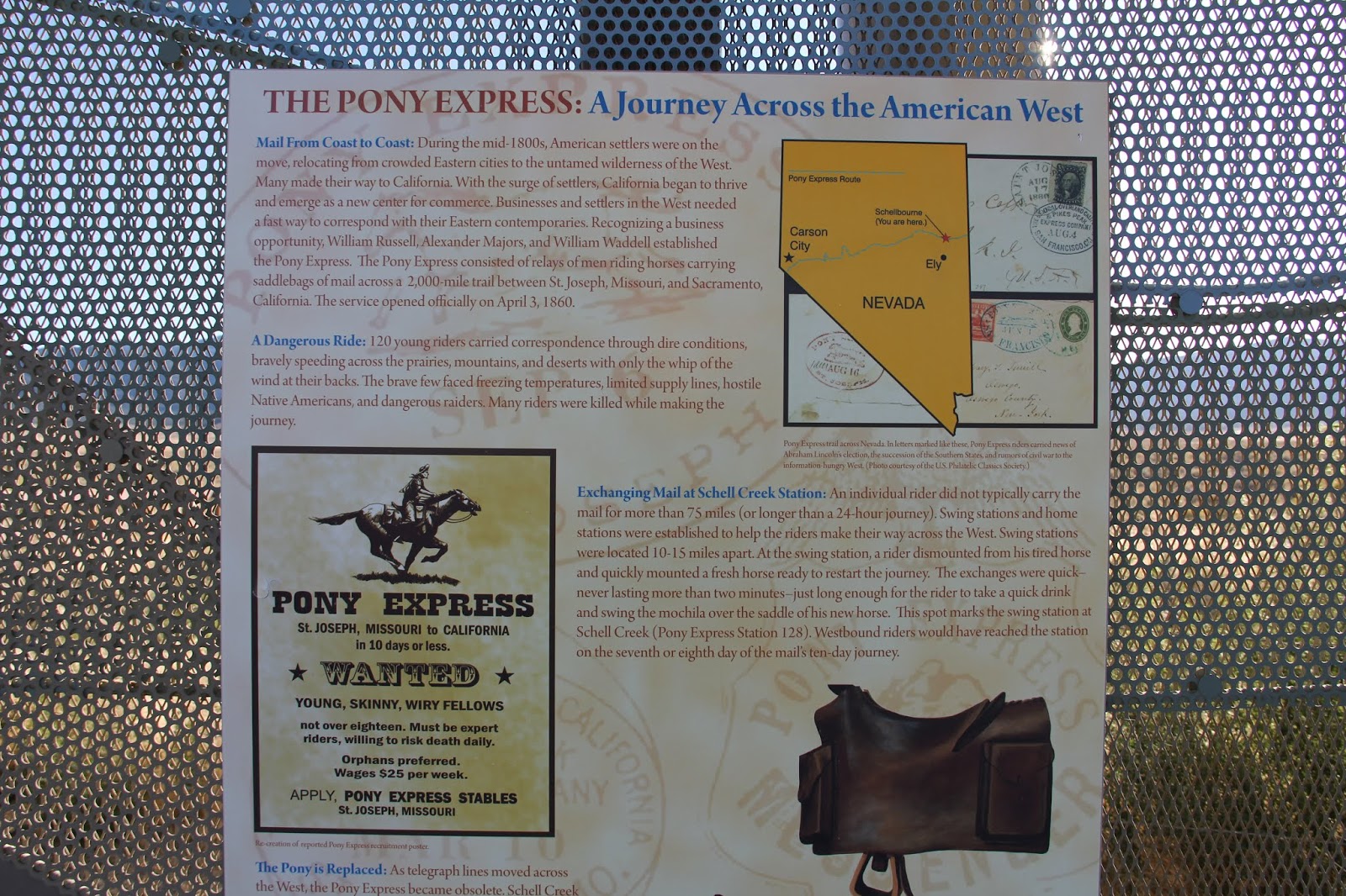
By Sunday morning I had a plan. Drive back to Springville along the Pony Express route
from Schell Creek Station to Lookout Pass Station. I downloaded these two maps on my phone mainly to augment my US road atlas and my Utah road atlas (very helpful).


I drove north from Ely along US 93 (Great Basin Highway) to the junction with White Pine County Road 18. There at a rest and information stop I linked up with the Pony Express Trail
.

From the stop I headed east up and over a pass through the Shell Creek Range
Looking west to the Cherry Creek Range.

Climbing the Schell Creek Range. The buildings of the large ranch (left center) are where the Schell Creek Pony Express station was located.
Schell Creek Pass. Looking east to Antelope Range.
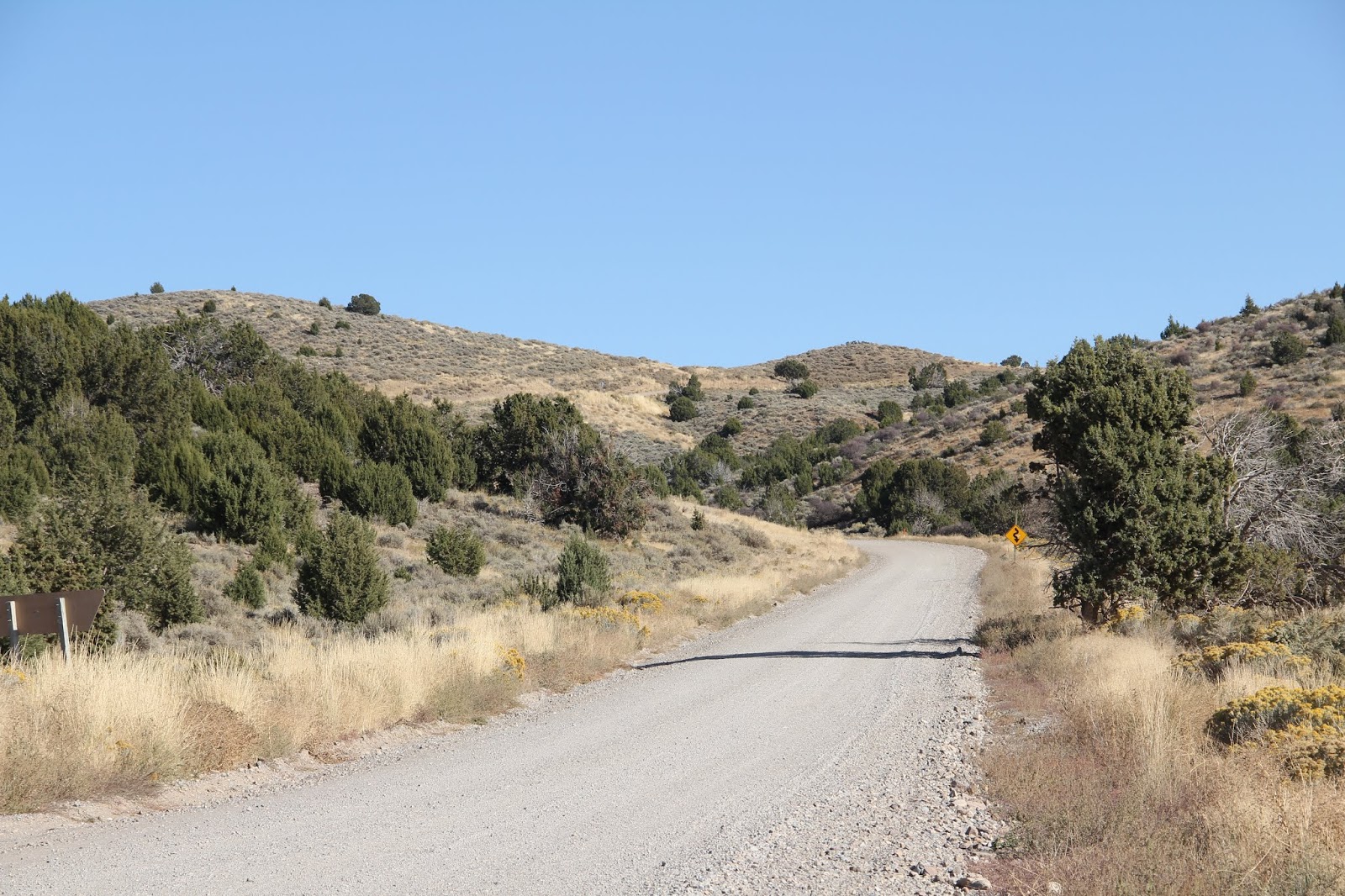
Some sections of the trail were down right fun to drive.
Highest point on the Pony Express Trail.
Happy to see pinon pine (left) and curl leaf mountain mahogany (right) both of which I have growing in my yard.
A rough portion of the road.
Deep Creek Valley and Deep Creek Range.
Crossing into the Goshute Indian Reservation.
The fence demarcates the boundary of the reservation.
No sign on the road of when I crossed into Utah.
Ibapah Utah. Once an important stop for stage coaches, the pony express and the Lincoln Highway but long since by-passed by I-80 and earlier highways running through Wendover to the north.
Elementary School.
LDS Chapel
Town center

Heading east out of town over a low pass on the northern end of the Deep Creek Range.
More fun driving

Looking east across the mud flats of the Great Salt Lake Desert to the Cedar Mountains.

Looking southeastward towards the oasis town of Callao.
It stopped traffic (me).
Six Mile Ranch
Every house and family is noted on the town map.
hay derrick
Willow Spring station in Callao.
Closed elementary school. Children now attend school in equally isolated Trout Creek to the south.
Looking west across Snake Valley to the Deep Creek Range.
Callao with green trees and the Deep Creek Range.
Drove around the north end of the Fish Spring Range to the Fish Springs Flats with its National Wildlife Refuge.
Fish Springs national Wild Life Refuge. Not too many birds this time of year, but I did see another coyote.
Looking west from Black Rock Station across the Fish Spring Flats to the Fish Spring Range with the Deep Creek Range in the distance. The trees are the Wildlife Refuge and the Fish Spring Station.

The climb up to Dugway Pass.
Looking east from Dugway Pass that cuts through the Dugway Range.
Not impressed with gun owners who need to shoot out road signs.
Cedar berries.
Dugway Valley
Simpson Mountains
Climbing to Lookout Pass
Looking east from Lookout Pass down into Rush Valley
Rush Valley and the town of Vernon with the first paved road since Nevada.
Mt. Timpanogos in the distance. From Lookout Pass the Pony Express Route heads northeastward around the northern end of Utah Lake. I have driven that part of the route before so I opted for the faster route home (it was almost dinner time) via Vernon (its paved roads had more pot holes than the whole dirt road route), Eureka and Santaguin. A delightful days drive.


No comments:
Post a Comment