Interesting historical tidbit.
Next morning, I set out to drive the Going-to-the-Sun Road. Last time I traversed this road was as a child on a road trip with my parents, grandparents and siblings. A few years ago, our family visited Glacier in early June when the iconic road was still closed with snow. We happily visited several cool places on the east slope of the park. https://beitemmett.blogspot.com/2018/06/springville-to-glacier.html
GLACIER NATIONAL PARK, MONTANA
I entered the park at St. Mary on the East.
Jackson Glacier
I had hoped to stop at Logan Pass and hike to Hidden Lake but there wasn't a parking place to be found. So, I headed down the western slope with a hike to Avalanche Lake as plan B.
Just in case the bears thought I would be tastier than these berries, I had bear spray at the ready in an outer pouch of my backpack.
From Glacier Montana I drove north across the border into British Columbia. Got a speeding ticket. Stayed in Golden.
GLACIER NATIONAL PARK, BRITISH COLUMBIA
In the past, big hikes for me most always ended with a headache. Caffeinated Dr. Pepper and Excedrin were my remedies. Today, knowing that it would be a big hike day, I decided to try some preventative medicine. I've never been a big soft drink (ie Dr. Pepper) drinker in the morning so when I passed a Tim Horton's I thought--I bet they have coffee (plus a sausage/egg muffin and a wild blueberry muffin). Coffee is a new drink for me. I wasn't sure how to order. Knowing that my occasional Pero drinking over the years worked best with significant sugar and milk I asked for a coffee with extra sugar and cream. The clerk said "oh, a double, double". "Sure" I said. To my surprise and delight, at the end of a long day of hiking, my head was ache free. Same thing on the next two hiking days.

Canada Highway 1--the main east west highway--cuts through Glacier National Park. Parts of the road are protected by avalanche tunnels (more like an inclined roof) that carry the descending snow over the highway.
On the advice of a park ranger, I parked in the Illecillewaet Campground and then hiked the Marion Lake Trail (8) and then the Abbott Ridge Loop (18) but not all of the side spur up to the ridge top. Around 16 kilometers total. It was an excellent choice. From this trail I could look north, east and south and see glaciers.


Howitzer used to shoot down avalanches.
The climb up to Marion Lake was a long steep forested trail of switchbacks.
Every once in a while, the trees opened up to wonderful views.
Home grown and home dried apricots for a snack.
Swiss Glacier to the north.
Mount Sir Donald and Vaux Glacier to the east.
Illecillewaet Glacier (top right)
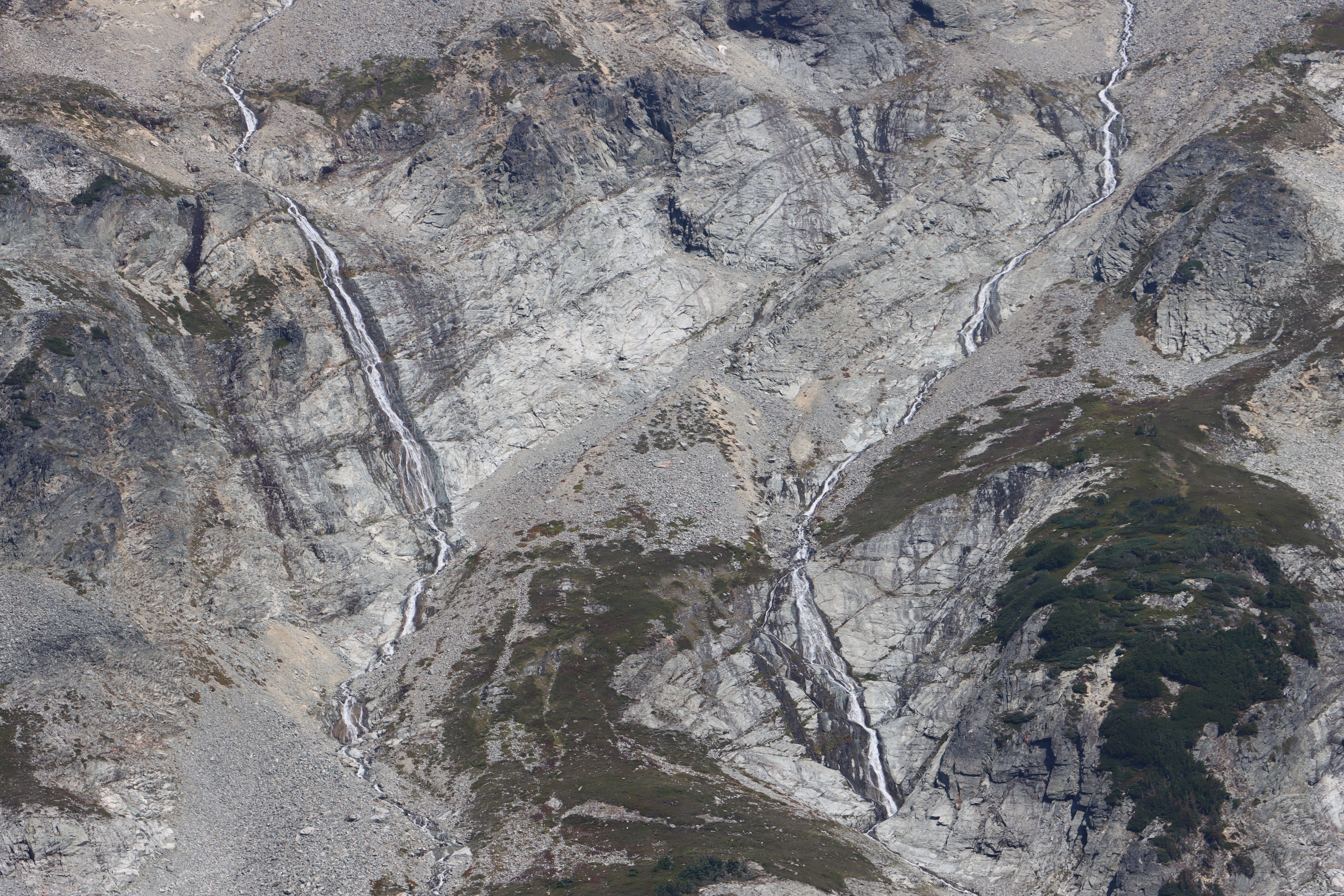
Cascade and waterfall coming off of Illecillewaet Glacier.
Tree line. The hike from Lake Marion to the tree line was like climbing rocky stairs. I had accidentally left my hiking poles at home, but luckily someone had left a nice wood stick at the base of this hike, so I took it along. I had thought I would take the short side of the loop back down, but then a look at the topography on the map convinced me that the longer route was the more gradual route--which would be kinder on my knees. It was a good choice. The farther and lower part of the loop opened up whole new vistas and surprised me with some nice bird sightings.
I ate my lunch on the middle ridge.
The trail goes up to the top of Abbott Ridge, but I went no higher.
Asulkan Glacier
Bonny Glacier and Mt Bonny
The trail cut across this rock field.
A nice terminal moraine (pile of rocks pushed into place by a glacier) at the bottom of the rock field.
I'm guessing the two prominent fins are lateral moraines.
Small owl (perhaps a baby Great Grey Owl) at eye level in a tree alongside the trail.
Spotted this big bird and then watched as it slowly walked toward me. As it walked a group of German hikers came up from behind and watched too.
Spruce Grouse
Combined run off from the whole Illecillewaet Valley
The forested hillside I switchbacked up.
Drove a few miles west to Revelstoke--a cute mountain resort town, that petitioned to have its nearby mountain declared a national park. If my counting is correct this is my ninth Canadian National Park.
MOUNT REVELSTOKE NATIONAL PARK
I love this park because instead a switchback-hike up through the trees, there was a switch back drive up through the trees. From the summit parking lot, I hiked out to Miller Lake and Eva Lake. Ran out of time and legs for the longer hike to the Jade lakes.
Fire lookout.
So fun to watch this weasel cut across the rock field.
A lucky photo. One of my favorites from the trip.
Had some raspberries for a snack.
I then drove a few hours west to the beautiful city of Kamloops. There were still live fires along the way. Loading up with water from the Thompson River.
A recent burn
After delicious Indian fish curry for dinner, I walked around town. Interesting sculpture. The two rivers are the Thompson and the North Thompson.
Fire haze made for a colorful sunset.
VANCOUVER AND POINT ROBERTS
Beautiful morning drive through the forested mountains of British Columbia. Some areas were bright and clear, others still hazy from fires.

Drove into Vancouver. Visited Granville Island where I had fish and chips for lunch.
I then went to the Granville Island Hat Shop which carries a large selection of my favorite hats--Tilley hats.
https://tilley.com/ They are wide brimmed (perfect for a melanoma survivor), washable, comfortable, have a lifetime guarantee and are my hat of choice for travel and hiking. I am now the owner of four of these hats.
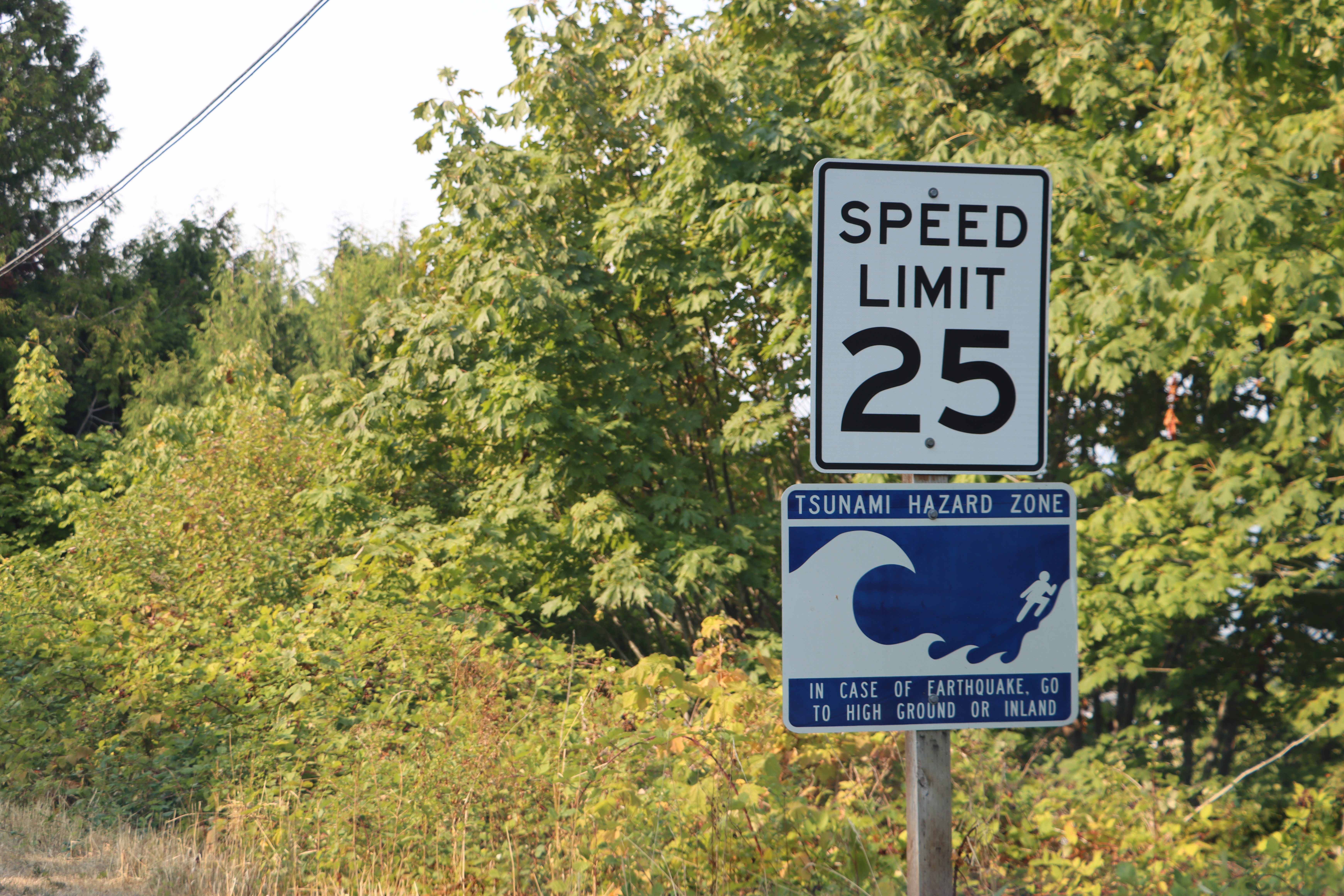
I then turned up my geographer geekness and headed south to the peninsula of Point Roberts--an exclave of the United States and the State of Washington that only has a land connection with British Columbia. I always showed this video about the drawing of the US/Canada border in my political geography class.
https://www.cbc.ca/strombo/news/why-is-the-canada-us-border-where-it-is-and-why-isnt-it-straighter.html When the border was drawn along the 49th parallel, map makers and politicians in the east did not realize that the line would bisect the Point Roberts peninsula. They did realize it would bisect the island of Vancouver and dropped the border south to include all of that island in Canada.
It was an easy border coming and going.
The southwest corner once had a big light house. Now it just has a light on scaffolding.
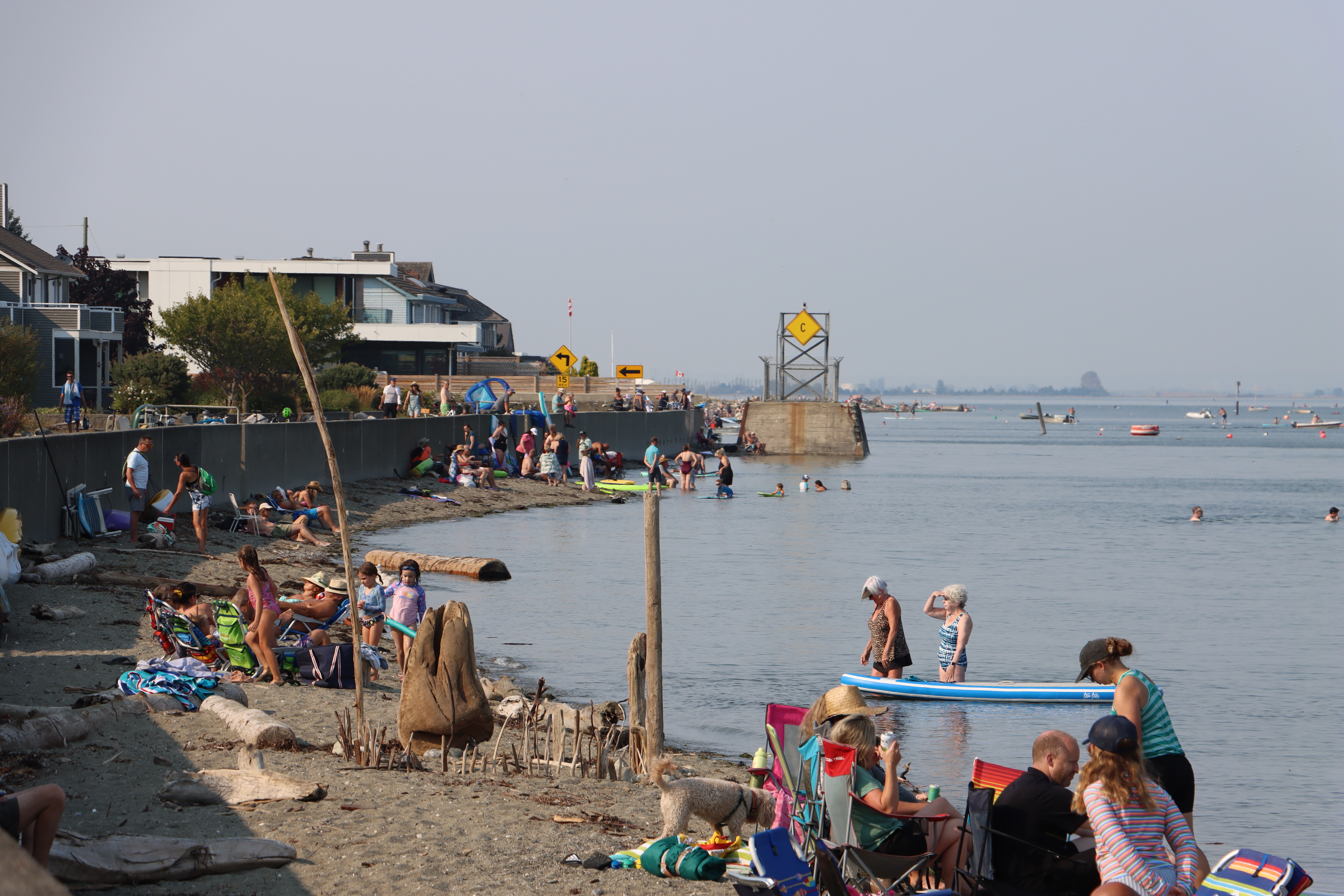
Lots of locals and tourists enjoying the rocky beach.
Looking northwestward to the Canadian ferry terminal for the ferry from Vancouver to Victoria.
The northeast corner of the peninsula looking out on Boundary Bay.
The yellow topped tower makers the border.
The yellow topped marker in the bay also markers the border. The rest of the State of Washingotn is on the far right. It is quite a bus ride for school kids each day.
As the recommendation of some locals, I waded out into the bay to get a photo of the marker and to straddle the border.
The two border markers following the 49th parallel.
Obelisks like this are used to mark the entire border. Clear cut swaths through forested lands also are used to mark the border.
Roosevelt Way follows the 49th parallel. The homes on the left are the United States, the homes to the right are Canada.
Open the gate and walk through to Canada.
Roosevelt Way marks the US side of the border.
Where Rosevelt Way bisects with Tyee Drive and where all the border crossing facilities are located. The tall trees mark the continuation of the border.
The same border marker from Boundary Bay on the Canadian side. I did see one woman paddle board across the border with no passport in hand.
The patio of a Canadian home right on the border.
That night I stayed in a cute little restored hotel in the center of Concrete Washington. I had initially planned to spend a night and more time in Vancouver, but when rain was forecast for Tuesday in the Cascades, I decided to move my Cascade hike up a day.
NORTH CASCADE NATIONAL PARK
This was my first visit to North Cascades National Park. I have now visited 35 National Parks. Route 20 that bisects the park was closed and had been closed for several weeks due to wildfires. While bisecting the park into a northern section and a southern section, route 20 never enters the park. Entry into the park almost always requires a hike or a boat ride. In researching the park, I learned that one of the most popular hikes was up to Cascade Pass in the southwest corner of the park (lower right on the above map). Also exciting was that there was a road (washboardy) that climbed part of the way there.


Watched six of these fowl hunt for food along the trail.
Almost to the top of Cascade Pass.
Once at the pass--the tree covered ridgeline, I decided I had enough energy to climb up to see Doubtful Lake and Sahale Glacier.
Looking down the Stehekin Valley.
Sahale Glacier and Mountain. I did not hike up to the glacier.
Favorite flowers of the trip.
Looking down to the parking lot. Between is the steep forested hillside with it many switchbacks.
My red Subaru is visible on the left end of the parking lot.
Probably about an 8 mile hike. I left my walking stick here for the next forgetful hiker.
Drove to Yakima for the night, then next morning I took a detour via state roads 24 and 240 to see the Hanford Site of the Manhattan project outside of Richland Washington.
Watched a video in the visitor center. It is here that the plutonium was produced for the bombs used on Nagasaki. The reactors (northern portion of the Hanford site) were all located along the Columbia River--a good cooling agent.
Richland High are the Bombers.
With a mushroom cloud used as a part of its mascot imagery.
"Atomic Bowl: Home of Nuclear Bowling"
Lots of wind driving I-84 across Idaho. I smashed into many tumblin' tumbleweeds.
It was a fast, fun road trip. So much beauty in this wonderful world.