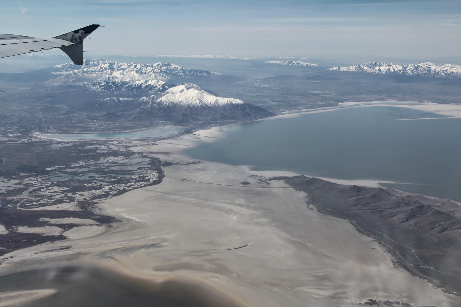
This year the annual Association of American Geographers' conference was held in Tampa Florida. I flew out on Tuesday (the first day of the conference) so that I could teach my Monday classes. BYU travel assumes the everyone prefers an aisle seat. When I confirmed my flight I scrapped those for a window seat. From that seat I could see the dry bed of drought troubled Great Salt Lake with the snow capped Wasatch Front in the distance.
The south end of Great Salt Lake, the south end of Antelope Island (temporarily linked to surrounding land) the north end of the Oquirrh Mountains with the Salt Lake Valley to the east (right) and Tooele Valley to the west.
The Salt Lake Valley with Utah Lake in the distance.
Park City with Deer Valley (right), Park City Ski Area (center) and The Canyons (left).
Park City ski resorts then moving southward the Cottonwood Canyons (with bits of several more ski areas), Mt Timpanogos, Utah Valley and Mt Nebo (top center)
Denver with the front range of the Rockies.
If I ever am in the Denver airport during a tornado I will know where to go.
Pivot irrigation circles in Kansas. The square grids are the result of the US township and range system that neatly divided the US into square mile grids.
Wednesday at the Tampa Convention Center I attended various sessions
and presentations, looked for new textbooks in the exhibit hall and then
presented my paper (It's not the Book of Mormon Musical: How the Mormon
Church has grown in Indonesia) in a session (entitled Connecting the
Social and the Religious, new spaces of Inquiry) sponsored by the
geography of religions and belief systems specialty group.


That
evening I joined with two of my BYU colleagues for a delicious fish
dinner (grouper) and key lime pie at the Hurricane Restaurant on the
Gulf Shore in St. Pete Beach--where we enjoyed a walk and the sunset while waiting our turn.
Next day we three BYU geographers headed out to see what we could find. We didn't want to do any of the theme parks without our families so I suggested we go see Cape Canaveral. It is a two hour drive across the Florida peninsula.We considered taking a tour of the Kennedy Space center but opted to not spend the money. Instead we took a photo of the distant rocket assembly towers.

We also stopped to look at one of the shuttles (Inspiration) in front of the Astronaut Museum. Back in Titusville we stopped at a 7-11 for snacks (dried plantains and dried yucca/cassava chips) and drinks. When paying the nice elderly cashier asked if we had come to see the rocket launch. No we hadn't, but yes we were interested so we asked when and where we should go. Gotta love serendipity when traveling.

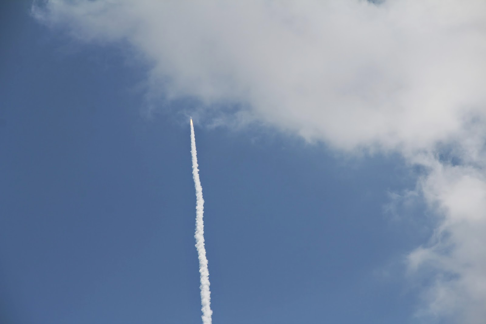
We were directed to this bridge (between Titusville and Merrit Island) where we met some nice and friendly tourists from Scotland/Canada who had more information about place and time. We sat around for an hour then walked up the pedestrian path on the bridge for the 1:45 launch of a spy satellite. It was very cool.
We then drove further east to the Canaveral National Seashore. It borders the Kennedy Space Center to the north. From the beach dune we could see the lightening deflecting antennas of the Space Center.
Playalinda Beach. Natural dunes (not many are left in Florida) covered in stabilizing vegetation.
My travel buddies: Ryan Jensen and Matt Bekker.
Ryan and I took a short swim in surprisingly not-cold-at-all water. Delightful.

Next stop was to look for manatees at the Haulover Canal.We spotted more than a few.

Three manatees.
Two pelicans.
The canal is part of the intercoastal waterway. Having completed two bucket list worthy things (rocket launch and manatee viewing) we then headed back to Tampa where we enjoyed some great Spanish food and more key lime pie at the Columbia restaurant.
Next morning we had a department sponsored breakfast for BYU geography faculty and former students who are now geography professors at other universities. It is always a fun gathering. I then attended an interesting lecture by a geographer who has recently spent time in Ukraine. He had great photos of the protests--a geographer on the barricade.

That afternoon I drove to Lakeland to reconnected with a friend I met in Nazareth back in 1989. Amer Rawashda left Nazareth that same year and is now a US citizen and a barber. We visited while he cut my hair.
On our Wednesday drive back and forth across central Florida via I-4, we saw no citrus groves or any type of agriculture, just a few pastures with grazing cattle. It may have been the route of the interstate, but nonetheless I began to wonder if they really grew oranges in Florida. I therefore decided on this drive to get off the interstate and to head south (US 17) from Lakeland to see if I could find some Florida Citrus. State highway 62 between Bowling Green and Parrish did not disappoint
http://abfla.com/1tocf/agriculture/oranges.html
I also found strawberry fields with what I assume were immigrant workers hard at work.

When I turned off the road and into the parking lot to take more photos, one of the supervisors came over to check me out (maybe thinking I was from the INS or something). I told him I was a geography professor wanting to take photos of Florida agriculture (which I will show when I teach about North America in my world geography class). He was very polite (kept calling me sir) and told me that all they grow are strawberries, that they are shipped all over the eastern US, and that the season was coming to an end.

I then drove westward to the mouth of Tampa Bay which is spanned by I-275.
The bay is much larger than I ever thought.

St. Petersburg in the distance.
I drove over the bridge (twice actually so I could go back and get these photos) to St. Pete where my cousin Carol Dorius Deese (white pants) lives. Her mother Lucy is my dad's oldest sister. She recently had knee surgery so her sister Diane (light blue) came down from DC to help out. I also got to meet Carol's daughter Stephanie (center) and grandson Rique whose father (out of town on business) came to the US from the Dominican Republic to play minor league baseball in Tampa. We enjoyed a delicious Diane cooked dinner and visiting.
Birds of Florida sculpture in the Tampa airport. I particularly liked the pelicans. When I was a boy my grandpa Fife would always ask us grandkids: "Ever hear the story of the Pelican?" He would then proceed to quote this:
Ever hear the story of the pelican?
His beak holds as much as his beli-can
His beak holds enough
To last him a week
And I don't see how the heli-can!
Every time I see pelicans I think of Grandpa Fife.
When I was a boy I gave grandpa Fife this Peli-can garbage can for Christmas. I then inherited it and now Joel uses it in his bedroom.


