
Our research this year is focused on three cities on the south coast of Java--which parallels the deep Java Trench. The first city is Pelabuhanratu--harbor of the queen.

On our way south through the green hills of Java we stopped at the office of BPBD (Badan Penanggulangan Bencana Daerah--Regional Disaster Mitigation Agency) for the regency of Sukabumi. These regional agencies were visited in May by Ron Harris and they committed to help in our research and training. The folks were very welcoming and helpful, plus they had great maps and posters, but when they found out we lacked official support from the police and home affairs ministry, they balked on helping us. We took them to lunch, became Facebook friends, and left hoping it would all work out. Later the next day they consented to let us do our thing and put us in contact with their local administrators.


Map of Pelabuhanratu Bay and the areas along that coast that would be inundated by low, medium and high tsunamis.
 The main fishing harbor.

The Inna Samudra Beach Hotel. Built in 1963 by a Japanese company (that a year earlier built Hotel Indonesia in the center of Jakarta)--which according to the director makes it seismically strong--the ninth floor is a tsunami evacuation zone.

Sunday morning big waves.

I first visited Pelabuhanratu on July 4, 1976 (US Bicentennial Day) with the four elders serving in Bogor. We rode the bus and I still remember seeing along the way many rubber trees for the first time. As dutiful missionaries we obeyed the rules and did not swim, but did wade along the shore. When we arrived salty and sweaty late that day in Bogor, the water to our home/church was not running so we walked down the street to the Siregar home for a much needed mandi (dipper bath). At the time we had heard tales of a drowning a few years early on a missionary outing to the rough south coast. Years later I got the full story which is part of my manuscript for my book to be--Mormons in Indonesia:
"To celebrate Indonesia’s Independence Day on August 17th
1973, the missionaries from Jakarta organized a MIA outing to
Palabuhanratu, a beach on the south shore of Java. The beach is well known for
its strong under currents. Several of the youth in the group went out to play
in the water including a young man (in his twenties) who was not a member of
the church. Some waded out too far and before they realized what was happening
they were floating in water over their heads. Most of the Indonesians were
non-swimmers and so they had a difficult time getting back to shore. Some
started to panic and calls for help reached the missionaries who were playing
Frisbee on the beach. Missionary rules prohibit swimming, but that didn’t stop
four of the elders from swimming out to see if they could help. They were in
their preparation day clothing which for some included thick Levi jeans—not the
best attire for swimming to the rescue. Steven Taylor had ocean swimming
experience and apparently knew enough to swim parallel to the shore until there
was a break in the current. He was able to rescue one of the young women in the
group. Elder David Koch and Matt Hyde were able to reach the young man who was
the farthest out and stay with him, but were unable to get him back to shore
before he slipped from their grasp and drowned. The fourth elder, Russell Snow,
ended up struggling in the current too. Taylor went out a second time to help
him until a small fishing boat small was able to come and rescue a much
relieved Ellsworth. (Russell
Snow interview, April 16, 2011)
Emerging from the danger of the south coast is a Javanese belief that the waters are the home of Nyi Loro Kidul--Queen of the South Sea. The green dressed goddess has mystic powers and is still the object of devotion of Javanese seeking her blessings. Years ago The Inna Samudra Hotel dedicated a room--308-- specifically to Nyi Loro Kidul where she can come and rest. Apparently President Sukarno even came here to seek her sakti (power) and is said to have "married" her as a great coming together of sea and land powers. Nowadays, visitors to the hotel can pay to enter the room for an hour to mediate, pray and make offerings. Some Javanese are intrigued with this tradition, but others are quite spooked by it all. The other night I was visiting with a hotel guest from Malaysia. He had arranged to go see the room and invited me to come along. His Indonesian business partner would not come along and when we asked a few of the Indonesian students in our team if they wanted to join us they declined too saying it was all too mysterious and scary.


No photos allowed.

I dutifully did not take photos, but I did find an Indonesian magazine with this photo of the room. The hotel night manager knelt with us on the rug before the altar and told us all about the goddess. I wouldn't call myself a believer, but those of us who went in sensed it as a place of reverence and devotion. He and the hotel manager (the next day) both told stories of how mystical images appear on photos taken in the area or outlined in clouds. The belief in the queen of the South Sea is an excellent example of the syncretic nature of religion in Java where Muslims have no problem believing in other deities beyond Islam.

A photo of a painting for sale in the hotel gift shop.

On our fist full research day, we met with all of the UVU, BYU and UPN (university in
Jogjakarta) students at 7:30 to divide up into three groups: trenching/auguring
in rice fields to look for tsunami deposits; getting ready for surveys and
presentations (pending BPDP permission) and getting ready for evacuation drills (my task).
I met with the six students assigned to me (three from Indonesia and three from
BYU) to discuss how geographers do field work—go out look and observe. I asked
what they thought we should look for in terms of evacuation routes. We came up
with some ideas and then took one of the vans into town. We found three evacuation
signs and so we dived up into three groups and followed the routes and signs to
see if they led to safety. It was fun (but I lost my lens cap somewhere along
the way—rats). We took photos of routes and signs, pinned maps of sign
locations on our phone maps, measured elevation from our phones, and found the
noted safe destinations of where to go in case of tsunamis. We then identified
12 other tsunami signs and evacuation routes. We followed two more routes
through villages and rice fields on towards the safety of the nearby mountains.
Through it all we learned that this town is pretty prepared with signs and
routes. One student took time off from this last walk so he could join in
Friday prayers at the village mosque. We then stopped at a roadside restaurant where
we had fresh grilled fish, fried squid, two vegetable dishes and rice. Plus
fresh orange juice.

Sign at the harbor: for an earthquake leave the building and find and empty filed. For a tsunami run to high ground.

Nice evacuation signs that point the way, tell how far and list landmarks (hospital, rec center, mountains, parks, government buildings, schools,etc) that are high enough in elevation to be safe.


Saturday our local BPDP contact arranged for us to meet with residents of a desa (village) outside of town. We met in the town hall. About 150 people came to learn about tsunamis. We gave them a pre-test survey to ascertain tsunami knowledge--we found out the survey was too long and complicated so later that day we revised it. While the adults took the survey, our students played with the kids. We then gave out tsunami education presentation. There were the usual complications: electricity went out for 20 minutes, the turquoise wall swallowed most all of the colors of our powerpoint presentation, people kept wanting to takes photos with the foreigners, noisy kids etc.. Our students taught them two fun songs about what to do in an earthquake and a tsunami.

Men sat up front and women in the back, but by the end of the presentation, most of the men had drifted away and the women, who seemed more interested in what was being said, had moved up.


While we were setting up, one nice father came up and asked if he could take a photo of me holding his young son. I was honored. I then asked for a photo with him and his two children. Later this nice man was the one adult who joined with us on the evacuation drill.


After the education presentation, I invited everyone to join with us in a tsunami evacuation drill. To solidify what we had just taught them--if there is an earthquake that lasts longer that 20 seconds (meaning there may be a tsunami) they have 20 minutes to get to an elevation of 20 meters. This village had no marked routes or signs. I asked the local leaders where people should go in case of a tsunami. They mentioned a hill. They described it as far away. I asked if we could go there. They offered to drive me out and around to the hill. I suggested it would be better if we all walked so people would become familiar with the route and the destination. In the end it was only the kids who were willing to brave the mid day sun. We walked through the narrow walkways of the village which soon opened up into rice paddies. The nice father and his piggy-backing daughter led the way. The rice paddy dikes that we walked on are about a foot wide and can be slippery, but even I was able to make it both ways un-toppled.

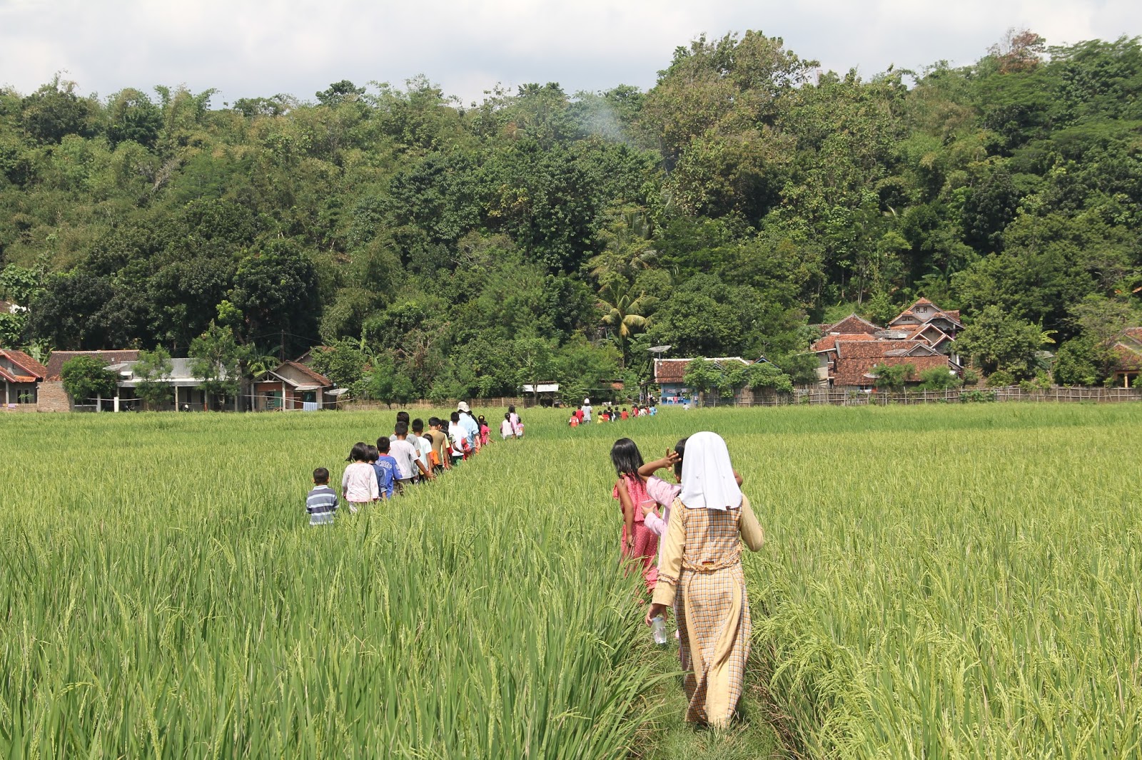

It took us only 15 minutes to walk a little less than a kilometer to the safety of a nearby hill. There we reviewed the three 20s. The kids got it and understood what to do. This was fun and rewarding.

This is a good guy.


Sunday was a non-research day for most of us. We had a short sacrament meeting, I wrote much of this blog, I went to a Padang restaurant (too spicy for many) with the Indonesian students in our group, I walked the beach looking at the rough waves pounding to shore, and I swam in the pool in the rain (very unusual for this time of year--the middle of the dry season--but it has rained almost every afternoon). Later that evening part of our team met with the head (left) of the hotel and restaurant association for the Regency of Sukabumi. He was very nice, but just couldn't grasp that it might be a good idea for hotels along the coast to post evacuation routes and information. He thought it was the duty of the central government.

Monday morning at 9:30 we turned right at this orange evacuation sign and headed up the hill to the Cikakak High School.


At noon we gave our presentation in the karaoke room, to the staff at our hotel and some of the women from the adjoining neighborhood.


Later that day we took a beautiful drive up to the village of Cimaja--a lovely village interlaced with catfish ponds and rice paddies. We taught in a two room pesantren (religious boarding school) which adjoined the central mosque.


Village head on the far right and first niqab (woman in red) that I have seen.

It rained and lightninged so we did not have an evacuation drill, but I did learn that five years ago 1,000 people from the village did practice an evacuation drill.
Tuesday we presented to all of the students (three different sessions) at the Cisolak Middle School and then that afternoon to leaders in the village of Cikakak.We had one practice drill at the school. The children were amazing. This school sits right along the coastal road so it is very vulnerable.


No comments:
Post a Comment