

This summer I’m back in Indonesia with the In Harm’s Way team
of faculty and students from BYU, UVU and UPN (Universitas Pembangunan
Nasional). Funding for our project comes from Geophysicists without Borders. This
year part of our team is surveying, trenching, augering and drone flying along the
coasts of Bali, Lombok and Sumba to find evidence of past tsunamis and to measure past levels
of inundation. We are also conducting interventions in schools where we survey
students about tsunami awareness and teach about preparedness. My main contribution
is to analyze evacuation procedures and routes and when possible to hold
tsunami evacuation drills.
Our first stop was the Island of Bali where we worked in the
area from Denpasar southward. This is a densely populated areas, with a heavy
tourist concentration. It is also very vulnerable—flat and threatened by
tsunamis from both the southwest and southeast. We joined the group a few days
late after the end of the English Summer Camp in Solo.
Saturday morning (July 15), Joel, Isaac and I joined part of
our team for two school presentations.

The first school was an elementary school on the narrow Tanjung Benoa peninsula


While I interviewed school officials about evacuation procedures, the rest of the team taught tsunami principles to the children in part by playing a large tsunami game based on the childhood game of Chutes and Ladders.


In the event of an earthquake and possible tsunami, the children of the school are to head down the street to two large hotels--Novotel and Ion-- which have upper stories that are safe.


While at the Novotel, I asked if there was any effort to ensure the safety of tourists. I was told that the parent company of the hotel requires that all rooms have placards by the doors (above) and brochures explaining what to do in the vent of an emergency. I was hoping to hear that a requirement to provide such information was a provincial or national policy, but not yet.


The second gathering point for the school children. The upper stories of hotels are probably the best and safest place for tourists to go in southern Bali.

Our second stop was at the Kuta Pura High School.


A student identifying the location of the school.


Monday morning we presented at SMP 2 (Junior High) in Denspasar.

Most of the students used their hand phones to take our survey via an Instagram link to a qualtrics survey.


Hindu shrine in the courtyard.


.


The open lower floors let the tsunami waters pass unimpeded. Allowing merchants to use the ground floor for shops helps cut down of vandalism and gives the building a secondary use.


Next stop was High School 6 in Denpasar.

We met with a large goup of students in the third floor of the central building.


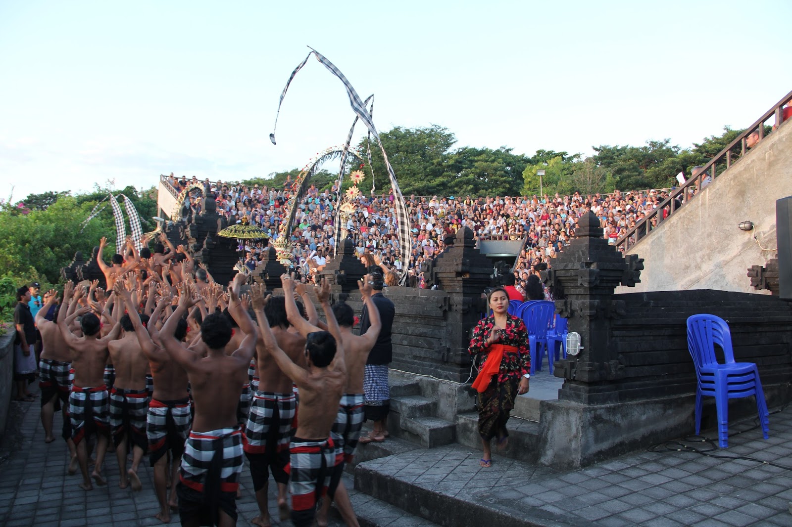
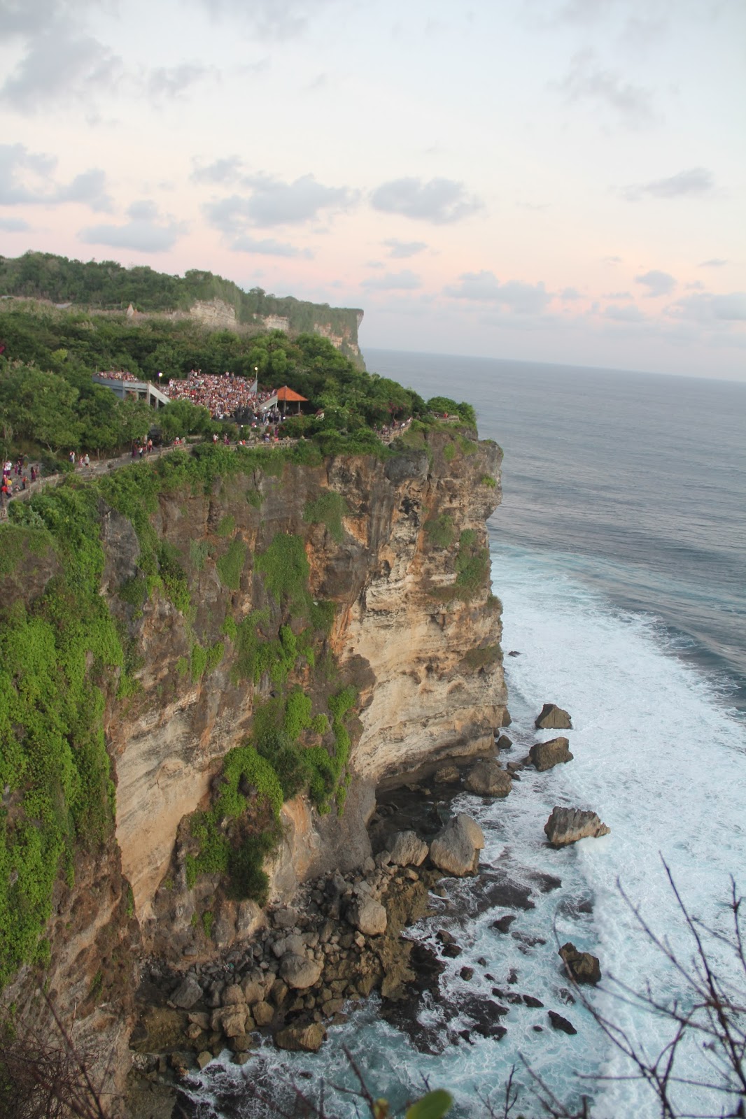
Later that afternoon three of use journeyed to the far west side of the Bukit (Hill) Peninsula to the cliff top shrine of Uluwatu. We handed out surveys as we could at a kecak dance to as many foreign tourists as were willing to help us out. Some were hesitant to pick one up as they neared the ticket gate, but later while in their seats with nothing else to do more decided to fill our the questionnaire. We are wanting to know how informed they are about tsunami causes and safety. We are hoping our study will provide useful data to encourage the tourism industry to make a great effort to inform tourists about tsunami dangers.


No comments:
Post a Comment