This year, Will's Utah Storm Soccer team opted to play in the prestigious Phoenix Presidents Day Tournament. Because of COVID gathering restrictions in Phoenix, the tournament shifted southward to Casa Grande--a 10 hour drive from Springville--where the games were held at Grande Sports World where the Barca Academy is housed (FC Barcelona training school).
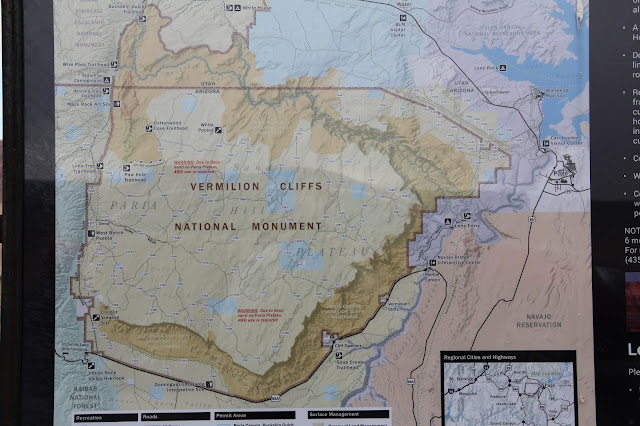
We headed south on Friday morning. First stop was an overlook south of Freedonia that looked north to the aptly named Vermilion Cliffs--which were hidden by the clouds. Looking eastward we could see the remains of a big fire a few years ago.
The Vermilion Cliffs from a different lookout.
We skirted the beautiful southern perimeter of the National Monument.
My motivation in taking US 89A was inspired by my recent reading of the Emerald Mile. It is a delightful book about the history and geography of the Colorado River and the Grand Canyon through the main lens of modern-day river runners but with plenty of side detours to Spanish explorers, John Wesley Powell's runnings of the Green and Colorado Rivers, the building of the Glen Canyon Dam and the 1984 floods that nearly breached the dam and allowed for the Emerald Mile (a wooden dinghy) to make a record breaking run down the turbulent, flood swollen river from Lee's Ferry to Lake Meade.
And so with plenty of warning to Will of a short (only a few miles and 1 hour) detour off the main route, we arrived at Lee's Ferry--located about 30 miles below Glen Canyon and right were the Colorado starts to erode and cut down into the Grand Canyon. I remember crossing nearby Navajo Bridge years ago, but I don't recall ever coming to the ferry site.
Looking upstream.
Downstream with the Vermilion Cliffs on the right/north.
Getting ready to run the river
Amazing how quick the river dropped into Marble Canyon.
I spy a California Condor surveying the river from its bridge perch!
In order to stave off extinction, most of these condors were bread and raised in captivity and then released in the Vermilion Cliffs area to mate and hopefully flourish. One friendly couple said they had seen eight condors catching updrafts off the bridge earlier in the day. Only #44 remained for us to see.
Next afternoon between games, Marie and I ventured to the Casa Grande National Monument. Never heard of it until I started looking in my new Arizona Road Atlas for places to visit when not soccer spectating.
Surprised to learn that long before the Mormon pioneers started irrigating the upper Gila River Valley (Safford, Pima, Thatcher) the Sonoran Desert peoples had mastered the art of diverting Gila River water to irrigate crops.
Driving out to the ruins we passed many fallow fields sprinkled with cotton remnants from last year's harvest. This cotton--an ancient crop that is still grown in the area, was strapped to the above sign.
Sunday Morning I headed west on I-8 for 30 miles and then turned south into the southern section of the Sonoran Desert National Monument. It was a fun little adventure.
Drove through lots of dry washes.
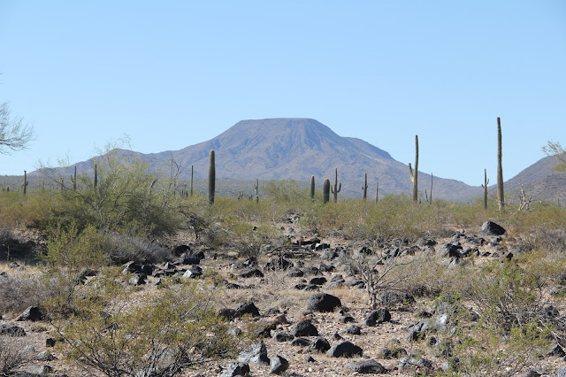
Table Top Mountain, If I had had more time I would have explored closer.
Table Top Mt from my return along I-8.
Will's team went 3-1 in the tournament with two games on both Saturday and Sunday.
Lining up for a free kick.
Will (nearly hidden by two players in white) breaking to go in for any follow up opportunities to shoot.
Quick Will was there for a ricocheted ball, but the goalie wanted nothing of it and came at the ball and Will with cleats up. One cleat bottom hit Will hard below the shin guard and took him painfully down.
He was back in the game a short time later.
Nice crescent moon in the western sky. While most of the US was in a deep freeze of snow we were enjoying 70 degree days and 50 degree evenings
Excellent cross to a header (below) and the first tournament goal for the team--only to have it called back for off sides by an earlier pass. A later goal gave Storm this first win.
The one positive side to not advancing in the tournament was that the team did not play on Monday. That meant we could start home in the morning which luckily got us back to Springville by 8:00 pm just as the snow really started to pick up. While Will slept and Marie cross stitched, I enjoyed the dive northward across very distinct vegetation belts. I loved going from the scrub of the Sonora, up through the saguaro cacti forests north of Phoenix, then cedar and pinon forest followed by the pine and firs around Flagstaff. We then dropped down into more desert scrub and colorful rocks of the Navajo reservation. As we passed through Maricopa County and the Navajo reservation I was reminded how important these two sections of Arizona were in helping Biden to win such a strategic swing state.
I had identified several possible stops--mostly National Monuments--along the way for more exploring, but our only stops (other than the one planned stop at the dam) were gas in Flagstaff and lunch in Page where during both stops we were able to visit with Joel for his end of P-day weekly call from Ghana.
Scenic view looking down on Marble Canyon below Navajo Bridge.
More of the Colorado gorge.
Scattered homes of the Navajo Nation. We passed several signs and Billboards along the way with COVID 19 precautionary reminders for this hard hit corner of the US.
The View of Glen Canyon Dam and Bridge from Page.
I was delighted to happen by this most excellent view area of the dam and river. More reminders of the Emerald Mile that documented the strain the flood waters of 1984 flood placed on this dam and the two flood release tunnels cut through the red rock on both sides of the dam.
1984. Full to brimming Lake Powell and flood gates wide open. (source: Wikipedia)
View from the bridge.
The white ring indicates how high the reservoir has reached in the past.


No comments:
Post a Comment