Monday, June 10, 2019

New Territory and Back Roads


Last Saturday I decided to do a mini road trip to towns, roads and regions of Utah I have yet to visit. My main objective was to drive I-70 from Salina to the Goblin Valley turnoff--the one section of Utah's interstate highways that I have never traversed. To do so I drove a big Triangle. I headed out at 7:15 driving south on I-15--with stops along the way at the never visited towns of Holden, Meadow, and Kanosh--to the western terminus of I-70 at Cove Fort. Then I headed east on I-70 with a side drive down Clear Creek Canyon Road (State Highway 4), a nice visit at the Fremont Indian Sate Park (a first for me), a visit to Monroe, lunch in Richfield, gas and Dr. Pepper in Salina, and then another side trip north to isolated Emery via Utah Highway 10 and back to the interstate along Miller Canyon Road (county road 912), and then across the San Rafael Swell (with three impressive rest stops offering great views and areas to explore) to the junction with Utah Highway 6 near Green River. From there I drove a familiar route northwestward along US 6 back home to Springville. 


Holden is a well cared for town with lovely yards and old homes. It is just west of the Freeway but is hidden from view by low hills.


At the corner of 300 N and 100 E.


Love the smell and look of these familiar rose bushes in the city park. I grew up thinning out and pruning orange rose bushes like this in our back yard.


Main Street in Meadow.

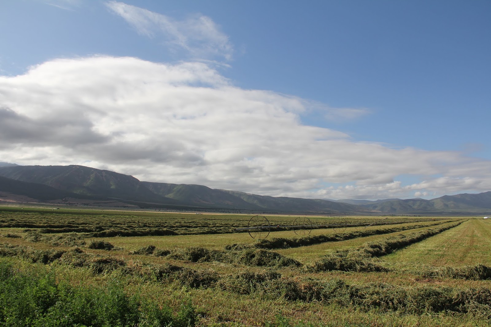
Fresh mowed alfalfa between Meadow and Kanosh.


Paiute Reservation just north of Kanosh.


There were about a dozen homes along one road (lined by a few trees) on this small reservation, plus a community health center and a nice park.


I was interested to see the Paiute language in use.


The Tithing Office on Main Street.


Kanosh Mercantile. What can't be found here might be found up the road 15 miles in Fillmore. If it's a Walmart you need then your closest options are in Richfield 64 miles to the east, Cedar City 97 miles to the south or Payson 100 miles to the north.


Kanosh from the west.

Black Rock Volcano to the west of town. I drove out to see about climbing to the top. I ended up not climbing but it was interesting to see the large volcanic rock quarry on the south end of the mountain.


Black Rock Volcano (from the south) hides seeing Kanosh from the freeway. For years I have wanted to get off the freeway and go see Kanosh. I finally did.


I-15 with Tabernacle Hill (center) and Tabernacle Crater (to the left of the domed hill) with a cinder cone core protruding up from the center of the crater. To read about our family's visit to that volcanic feature go to this blog post: http://beitemmett.blogspot.com/2017/10/topaz-and-black-rock.html
 

Clear Creek was running full and muddy.


Newspaper Rock

Cropped close-up of Newspaper Rock. Hiking up to the site is no longer allowed. Perhpas because people like MIKE think it is cool to deface this ancient art.

Drawing of Newspaper Rock.

I hiked the Alma Christensen trail. My Subaru and I-70 below.


Lizard


 I-70 with the snow covered Tushar Range in the distance.

 Bumblebee


 Delightful fragrance and another bumblebee.


Parade of Rock Art trail.


Unusual to see deer in the petroglyphs and not just the usual big horn sheep.

Two people. The one on the right may be a floating deity.

A short hike under I-70 and across Clear Creek to 100 Hands Cave which really is just an over hang with 31 hand prints--pictographs.


From a view point on the north side of the canyon you can see the large and impressive Indian Blanket (center).


At Sheep Shelter the images of sheep are on the inside upper portion of the outside wall. Since grating has been put in place to prevent defacing and graffiti, a mirror has been installed so that visitors can sort of see the sheep.


Monroe in the Sevier River Valley. SS white letters are on the hillside above town for South Sevier High School.

Looking northeastward across the fertile Sevier River Valley towards Richfield.

SS letters between the two buildings.


More yellow roses.


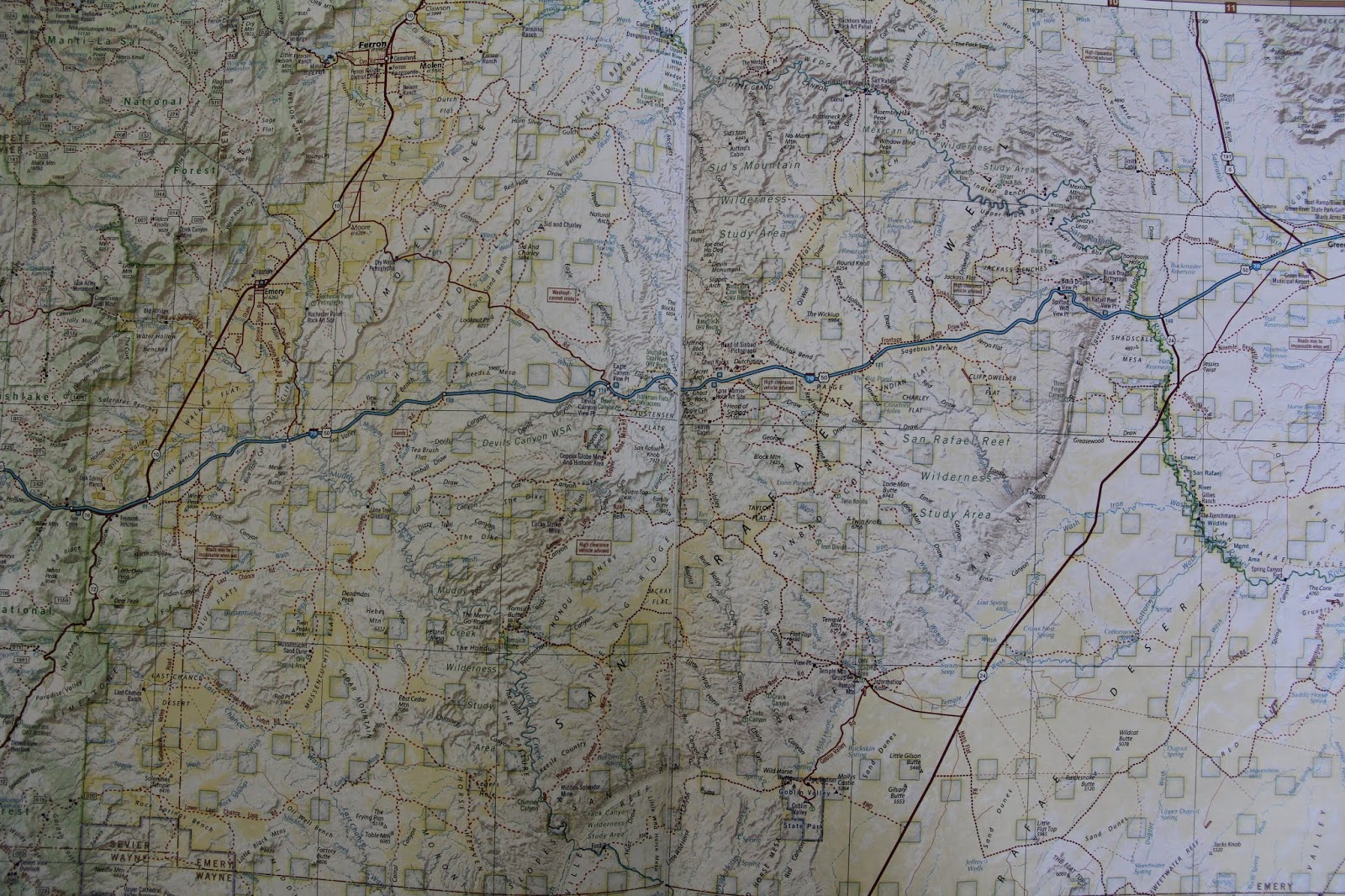
The road never traveled: I-70 (in blue) between Salina (left, off the map) and the road to Goblin Valley (right, red road heading south on the east side of the map).


Old and new church steeples.


Along Miller Canyon Road.


Don't know its name but it could be a Utah Sphinx.


source: https://www.lemkeclimbs.com/san-rafael-swell.html

First I-70 rest stop. Looking south.


Looking northwestward.


Looking southeastward towards Goblin Valley.

Rest Stop 2. Devil's Canyon Viewpoint.

San Rafael Knob.

Devil's Canyon


Ghost Rock Rest Stop. Looking northwestward towards the southern end of the Wasatch Mountains. The towns of Emery, Ferron, Castledale and others sit at the east base of this range in what is known as Castle Valley. The San Rafael Swell then extends eastward from these towns. The San Rafael River runs through this area. One summer the geography faculty canoed down this river and then the boys and I have camped at the Wedge Overlook that looks down from the north rim into the Little Grand Canyon carved by the San Rafael River.  For images of our visit to he Wedge see this blog post: http://beitemmett.blogspot.com/2013/11/the-wedge.html


I-70 heading eastward from Ghost Rock. Lots of rain this spring has made for a very green desert.

Chimney Rock

The view northward from up on Ghost Rock.


Ghost Rock


San Rafael Reef was quite an impediment to travel across this region. Eventually Spotted Wolf canyon was blasted wider so I-70 could be built.


Looking east towards Green River.


Got home in time to go watch the Art City Days fireworks show with Marie and Will. 

Sunday, June 9, 2019

SHS: Matthew 26; Mark 14: Luke 22; John 18

Matthew 28:
36 Then cometh Jesus with them unto a place called Gethsemane, and saith unto the disciples, Sit ye here, while I go and pray yonder.

 
An olive grove on the Mt of Olives near the traditional site of Gethsemane and just below the lower entrance to the Orson Hyde garden. This photo is during the spring/Passover season and for me represents how things may have looked when Jesus came to the "place of the olive press" (Gethsemane) to atone for our sins.


For many more images and thoughts about Gethsemane and the Atonement please see this blog post: http://beitemmett.blogspot.com/2009/10/olive-press.html

Also see this wonderful talk by Truman Madsen about the symbolism of Gethsemane, olives and the Olive Press:  https://speeches.byu.edu/talks/truman-g-madsen_olive-press/


Olive press.

 The traditional site of Gethsemane with some very very old olive trees.


57 And they that had laid hold on Jesus led him away to Caiaphas the high priest, where the scribes and the elders were assembled.


Roman era stone steps leading from the Kidron Valley up to the western slopes of Jerusalem. It is very likely that Jesus would have taken these stairs leaving from the Upper Room and then being brought back to be tried by Ciaphas.

 "I walked today where Jesus walked."


For more images about the Kidron Valley, Gethsemane and the Trail of Jesus before the Sanhedrin see this blog post:
http://beitemmett.blogspot.com/2013/03/holy-week-thursday.html

Sunday, June 2, 2019

SHS: John 13-17

John 13:
5 After that he poureth water into a basin, and began to wash the disciples’ feet, and to wipe them with the towel wherewith he was girded.

 From the Syrian Orthodox Church in Jerusalem

John 13:
38 Jesus answered him, Wilt thou lay down thy life for my sake? Verily, verily, I say unto thee, The cock shall not crow, till thou hast denied me thrice.

Door from the Church of St. Peter in Gallicantu showing the Last Supper in which Jesus in blue is identifying Peter in red as the one who will deny him.

John 14:
27 PeaceI leave with you, my peace I give unto you: not as the world giveth, give I unto you. Let not your heart be troubled neither let it be afraid.

 From the beautiful gardens at the Garden Tomb.

Here are my thoughts from a few years back about the Israeli/Palestinian Conflict and what I think should be done to bring about political peace:

http://beitemmett.blogspot.com/2014/07/the-israelipalestinian-conflict-my-view.html

John 15:
1 I am the true vine, and my Father is the husbandman.
2 Every branch in me that beareth not fruit he taketh away: and every branch that beareth fruit, he purgeth  it, that it may bring forth more fruit.
3 Now ye are clean through the word which I have spoken unto you.
4 Abide in me, and I in you. As the branch cannot bear fruit of itself, except it abide in the vine; no more can ye, except ye abide in me.
5 I am the vine, ye are the branches: He that abideth in me, and I in him, the same bringeth forth much fruit: for without me ye can do nothing.

Thick vine, new branches and ripening fruit in Bethany. 

 Non-trellised vines in a Palestinian vineyard south of Bethlehem (1982).

More untrellised vines south of Bethlehem. Noticed the terraces of vines in the distance.

Impressive three story vine whose branches provide roof top shade in the Armenian Quarter of Jerusalem. 

John 15:
12 This is my commandment, That ye love one another, as I have loved  you.

Sunday in Cape Town (2015)

Here is a blog post from 2015 in which I lament the lack of love and peace in the world today: