Yesterday in an epic 13 hour drive we circumambulated the Great Salt Lake looking at a variety of man-made wonders.
The first big wonder was Metaphor: the Tree of Utah (aka the Tree of Life) created by Swedish artist Karl Momen. It was dedicated in 1986. There is no exit and no frontage road access so the only way to see it while not traveling 80 mph on west bound I-80 is to pull off of I-80. I imagined us pulling off to the the side shoulder for a quick photo but happily there was room for a dozen or so cars to safely park well off of the freeway

 Bird's nest in the tree.


The globes are covered with Utah rocks and minerals.


 Looking north across the salt flats


Utah Tree lower right. Sun Tunnels upper left. We traveled via I-80 to Wendover (gassed up) and then followed the TL Bar Ranch Road north to the tunnels.

There are no well marked directions to get to the tunnels--we passed a few sign posts, but no signs for the south approach remain. I had read a few directions on line so had a general idea of how to get there. Sarah was driving at the time so I knew from looking at the Utah Road Atlas when we were almost there once we passed Lion Mountain. I took this photo thinking the structure in the center might be the tunnels, but now I realize that the tunnels show up in the far right center of the photo.
 The tunnels show up better in this zoomed in and cropped photo. It is pretty much in the middle of no where.
 Sun Tunnels. Created by Nancy Holt in 1976.
"Nancy Holt, an artist exploring the human perception of time and space, earth and sky, built the Sun Tunnels as a unique art project completed in 1976. The four tunnels are concrete tubes laid out in an X shape, each drilled with holes to pattern the constellations of Draco, Perseus, Columbia, and Capricorn. They are massive - nine feet high by 18 feet long....Holt has said her tunnels bring the sky down to earth, with the dazzling effect of light bouncing through the tubes. Two of the tunnels align with the setting and rising sun during the summer solstice and two line up during the winter solstice."
https://utah.com/wendover/sun-tunnels


 Looking to the southeast
 The view south to the Pilot Range. Our drive north from Wendover paralleled the east side of the mountains. Lion Mountain is in the foreground.


 photo by Will
 View from the east.

 photo by Joel
 photo by Joel
 photo by Sarah
 photo by Joel
 photo by Sarah.
 photo by Sarah
We are happy to have Joel with us during his mission intermission. He was evacuated home from his mission in Ghana on March 26 and will leave of June 15 for a "temporary' reassignment to the Manchester New Hampshire mission.
 photo by Joel
 photo by Joel

This group was chllin' in the northwest tube the whole time we were there. I wanted to ask them to take a photo of our family, but Marie nixed that non proper social distancing idea.

The Spiral Jetty is the work of Robert Smithson (whose wife Nancy Holt built the sun tunnels after her husband passed away--creating landscape art bookends on either side of the Great Salt Lake). It was constructed of basalt rock in 1970. At times it has been submerged completely by the lake. Five years ago when we first visited the lake level was much lower that this visit.
Here is a link to our first visit: http://beitemmett.blogspot.com/2015/11/spiral-jetty-and-bear-river-bird-refuge.html


photo by Joel


In our drive we also traversed and/or crossed many man-made thoroughfares across the inhospitable desert.
Our first stop of the day was at Fairfield Utah which was an important stop for Stage Coaches and the Pony Express. It was also the site of Camp Floyd--built by the Federal Government to keep those pesky Mormons in line.


From Fairfield we passed two more pony express stops meaning I have now driven the length of the route from the Shell Creek Station in Nevada to the Fairfield Station. For more of my travels on the westward continuation of the Pony Express trail (and Lincoln Highway) see this blog post: http://beitemmett.blogspot.com/2019/10/great-basin-national-park-and-pony.html


The first trans-continental Lincoln Highway was another amazing man-made feat.

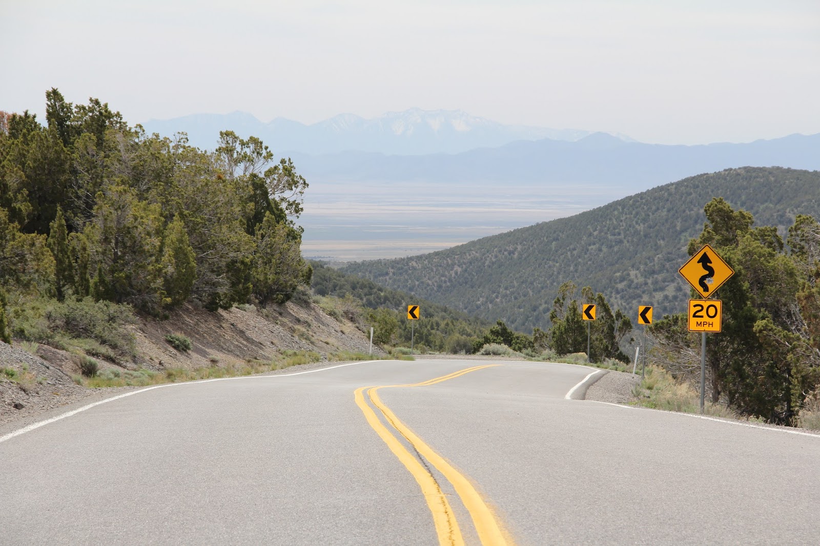
 The original route of the Lincoln Highway (now Utah highway 199) over Fisher Pass.


Driving north through Skull Valley we visited Iospea (Hawaiian for Joseph) the site where native Hawaiian converts to The Church of Jesus Christ of Latter-day Saints were encouraged to settle when then emigrated Utah in 1889 to be near a temple. For three decades they ranched and farmed. Then in 1917 when the Hawaii Temple was completed they packed up and moved back home (an understandable move!). The site of the town (surrounding the green trees of a ranch house in the above photo) in now part of Ensign Ranches. The only visible remnant of that amazing human endeavor is the well cared for cemetery on the foothills above the town.


Interstate 80 (in red) is another man made marvel. General/President Eisenhower initiated the Interstate Highway in 1956 to further connect the country and to make it so that troop convoys would no longer have to spend 63 days crossing the continent as he had done as a young solider.

West bound lane of Interstate 80 approaching the Tree of Utah.

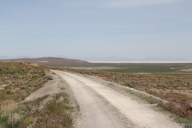
TL Bar Ranch Road heading north along the east flank of the Pilot Mountains.

Pilot Mountain

We stopped at this marker and were reminded of the various westward expansion pioneer trails we were intersecting on this drive including Hastings Cutoff of the California Trail and the Donner Party Trail.


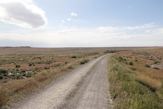
We explored in depth and at a slow bumpy speed the man made wonder of the transcontinental RR. From the Sun Tunnels we drove through the RR town of Lucin. It is known as the terminus of the Lucin Cutoff which was built across the middle of the Great Salt Lake rendering the northern route of the transcontinental RR obsolete. That northern route has now been turned into a back country byway that runs atop the original RR grade built mainly by Chinese workers for the Central Pacific.
 A few years ago I visited Lakeside for a closer view of the Lucin Cutoff: http://beitemmett.blogspot.com/2018/11/lakeside-and-skull-valley.html
We (permit holding Will and then dad) drove along the grade from Lucin to Rozel. I only learned about this route the night before while looking at my Utah Road & Recreation Atlas.

"The Transcontinental Railroad National Back Country Byway, also known as the Central Pacific Railroad Grade, is administered by the Bureau of Land Management for public use and enjoyment. Due to its unique history and scenic beauty, the Transcontinental Railroad Grade is a designated Area of Critical Environmental Concern and is listed on the National Register of Historic Places. The 90-mile Backcountry Byway begins west of lands managed by the National Park Service at the Golden Spike National Historic Site. The byway follows the old railroad grade through the remnants of railroad sidings, towns, and trestles. You should carry plenty of water, spare tires and be prepared for gravel roads in a remote setting. Today, cattle graze where thousands of Chinese immigrants labored in 1869 to open the West to industry and commerce. The Transcontinental Railroad Back Country Byway is interpreted at over 20 sites along the grade. Enjoy the past as you travel this route on your public lands." https://www.blm.gov/visit/search-details/16248/2

The modern day transcontinental RR at Lucin.
 headingwest

headingeast
 The eastern staring point of the railroad byway in Lucin


The byway dipped around many original 150 year old trestles.

 A large bird nest under one of the trestles.


 photo by Joel.
While driving for the last third of our journey, Sarah entertained us by reading all of The Lion, the Witch and the Wardrobe.


After reading my original blog post, my BYU geography colleague Matt Bekker, who is a dendrochronologist, sent me a copy of this poster that he presented at the AAG meetings last year. I had no idea this was one of his many research projects. He has traveled the same route taking core and crosscut samples from the trestles and cross ties. Some of the trestles were built with California redwood and other with Douglas firs from Utah and Wyoming. Good work Matt.


In some places the grade was quite elevated with drop offs on both sides of the single lane track. Many old railroad ties litter the sides of the road for much of the route
 First view of the Great Salt Lake (and its surrounding mud and salt flats) and the Promontory Range to the southeast.

 Heading south to the Spiral Jetty with the northern most section of the Great Salt Lake in the western distance.

 photo by Joel

The Spiral Jetty is in the lower left of the map. After our visit there we headed home with a stop in Brigham City for drive through food. Thanks to my siblings for being at the ready to come searching for us if we didn't report back in by sunset. We traveled some desolate roads far from cel coverage. And thanks to Marie and the kids for enjoying a much needed outing--no matter how obscure and off the beaten track it may have been.
The first big wonder was Metaphor: the Tree of Utah (aka the Tree of Life) created by Swedish artist Karl Momen. It was dedicated in 1986. There is no exit and no frontage road access so the only way to see it while not traveling 80 mph on west bound I-80 is to pull off of I-80. I imagined us pulling off to the the side shoulder for a quick photo but happily there was room for a dozen or so cars to safely park well off of the freeway


The globes are covered with Utah rocks and minerals.


Utah Tree lower right. Sun Tunnels upper left. We traveled via I-80 to Wendover (gassed up) and then followed the TL Bar Ranch Road north to the tunnels.

There are no well marked directions to get to the tunnels--we passed a few sign posts, but no signs for the south approach remain. I had read a few directions on line so had a general idea of how to get there. Sarah was driving at the time so I knew from looking at the Utah Road Atlas when we were almost there once we passed Lion Mountain. I took this photo thinking the structure in the center might be the tunnels, but now I realize that the tunnels show up in the far right center of the photo.
 The tunnels show up better in this zoomed in and cropped photo. It is pretty much in the middle of no where.
"Nancy Holt, an artist exploring the human perception of time and space, earth and sky, built the Sun Tunnels as a unique art project completed in 1976. The four tunnels are concrete tubes laid out in an X shape, each drilled with holes to pattern the constellations of Draco, Perseus, Columbia, and Capricorn. They are massive - nine feet high by 18 feet long....Holt has said her tunnels bring the sky down to earth, with the dazzling effect of light bouncing through the tubes. Two of the tunnels align with the setting and rising sun during the summer solstice and two line up during the winter solstice."
https://utah.com/wendover/sun-tunnels


We are happy to have Joel with us during his mission intermission. He was evacuated home from his mission in Ghana on March 26 and will leave of June 15 for a "temporary' reassignment to the Manchester New Hampshire mission.


This group was chllin' in the northwest tube the whole time we were there. I wanted to ask them to take a photo of our family, but Marie nixed that non proper social distancing idea.

The Spiral Jetty is the work of Robert Smithson (whose wife Nancy Holt built the sun tunnels after her husband passed away--creating landscape art bookends on either side of the Great Salt Lake). It was constructed of basalt rock in 1970. At times it has been submerged completely by the lake. Five years ago when we first visited the lake level was much lower that this visit.
Here is a link to our first visit: http://beitemmett.blogspot.com/2015/11/spiral-jetty-and-bear-river-bird-refuge.html


photo by Joel


In our drive we also traversed and/or crossed many man-made thoroughfares across the inhospitable desert.
Our first stop of the day was at Fairfield Utah which was an important stop for Stage Coaches and the Pony Express. It was also the site of Camp Floyd--built by the Federal Government to keep those pesky Mormons in line.


From Fairfield we passed two more pony express stops meaning I have now driven the length of the route from the Shell Creek Station in Nevada to the Fairfield Station. For more of my travels on the westward continuation of the Pony Express trail (and Lincoln Highway) see this blog post: http://beitemmett.blogspot.com/2019/10/great-basin-national-park-and-pony.html


The first trans-continental Lincoln Highway was another amazing man-made feat.


Driving north through Skull Valley we visited Iospea (Hawaiian for Joseph) the site where native Hawaiian converts to The Church of Jesus Christ of Latter-day Saints were encouraged to settle when then emigrated Utah in 1889 to be near a temple. For three decades they ranched and farmed. Then in 1917 when the Hawaii Temple was completed they packed up and moved back home (an understandable move!). The site of the town (surrounding the green trees of a ranch house in the above photo) in now part of Ensign Ranches. The only visible remnant of that amazing human endeavor is the well cared for cemetery on the foothills above the town.


Interstate 80 (in red) is another man made marvel. General/President Eisenhower initiated the Interstate Highway in 1956 to further connect the country and to make it so that troop convoys would no longer have to spend 63 days crossing the continent as he had done as a young solider.


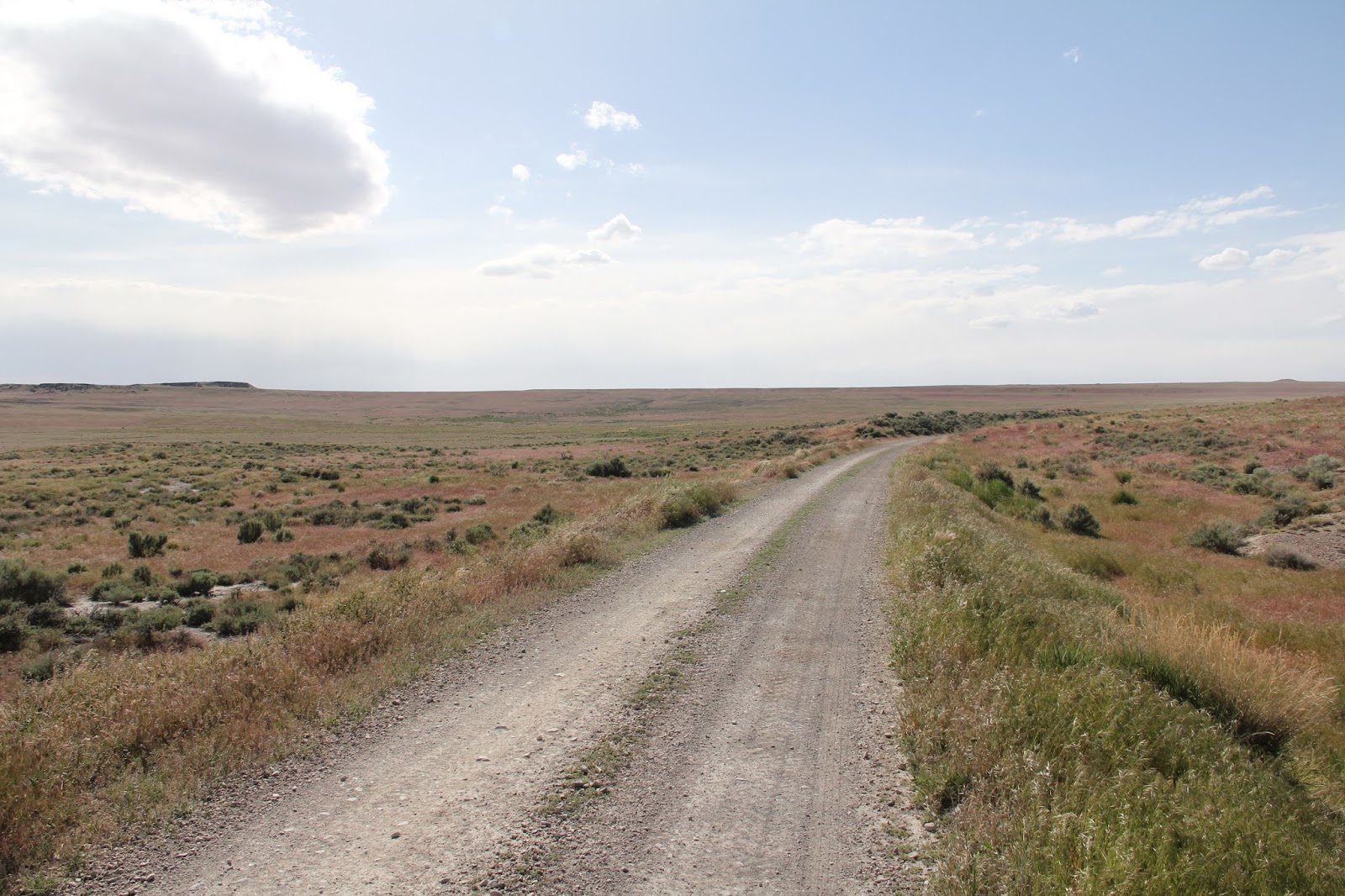
TL Bar Ranch Road heading north along the east flank of the Pilot Mountains.

Pilot Mountain
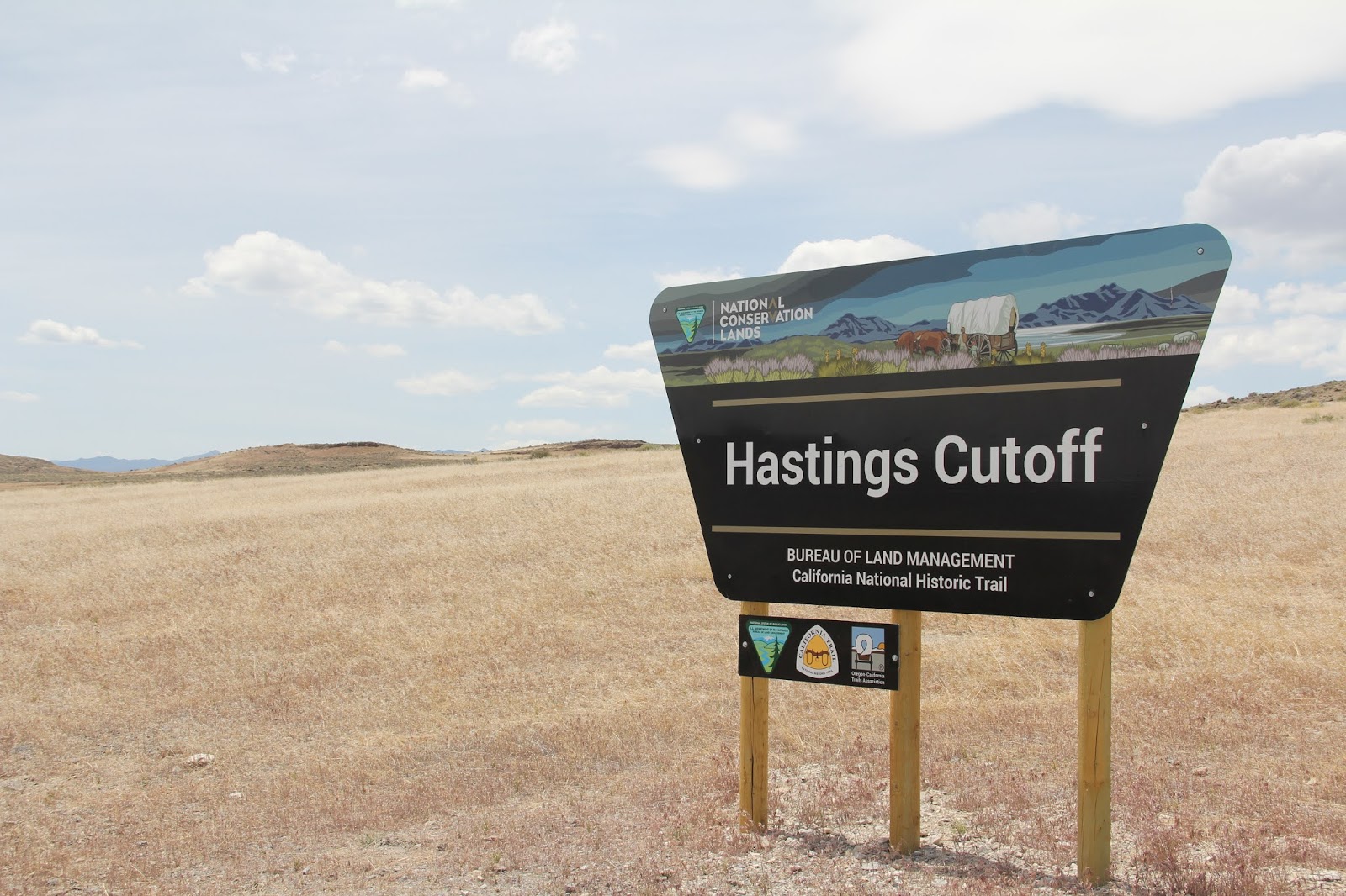
We stopped at this marker and were reminded of the various westward expansion pioneer trails we were intersecting on this drive including Hastings Cutoff of the California Trail and the Donner Party Trail.


We explored in depth and at a slow bumpy speed the man made wonder of the transcontinental RR. From the Sun Tunnels we drove through the RR town of Lucin. It is known as the terminus of the Lucin Cutoff which was built across the middle of the Great Salt Lake rendering the northern route of the transcontinental RR obsolete. That northern route has now been turned into a back country byway that runs atop the original RR grade built mainly by Chinese workers for the Central Pacific.

We (permit holding Will and then dad) drove along the grade from Lucin to Rozel. I only learned about this route the night before while looking at my Utah Road & Recreation Atlas.

"The Transcontinental Railroad National Back Country Byway, also known as the Central Pacific Railroad Grade, is administered by the Bureau of Land Management for public use and enjoyment. Due to its unique history and scenic beauty, the Transcontinental Railroad Grade is a designated Area of Critical Environmental Concern and is listed on the National Register of Historic Places. The 90-mile Backcountry Byway begins west of lands managed by the National Park Service at the Golden Spike National Historic Site. The byway follows the old railroad grade through the remnants of railroad sidings, towns, and trestles. You should carry plenty of water, spare tires and be prepared for gravel roads in a remote setting. Today, cattle graze where thousands of Chinese immigrants labored in 1869 to open the West to industry and commerce. The Transcontinental Railroad Back Country Byway is interpreted at over 20 sites along the grade. Enjoy the past as you travel this route on your public lands." https://www.blm.gov/visit/search-details/16248/2

The modern day transcontinental RR at Lucin.


headingeast


The byway dipped around many original 150 year old trestles.


While driving for the last third of our journey, Sarah entertained us by reading all of The Lion, the Witch and the Wardrobe.


After reading my original blog post, my BYU geography colleague Matt Bekker, who is a dendrochronologist, sent me a copy of this poster that he presented at the AAG meetings last year. I had no idea this was one of his many research projects. He has traveled the same route taking core and crosscut samples from the trestles and cross ties. Some of the trestles were built with California redwood and other with Douglas firs from Utah and Wyoming. Good work Matt.


In some places the grade was quite elevated with drop offs on both sides of the single lane track. Many old railroad ties litter the sides of the road for much of the route


The Spiral Jetty is in the lower left of the map. After our visit there we headed home with a stop in Brigham City for drive through food. Thanks to my siblings for being at the ready to come searching for us if we didn't report back in by sunset. We traveled some desolate roads far from cel coverage. And thanks to Marie and the kids for enjoying a much needed outing--no matter how obscure and off the beaten track it may have been.
No comments:
Post a Comment