Last weekend I road tripped to Wyoming's Wind River Range.
I took a new route for part of the way. The Monte Cristo road from Huntsville to Woodruff. This is looking westward to Mt, Ogden (left of center).
Just before getting to Kemmerer, I decided to side trip to Fossil Butte National Monument. I don't recall ever hearing about this monument but I noticed it on the map when planning my route and decided to take a look.
The butte and surrounding lands are loaded with amazing fossils from what was once an ancient lake bed.
The visitor center is well worth a visit. It has an amazing collection of fossils that have been quarried in the area, including turtles, alligators, fish and insects.
I then drove to the northern end of the park.
That night I stayed in Pinedale Wyoming.
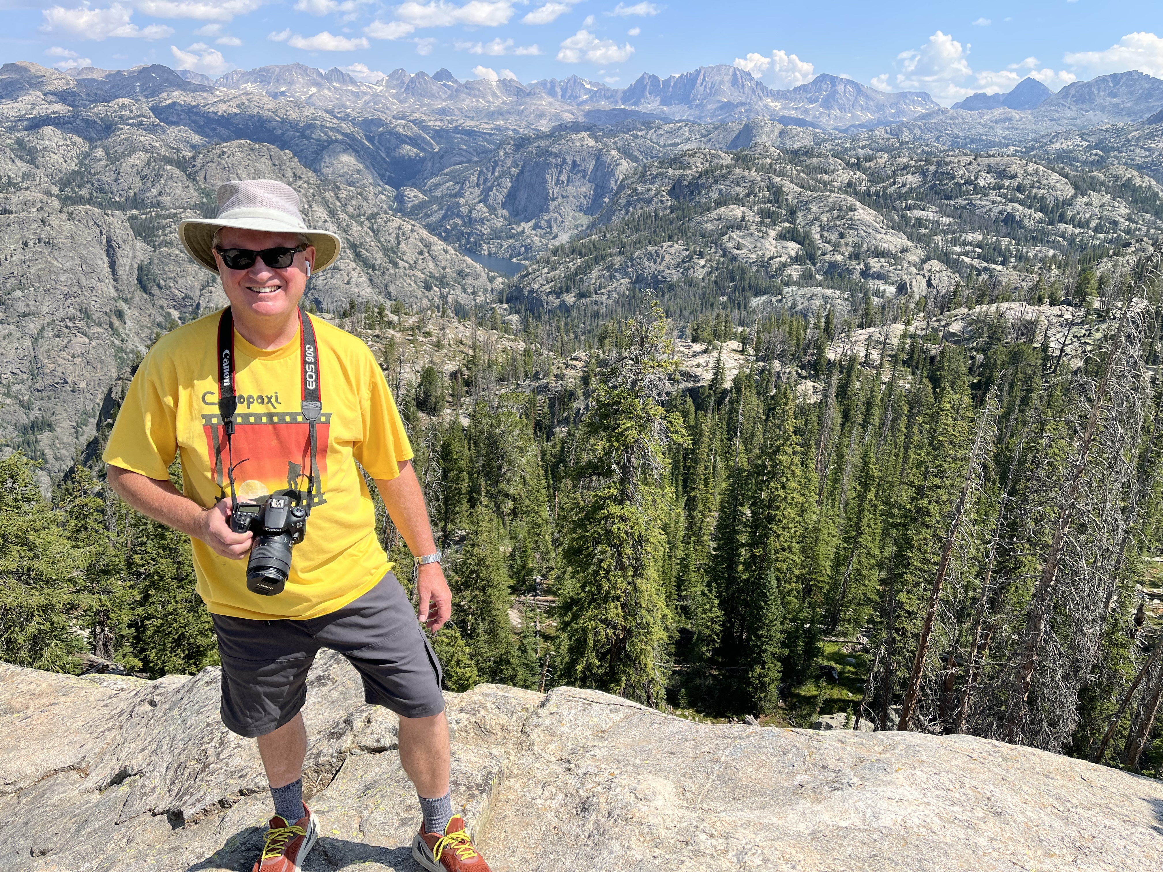
Next morning, I drove north from town to the Elkhat Park trail head. I then hiked 11.5 miles out to Photographers Point and past several ponds and lakes including Middle Sweeney Lake and Miller Lake. It was a spectacular day.
First view of the magnificent Wind River Range. When I was growing up many scout troops from Logan would come camping here. Several of my brothers came, but it was never an option when I was a scout. Our Springville ward was planning a back packing trip here and Will and I were planning to go, but then the pandemic hit.
Logs for lunching.
Lots of downed trees. Usually the trail would just wind out and around the logs.
Middle Sweeney Lake
New growth.
So surprised to see water lilies in bloom. The east end of Miller Lake.
There had been black bear sitings along parts of the trail (and I forgot to bring my bear spay) but the only predators I found along the way (especially around the lakes) were persistent mosquitoes.
Stream flowing out of the lake.
At the west end of the lake I pulled up a lake side rock and just sat and enjoyed the beauty.
Notice the blue dragon fly.
Can you tell I loved the lilies?
N

More dragon flies.
Sunday morning I drove up into the range via the Green River.
Green River Lake with Flat Top in the distance.
 |
| Where the Green River flows out of the lake. |
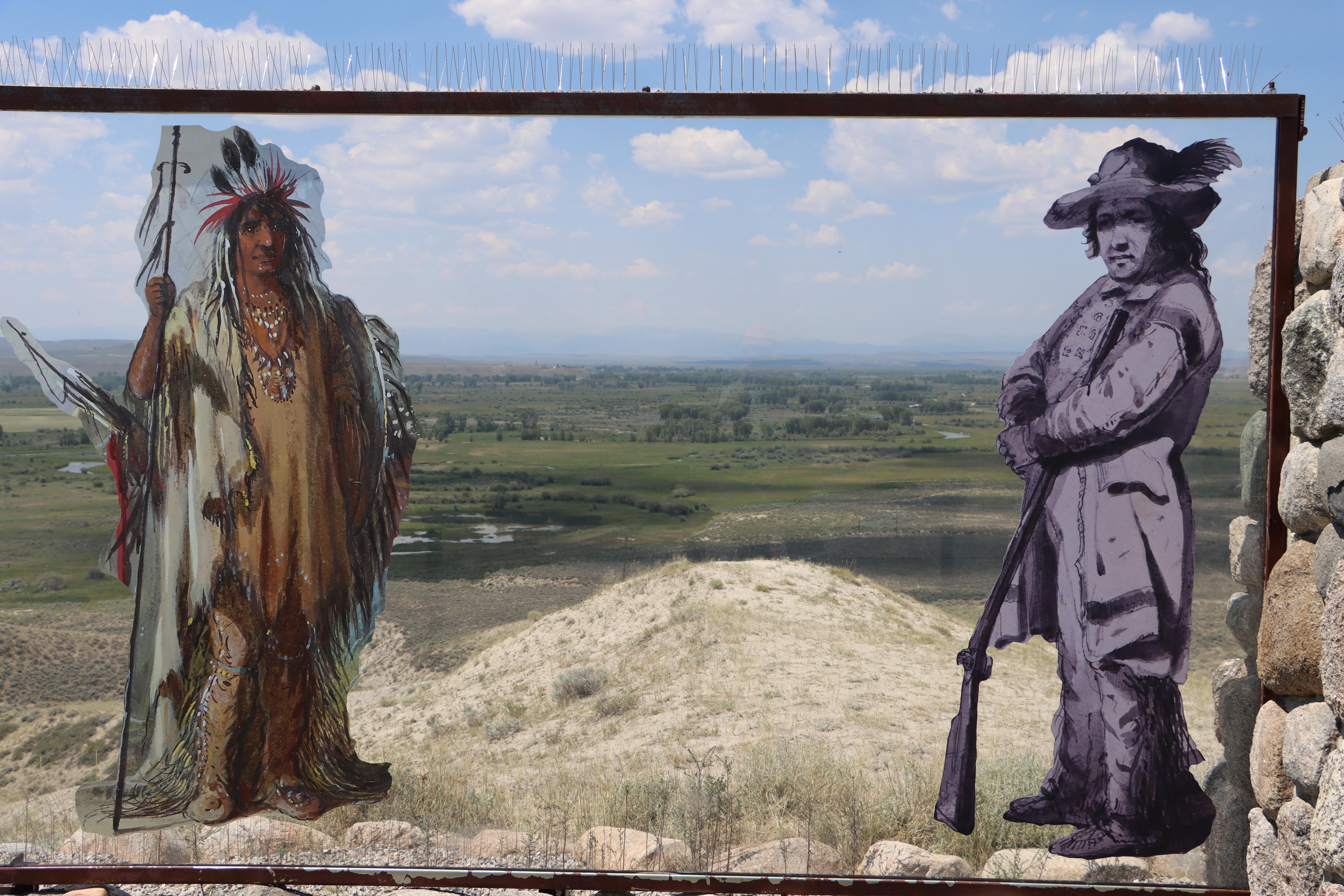
This was an informative stop.
Down in the valley on the banks of the Green River, fur trading rendezvous were held.
This large animal crossing is for the annual migration of prong horn antelope.
I then drove a loop around the range. I drove though Jackson Hole, Grand Teton Park, Dubois, The Wind River Indian Reservation, Fort Washakie (where this photo of the east side of the Wind River Range was taken), Lander, South Pass, Farson and back to Pinedale.
I took a side route to see the historic mining town of South Pass.
A restored South Pass City. I didn't take time to explore.
I have driven this route before (the last time was in 2014) and I remember always being puzzled about where South Pass was. I imagined it to be a distinct and obvious route through the Rocky Mountains, but I never could visualize where the route/pass was. This time it clicked. There to the north was the imposing Wind River range. On its south side was South Pass which now I could see was the obvious and easiest way to get further west. Forth to the south were some smaller mountains and buttes.
I crossed the Sweetwater River, just like many of my pioneer ancestors. Looking east as the water flows eventually into the North Platt and then the Missouri and Mississippi Rivers. It's a long journey to the Gulf of Mexico.
The Sweetwater in the valley flows parallel and very close to the Continental Divide here. The divide is at the top of the distant hill. This is the route the pioneers would have followed heading up to South Pass at the top of the hill where a very subtle continental divide sits.
The buttes and hills to the south of South Pass.
The Wind River Range to the north.
The view from south pass looking southwestward towards Fort Bridger.
Monday morning I headed home. West of Kemmere I was intrigued with this long white train of box cars all festooned with arm high graffiti
As a child, Bear Lake was never this low. I'm standing where the shoreline once was.
Northern end of Bear Lake. Always a beauty.
I arrived home to see our mountain once again on fire. This time it was started by a person on drugs resting or camping in a thicket of scrub oak who tried to kill a spider with a cigarette lighter. Twenty years ago a much large fire raced across this whole slope. It was caused by some idiot taking target practice at an electrical transformer.
We watched skilled pilots from two helicopters dump lake water and from two planes dump retardant in pass after pass. They and the workers on the ground line got the fire under control with a heavy rain later that evening putting it all completely out.
My frequent hikes along the shoreline trail pass through the area where the fire started (lower left).