Each year when I attend the annual meeting of the American Association of Geographers I always try to squeeze in some sight seeing in the area. This year the meeting was in Boston--a town I have visited and explored often. Since my paper on tsunami mitigation in Indonesia was on the first day I decided to take a few days for a more extended road trip. In my quest to visit more national parks my initial plan was to head north to Acadia National Park in Maine. Then I thought, why not go a little further, perhaps to the Bay of Fundy, perhaps Prince Edward Island? So on Thursday afternoon I headed north to see what I could see. It was a day of heavy rain so I decided to drive as far as I could in hopes that the next few days would have better weather. I got as far as Calais (pronounced Calas not the French Calay), Maine, right on the border with Canada. It's a small town with two motels.
NEW BRUNSWICK
Next morning I crossed over into St. Stephen New Brunswick--the first of several Saints on my route through New Brunswick including St. George and Saint John (as opposed to St. John's in Newfoundland). The nice border agents gave my car and luggage a full check over.
My first stop was Fundy National Park. In the higher elevations there was still a lot of snow, frozen lakes and closed roads. Also closed for the season was the visitor center.
Wolfe Lake
Bennett Lake

I have long known about the Bay of Fundy's unique claim to fame--the highest variance of tides in the world--up to 16 meters difference from low to high tide.
Lobster boats in the harbor of Alma about three hours before the lowest tide.
Fundy coast line in Alma.
East of Alma
Cape Enrage Light Station with afternoon fog over the Bay.
Skipping Rock Bay (my name)
One of many fly eating spiders on the skipping rocks.

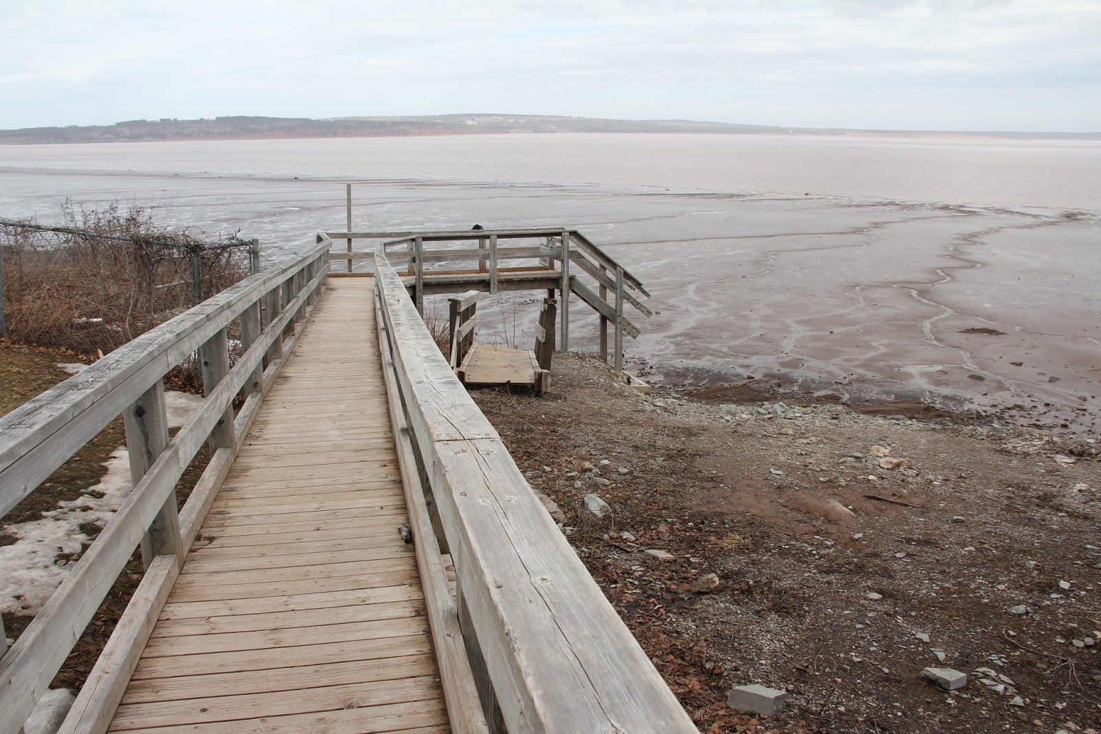
By luck I arrived at Hopewell Rocks at low tide. Unfortunately the main parking lot, path and stairs down to the shore line were closed. In that parking lot I met a nice retired couple from Saskatchewan who were visiting the Maritimes for their first time, They had just learned from a nice local that there was another parking lot that also had access to the shore. I followed them.
Here was the access path.
Unfortunately, I didn't know what FERME meant.

Also unfortunately, the stairs had been pulled up for the winter season. No worries, I hopped the wood railing and climbed down (not sure Marie would have approved). The Saskatchewan couple opted out.
I knew I had a few good hours before the tide would threaten my safety.
Looking northeastward towards the end of the Bay.
Low tide at Hopewell Rocks.
The partially hidden main access metal stairs (closed) leading in and out of the area.
Notice the blue rope hanging from the right side rock. There were blue ropes bolted to the rock wall all along the coast. I am assuming they are there as a place to hang on if caught in the high tide.
The seaweed on the narrow necks of rock are an indication of how high the high tide gets.
Sporting my souvenir hat from the American Association of Geographers.
I also signed one of several banners that will be carried in the upcoming March for Science in Washington. My name is inside the C.
PRINCE EDWARD ISLAND
After enjoying low tide (I need to come back with more time to spend a
day watching the tide come in) I then drove to Prince Edward Island.
Rainbow over Northumberland Strait between the provinces of New Brunswick and Prince Edward Island.
Opened in 1997, the Confederation Bridge (named that because the 1864 conference for the confederation of the provinces of Canada was held in Charlottetown PEI) now connects P.E.I. to the rest of Canada. It is 8 miles long and is free going to the island but costs $46 to get off the Island. I spent the night in Summerside.
Next morning, acting as proxy for my daughter Sarah who is a big fan of red-headed Anne of Green Gables, I headed out to see the land of Anne. It was fun to explore with that goal in mind.
Sarah's well read copy.
Snow was still melting and fertile fields for grain and potatoes were still fallow.
Fishing and farming, plus tourism, (all in the appropriate season) seemed to be the main endeavors of the island.
New homes on the north shore.
Golden stubs of grain.
Stacked lobster traps.

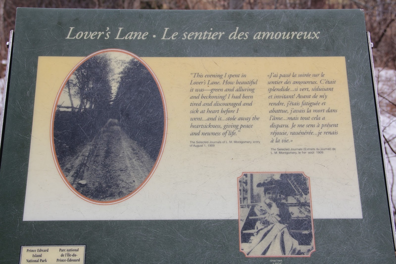
The green gabled road signs lead me around the center of the island to the town of Cavendish and the P.E.I National Park that includes the home where Anne of Green Gables author Lucy Maude Montgomery grew up.
Closed for the season. That didn't stop me. I tread lightly over the muddy construction area to go see Anne's house.
I decided to explore Balsam Hollow. There were no barricades to skirt. I took photos for Sarah to enjoy.

I came to appreciate Lucy Maude Montgomery's love for nature.

The squirrel was so intent on his munching that I was able to get quite close.
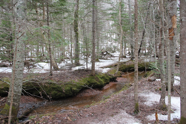
Photo of the house from the fairway of the surrounding golf course--all part of the Prince Edward Island National Park.
Since no gift shops (so I could buy a souvenir for Sarah) were open at the home, in the national park, or in the surrounding town of Cavendish, I stopped before leaving the island at the welcome center near the bridge. There, when I told the nice clerk that my daughter was a big fan, she coerced me, in a moment of lapsed judgement, to take the following photos (they had dresses, red wigs and hats to fit all sizes). Sarah had a good laugh when I texted her these photos.
Lucy Maude Montgomery's tombstone.
Current post office and church where the Montgomerys worshiped.
North shore--part of the National Park.
Driving route 13 across the center of the island.
Passed this ski area--not much, but it means retiring to PEI is even more enticing.
NOVA SCOTIA

I had hoped to explore Acadian areas of Nova Scotia, but time ran out so the best I could do was a short side trip to Joggins to see the Bay of Fundy from the other side.
Moving towards low tide.
MAINE
Crossing back into the United States on Saturday afternoon was a breeze. Driving across New Brunswick I imagined what if I wasn't allowed back in because of my lack of support (and sometimes criticism) of the current president. Happily it didn't happen.
Just south of Calais I happened by the Saint Croix Island International (shared jointly by the U.S. and Canada) Historic site. In 1604 French explorers established a settlement on the island (in the middle of the photo) one of the first in North America. Since they were at the same latitude as France they assumed a more mild winter. Unfortunately this side of the Atlantic has harsher winters. When the river froze and the ice buckled the fur traders were not able to cross to the mainland for water, wood and game. After one year they abandoned the site.
Further down U.S. highway 1 happened upon this marker of the 45th parallel--half way between the equator and the north pole.

Sun setting over the woods of Maine.

Driving by Columbia Falls Maine I spotted a beautiful lit church in the distance so I decided to stop for a few photos.
I arrived in Ellsworth Maine in time for a late dinner of delicious scallops. Next Morning (Palm Sunday) I was up at 4:30 so I could get to Acadia National Park in time to watch the sun rise from Cadillac Mountain. Unfortunately I had assumed that the park would be open. No such luck. Once again I found myself scrambling to see what I could see in spite of blocked roads--including the main loop road through the park and the road up to Cadillac Mt.
In my limited trip preparation (which did not include finding out season opening dates) I had noticed several hiking trails along the eastern coast of the park. I headed that way on the local non-park roads and parked in a picnic area close to the coast. From there I had a delightful two hour walk and watch along the rocky coast of Acadia. I loved the changing light.
Looking north to Sand Beach.
Looking south towards Otter Cliff
The buoy marking the shoal had a bell. When I first heard it I thought it was a nearby church ushering in Palm Sunday.
Must have been quite a storm to buckle this tree.
Otter Point
Otter Cove
After April 15, cars will be able to access this parking lot at Otter Point. I enjoyed a quiet walk (only saw a handful of other people) along the shoreline trail to get there.
Northeast Harbor
Somes Sound which is a rare fjord along the east coast.
The head of the fjord looking south.

Bass Harbor Head Lighthouse
It was a great road trip and I made it back to Boston with barely enough time to catch my 5:30 flight home.
 First heat of the 100 (photo courtesy of Marie Emmett)

 Final stretch of the 200
 Lining up for the 800.
 Pulling ahead in the first lap.
 First lap
 Turning around after winning the 800 to walk over (with a slight limp) and line up for the 100 final.
 It hurt.
 200
200 800
800
 100 (Will beat the third place finisher in the semifinal heat)
 Way to go Will!