A friend invited me to talk about the summer solstice tonight at a celebratory bonfire he his hosting. At first I thought he wanted an astronomical, physical geographical treatise, but then, he, knowing me, clarified that he wanted my human geographical take (thankfully) on the sun and its alignments and how we as humans have responded to these consistent heavily cycles. I agreed, but wasn't sure what I would say. Then it all started coming back to me--places I'd visited where the sun was a key character.
Starting with the oldest, the mounded burial site of Newgrange (3,200 BCE) in the Boyne River valley of east central Ireland is one of several neolithic sites in the area.
The entrance and its geometric decorated entrance stone provides entry into a long corridor that ends in a central chamber where it is thought the ashes and bones of ancestors were worshiped.
Then in 1962, a Roof Box was discovered about the entrance (rediscovered in 1699) and then in 1967 it was discovered that on sunrise during the winter solstice, the rays of the sun align in the right direction and at the right angle to penetrate all the way in and illuminate the central altar for only 17 minutes. Amazing that this was all figured out by people living so long ago.
Source: https://www.meathchronicle.ie/2019/12/23/stunning-new-images-of-light-entering-newgrange-passage-tomb/
https://www.youtube.com/watch?v=KVXWZkwV0RQ
One of the many neolithic kerbstones that makes up the ground level course of stones.
No one knows for sure what this solstice alignment means. Some theories suggest that it is tied into the burial site being a portal connected to deceased ancestors or that it was related to the rebirth of the sun and the hope that each new day would be longer.
Stonehenge, built sometime between 3,000 and 2,000 BCE is perhaps the most famous solstice site.
Source: https://www.english-heritage.org.uk/visit/places/stonehenge/things-to-do/stone-circle/celestial-stonehenge/
"The sarsen stones, put up in at the centre of the site in about 2500 BC, were carefully aligned to line up with the movements of the sun. If you were to stand in the middle of the stone circle on midsummer’s day, the sun rises just to the left of the Heel Stone, an outlying stone to the north-east of the monument. Archaeological excavations have found a large stone hole to the left of the Heel Stone and it may have held a partner stone, the two stones framing the sunrise.
On midwinter’s day, turning 180° to face towards the south-west, the sun would originally have set between the two uprights of the tallest trilithon, at the head of the sarsen horseshoe. It would have dropped down into the Altar Stone, a sandstone block which was placed across the solstice axis. Today, this effect has been lost because one half of the trilithon has fallen at some point in the history of the monument. Analysis of a laser survey of Stonehenge has shown that those stones that frame the solstice axis were the most carefully worked and shaped using hammerstones, creating vertical sides that framed the movement of the sun.
The whole layout of Stonehenge is therefore positioned in relation to the solstices, or the extreme limits of the sun’s movement; the word solstice is derived from the Latin sol ("sun") and sistere ("to stand still").Marking the movements of the sun was clearly important to the people who built Stonehenge, as they went to such enormous effort to carefully line up the monument. However, there is very little evidence as to what ceremonies might have taken place here; there are few clues from excavations within the stone circle seems to have been kept clean and separate from everyday debris. We can imagine that people gathered at the monument to celebrate the midsummer and the midwinter, although only a few people would have been able to directly observe the important alignment.
The people who built Stonehenge were farmers, herders and pastoralists and so the changing seasons would have been of immense significance. This was practical – the seasons dictated what they could grow and when – but also probably spiritual. So Stonehenge is likely to have been much more than simply a calendar. These dates may have been important times of year to remember the dead, as we know that people buried about 150 of their cremated dead at the monument, or to worship a solar deity.
It’s also thought midwinter, rather than midsummer, would have been perhaps the most important focus for the people who built Stonehenge....
Why celebrate and gather at midwinter? The nights are long and the days are cold, and after the bounty of summer and autumn, stocks of food are beginning to dwindle. The ground is frozen solid. Nothing seems to grow. The sun’s dim light barely scrapes above the horizon, and around the solstice the sun seems to stand still – its position in the sky barely moves at all, and that’s plain to see as people gather to watch the sun set between the Great Trilithon. It might have seemed that the sun – giver of light, warmth and life – was dying.
And then, thankfully, the sun starts to move northwards again, and after a few days it no longer rises between those two great stones. It’s still cold, and the nights are still long, but as the sun resumes its journey north it’s clear that the days will get longer, and warmth will return. The rebirth of the sun promises of another year of life." source https://www.english-heritage.org.uk/visit/places/stonehenge/things-to-do/stone-circle/celestial-stonehenge/
My first encounter with the human landscape being influenced by the alignment of the sun was in 1982 when our BYU Study Abroad group finished our semester with a trip to Egypt. We visited the Aswan Dam, flew over its reservoir Lake Nasser, and then visited the famed ruins of Abu Simbel. I loved it all.
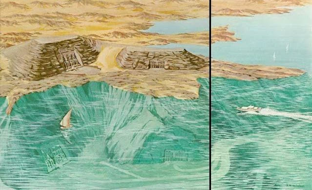
When the Aswan Dam was proposed it meant that many monuments further up the Nile would be flooded by Lake Nasser.
To the rescue came UNESCO who helped cut up the two Temples and hoist the huge stones (807 blocks and 235 blocks weighing between 7 and 13 tons each) up above where the reservoir would reach and then fit the numbered stones all back together over a man made hill held up by metal scaffolding.
Lake Nasser at Abu Simbel above where the monuments once sat
The relocated monuments.
Dedicated to the wife of Rameses II, Nefertari. 13th semester BCE
Dedicated to Ramses II.
While the whole relocation of the temples up from the shore of the Nile was very impressive, what was most impressive for me to learn was that at the new location, the whole structure was aligned just as the ancient Egyptians had done so that twice a year on October 22 the pharoah's birthday and on February 22 the pharaoh's coronation day, the rays of the sun would reach into the inner sanctuary and illuminate statues of Ramses II and three gods: Ra-Horakhty, Amun Ra and Ptah (who does not get the suns rays). Ra-Horakhty is a compounded god of Ra the God of the Sun and Horus who is associated with rising or journey of the sun across the horizon. Amun Ra is associated with creation and breath. Ptah is the god of craftsmen and architects. These two dates are a month after the spring and fall equinoxes.
Keeping the gods of the sun and creation, plus the pharaoh happy with such precisely aligned monuments, certainly gave Egyptians hope for favorable futures.
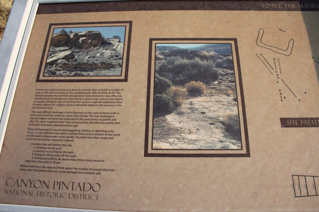
My most recent discovery were the alignments at Lookout Point ruins in Canyon Pintado in western Colorado. Here, at many different sites, Fremont Indians (500-1100 CE) have left beautiful rock art. Also, at Lookout Points they left a hill top structure with lines of putting-green size holes carved into the solid rock. These lines of holes align with the summer solstice sunrise, equinox sunrise and winter solstice sunset. Given the harsh planting and growing environment, these alignments seem most closely tied to agriculture.
For more on Canyon Pintado: https://beitemmett.blogspot.com/2020/10/colorado-cruising.html
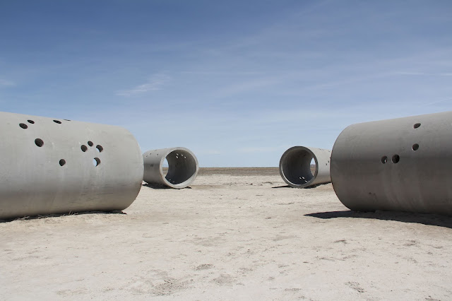
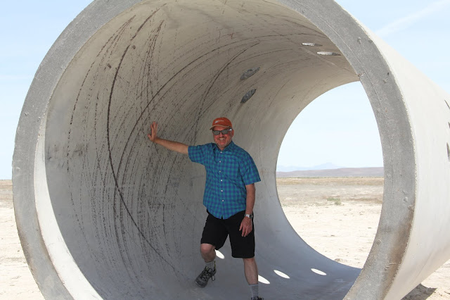
Sun Tunnels by Nance Holt 1976. Located in the west desert of Utah.
"Composed of four concrete cylinders that are 18 feet in length and 9 feet in diameter, Sun Tunnels is arranged in an open cross format and aligned to frame the sun on the horizon during the summer and winter solstices. Each tunnel is perforated by a series of holes corresponding to stars in various constellations—Capricorn, Columba, Draco, and Perseus—so that shadows cast by the sun through these small apertures into each tube trace the earth’s rotation. The work centers Holt’s interest in perception and involves a focus on time—sculpting the sun’s light through the interplay of land and sky, and celestial shifts from day to night." https://www.diaart.org/visit/visit-our-locations-sites/nancy-holt-sun-tunnels
For more of the Sun Tunnels: https://beitemmett.blogspot.com/2020/05/man-made-wonders-of-great-salt-lake.html
I had thought to pontificate on what all of this might mean. For now, all I can say is that throughout time and in a variety of places we humans have looked to the sun to feel connected with our ancestors, to honor gods and rulers, to petition and placate higher powers to help keep us lighted, warm and fed, and to celebrate the beauty and order of this world and the cosmos. All good reasons to celebrate a solstice.


