
It was a full and fun four day road trip along many new roads (for me) in Colorado.

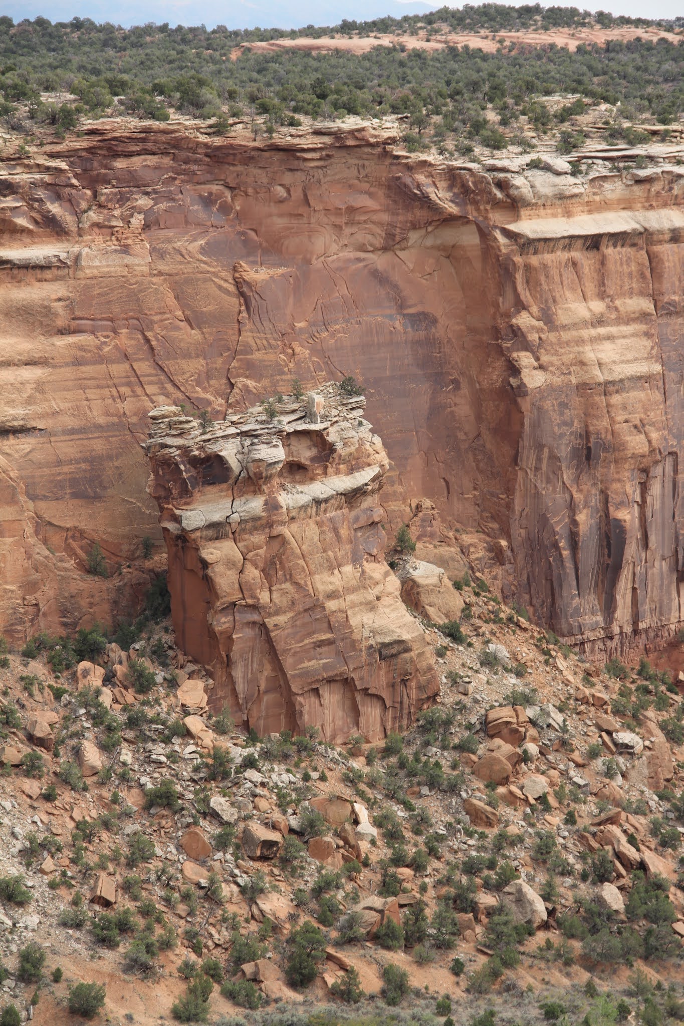
First stop was the Colorado Monument outside of Grand Junction. It was the first of many delightful surprises along the way. Beautiful red rock landscpapes reminiscent of national parks in southern Utah.


Sentinel Spire


Independence Monument


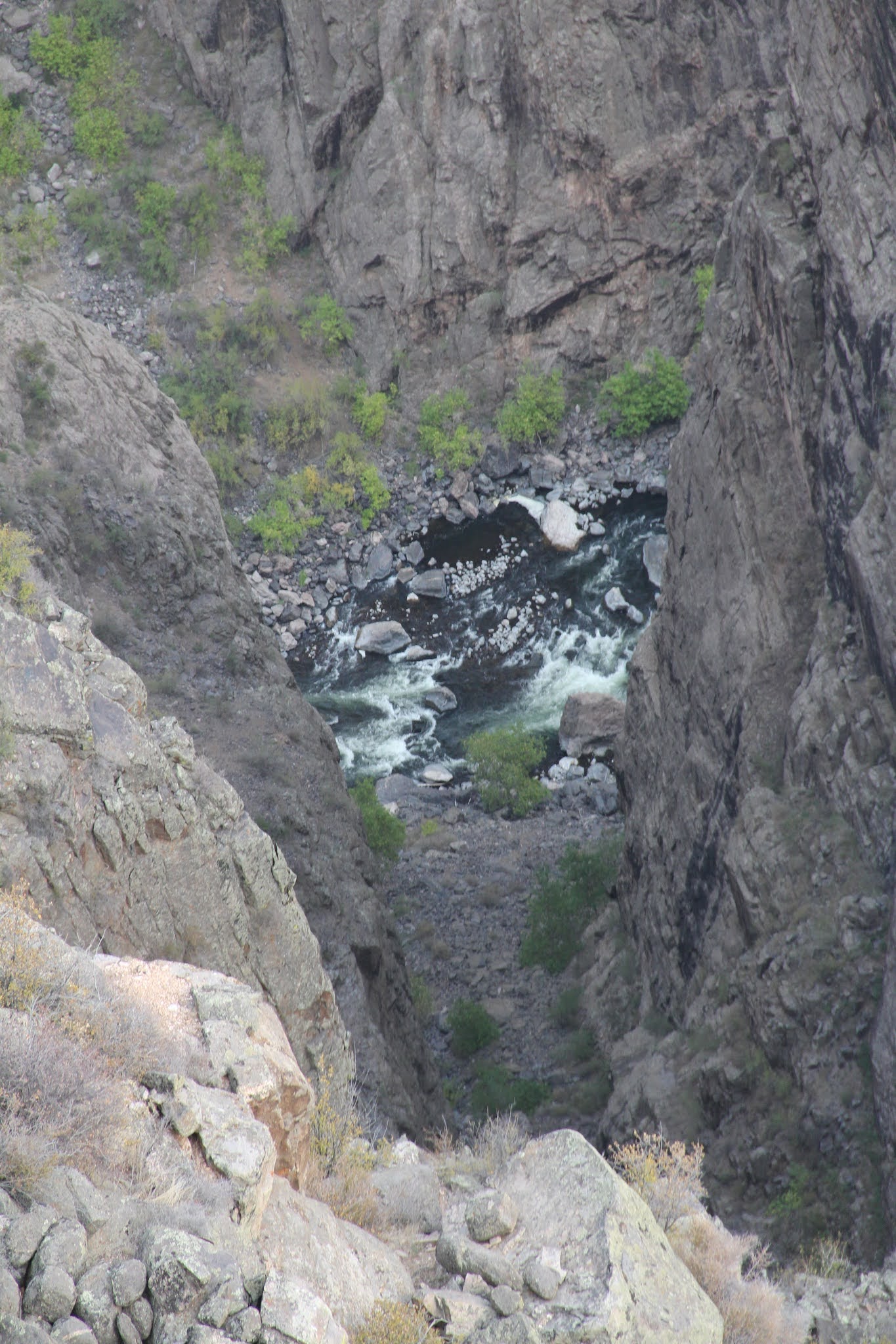
I added a new national park to my growing list. First view of the Black Canyon of the Gunnison was jaw dropping. Photos don't often do it justice. I visited ever viewpoint on the south rim, most of which required a short walk out to the canyon rim.


The light colored dikes infused amidst the black basalt added wonderful color and texture to the canyon walls.


Tenacious trees

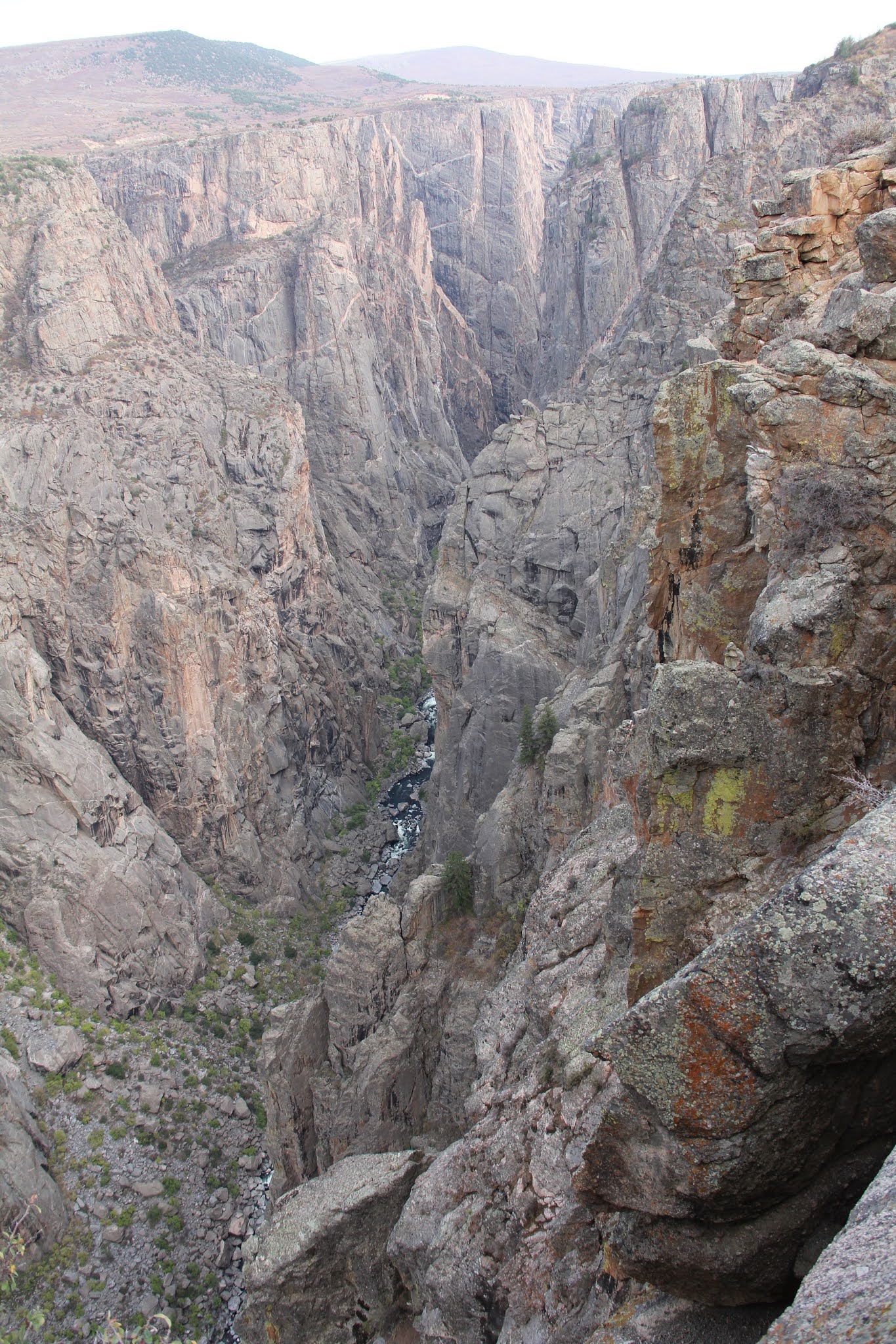


Sadly all four days were influenced by a thin haze from fires in both California and Colorado.


The Gunnsion River flowing westward.


Looking eastward from Tomichi Point.


I then drove down the steep windy road to East Portal.

Gunnison Diversion Dam in the distance.


Gunnison Diversion Dam. A very impressive undertaking.


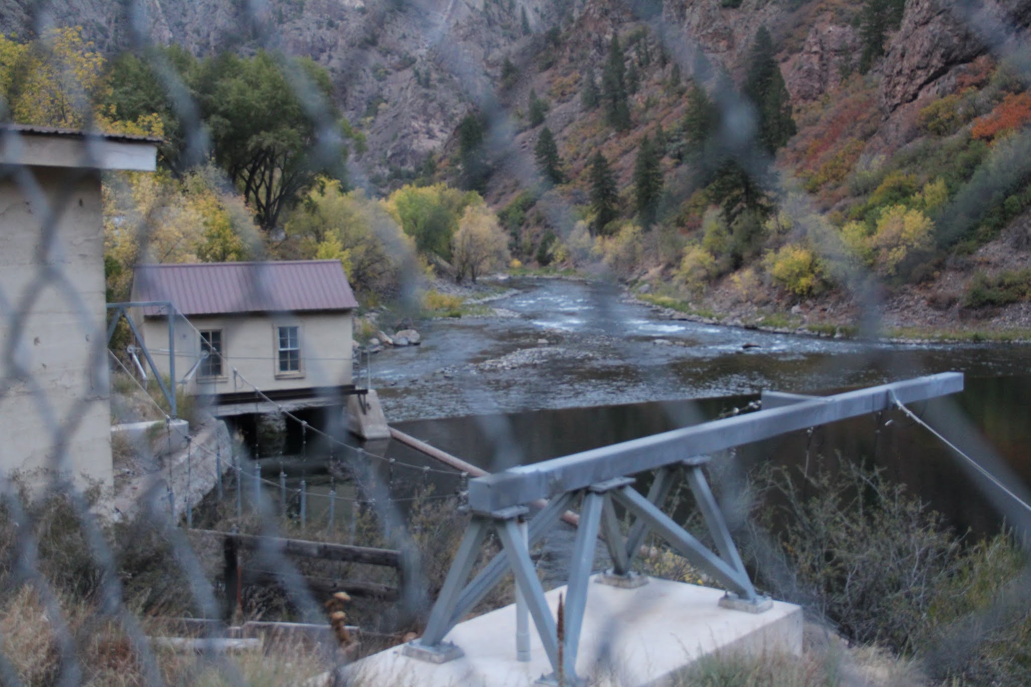
The intake building.

Further east up the Gunnison is the Crystal Dam

End of the road at the dam.

Drove in the dark to the 1950s styled Black Rock Motel (cheap) in Montrose.

Next morning my first stop was to see where the Gunnison Tunnel flowed out into the South Canal that brings irrigation water to the farms of the Uncompaghre River Valley.


South Canal

There were two outflows--one a narrow cement ditch and the other much wider and emerging from the square structure. I'm not sure which comes out of the Gunnison Tunnel. The tunnel begins in those distant mountains.


Saw another theodolite across the river at the top of the stairs.


I never realized how much water was stored in these three dams of the Gunnision. It allows Colorado to utilize its share of the Colorado River Compact, meaning down stream states like California, Nevada and Arizona are having to get used to lower water flows--which are exacerbated by climate change.

Blue Mesa Dam


From Blue Mesa Reservoir I turned south on highway 149 for a beautiful mountain drive through the mining towns of Lake City and Creede to South Fork and then on to Alamosa.


Lake City


Lake San Cristobal


Looking west towards the San Juan Mountains from near the Continental Divide.


Other side of the Divide.


Rio Grande Pyramid with Brown Lakes which feed into the Rio Grande.

Rio Grande


Rio Grande east of Creede.


Another fist visit to a National Park--Great Sand Dunes. The view from the south after entering the park.


It took me an hour to hike up to the highest dune for wonderful views.


Recruited a fellow hiker to take a photo--this one was unplanned.


The evening winds from the east were beginning to pick up.


When asked, a few hikers with dogs confessed that their dogs were not happy with the low blowing sands.


Shadow selfie.


Spent the night at the aptly names Dunes Motel (much nicer than the previous night's stay) in Alamosa.

On the third day I drove south to San Luis. Years ago I had a student at BYU from the San Luis Valley. I remembered her talking about its Mormon pioneer heritage. More recently I heared about an intriguing Statoins of the Cross Shrine in the town of San Luis. A few years ago two Mormon missionaries got in trouble for taking some disrespectful photos at this shrine. San Luis, the oldest city in Colorado, was settled by migrants moving north from Spanish New Mexico. Two murals in the center of town speak to that heritage. The one above shows the blending of Spanish and indigenous culture into a new mestizo/Hispanic culture

The colonizers meeting the colonized.

The shrine sits on a hill overlooking the town. The pathway leading up the hill to the church is lined with statues for each of the 15 stations of the cross.

Jesus receives the cross.

Jesus is nailed to the cross.

 San Luis and the fertile, irrigated San Luis valley

Jesus nailed to the Cross and Jesus on the Cross.

Jesus in the tomb.


Virgin of Guadeloupe

Resurrection


Rio Grande River north of San Luis
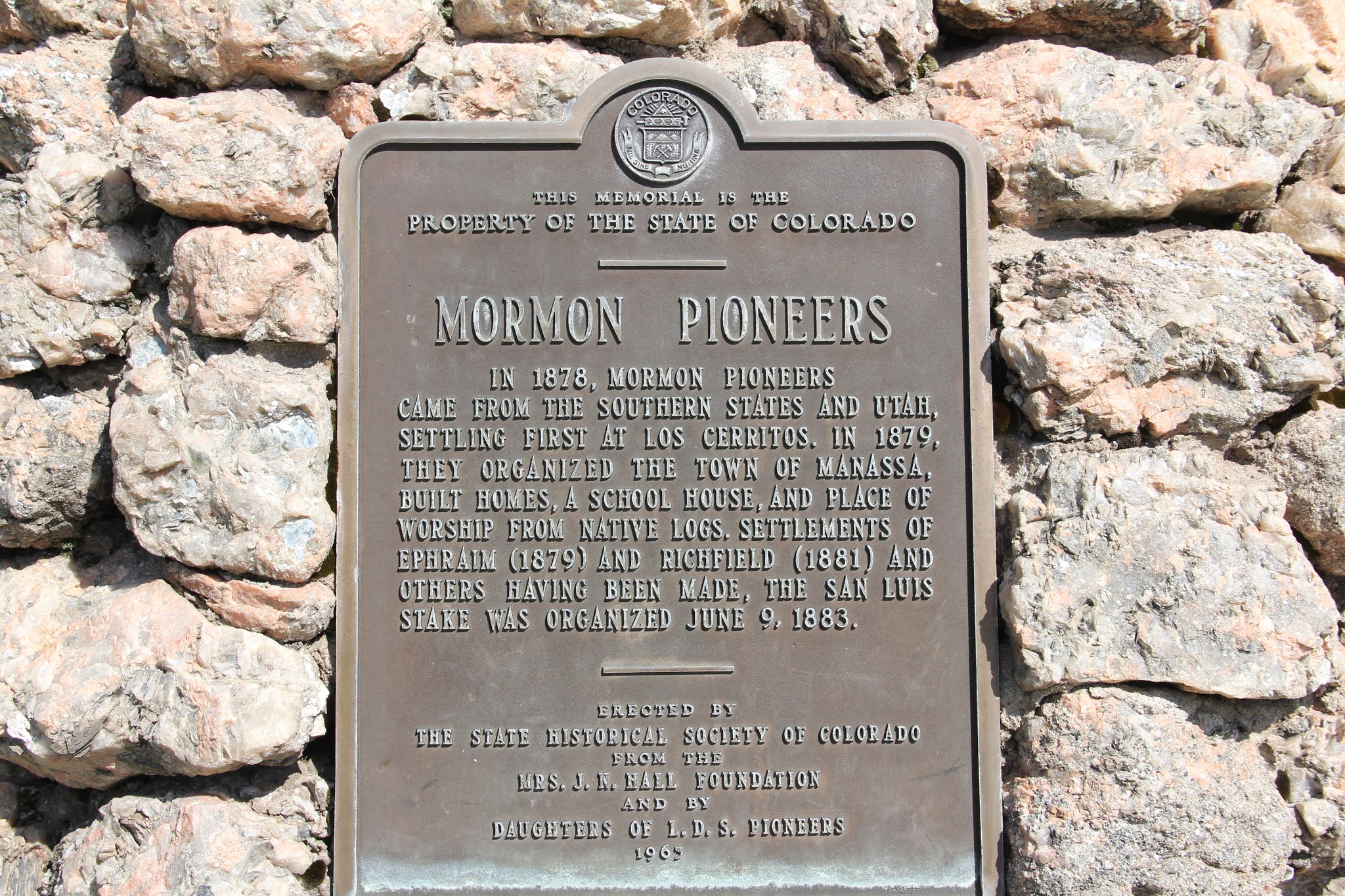

Manassa Colorado


Boxer Jack Dempsey is from Manassa. His parents were converts to the LDS CHurch and he was baptized at age 8.

Between Manassa and Sanford--two of a half dozen Mormon settled towns in the valley

The hay derrick (left) was a common farm implement on farms in the Mormon Culture Region.


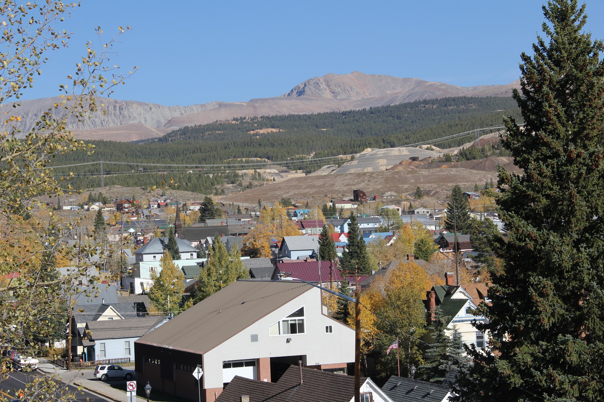
Leadville

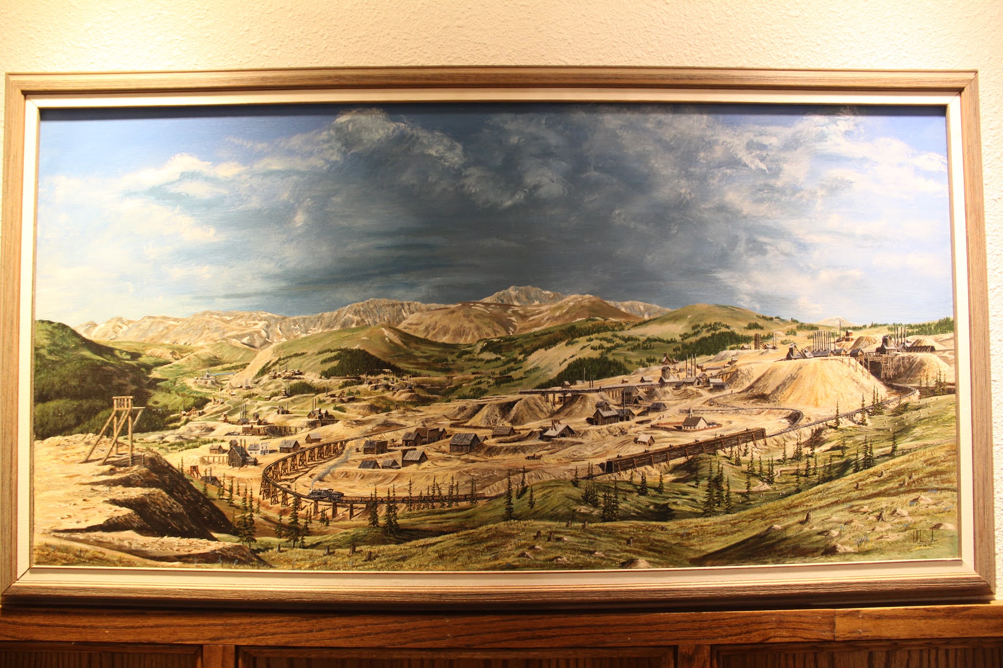
I enjoyed the National Mining and Hall of Fame Museum


The Frost collection of minerals from around the world was pretty amazing.


The one-time mining areas east of town.


This road up to the summit made me just a little nervous. The steep roads were cut out of steep slopes and some sections lacked needed guard rails. The older I get the more fearful of heights I have become. My hands were sweating in a few places, especially when the right side of the road was on the down-sloping side.


Looking east from the summit.

Looking west.


Next morning I walked out of my hotel to this view of morning sun on the aspens of Aspen. I then enjoyed a walk around town.


Snowmass. One day I hope to ski some of Colorado's resorts.


At the recommendation of my brother Bill, I added a drive from Carbondale to Delta. It was an excellent recommendation. Aspen yellows were at their peak.


Nearly bone dry.


My final adventure was driving highway 139 (first time) from Loma (west of Grand Junction) north to Rangely and Dinosaur. I imagined the road to look like this most of the way, which looks alot like the road from Green River to Price in Utah, But one over the Book Cliffs, the landscape turned greener and more mountainous.


This dugway leading up to the pass had guardrails and thus no fear factor for me.


Last adventure: Canyon Pintado--a lot like Nine Mile Canyon outside of Price.
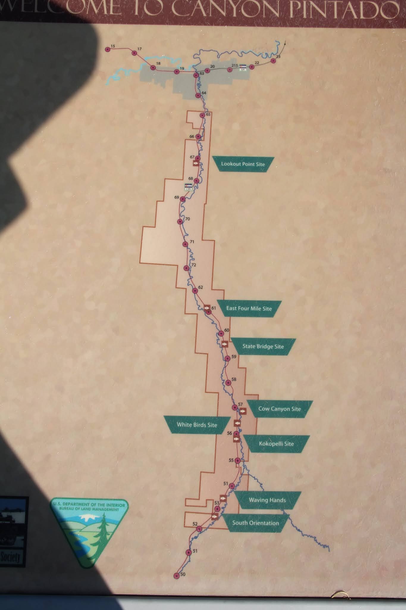
I stopped at all eight sites.


Waving hands


Kokopelli


Flying birds and maize

Lots of natural gas extraction facilities along the way.


Perhaps the shields mentioned by Escalante.


The last stop was my favorite. Up on a cliff was a three sided wall with large post holes carved into the rock (see diagram in top right of photo). No one know what this all means, but some suggest it shows the direction of sun rises to help with knowing when to plant. It was like a treasure hunt trying to find all 13 holes. I found all but one.

The sun is shinning of the walls of the structure.

A right angle of two of the walls


No comments:
Post a Comment