
Last Friday after work I headed south for a delightful weekend of exploring Canyonlands National Park and environs.

Afternoon sun on the Book Cliffs

Morning sun on the La Sal Mountains as I drove north from Monticello.

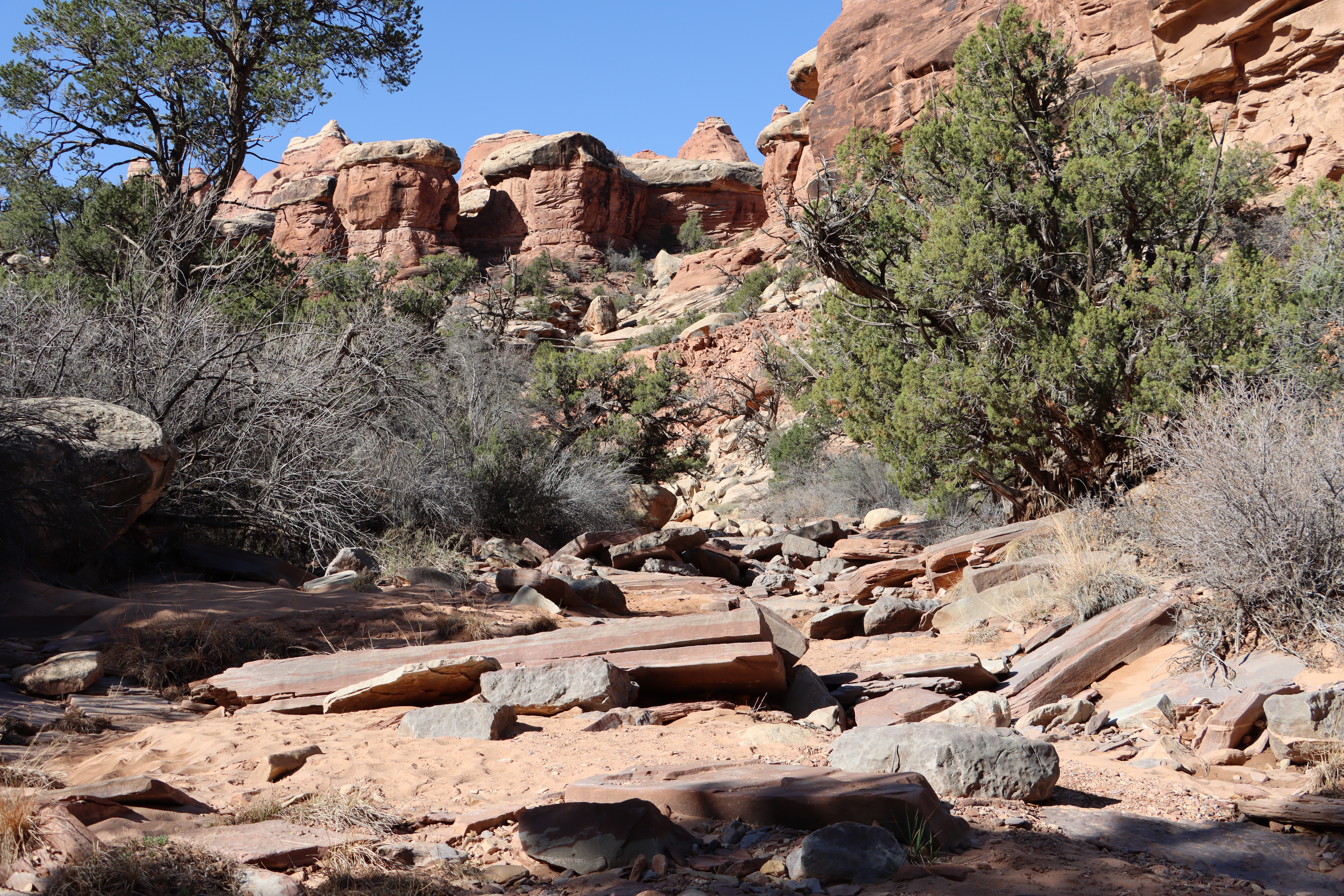
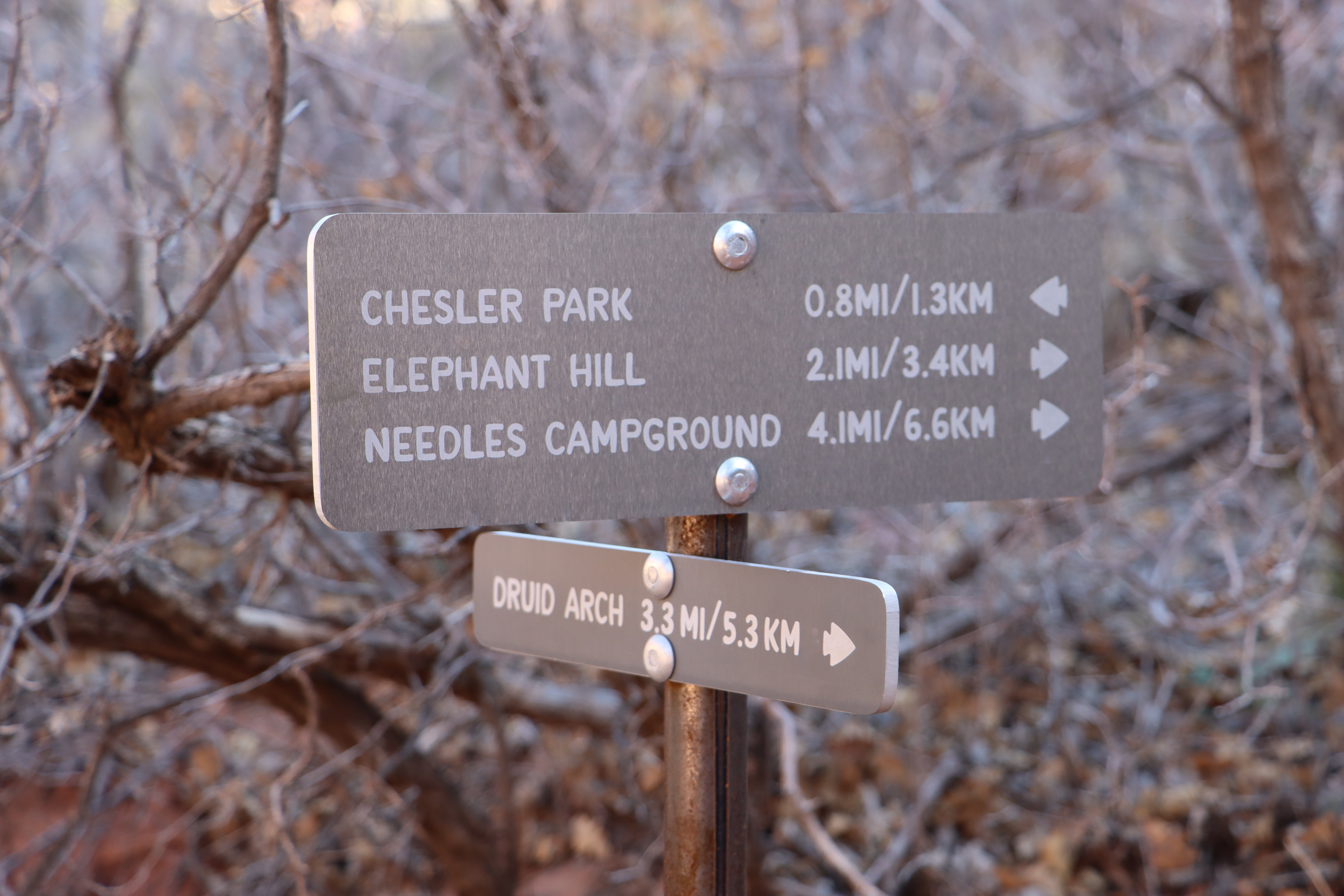
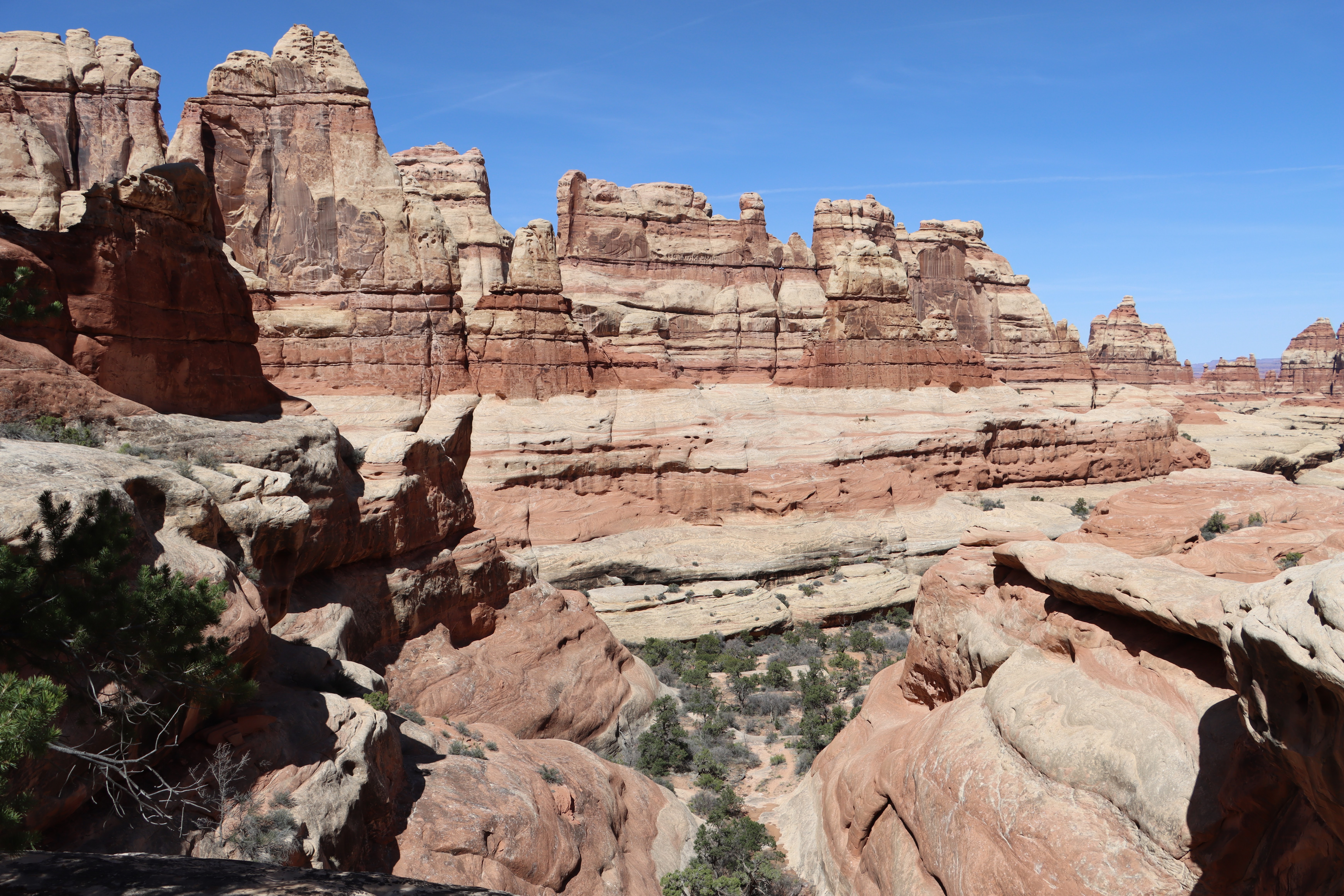
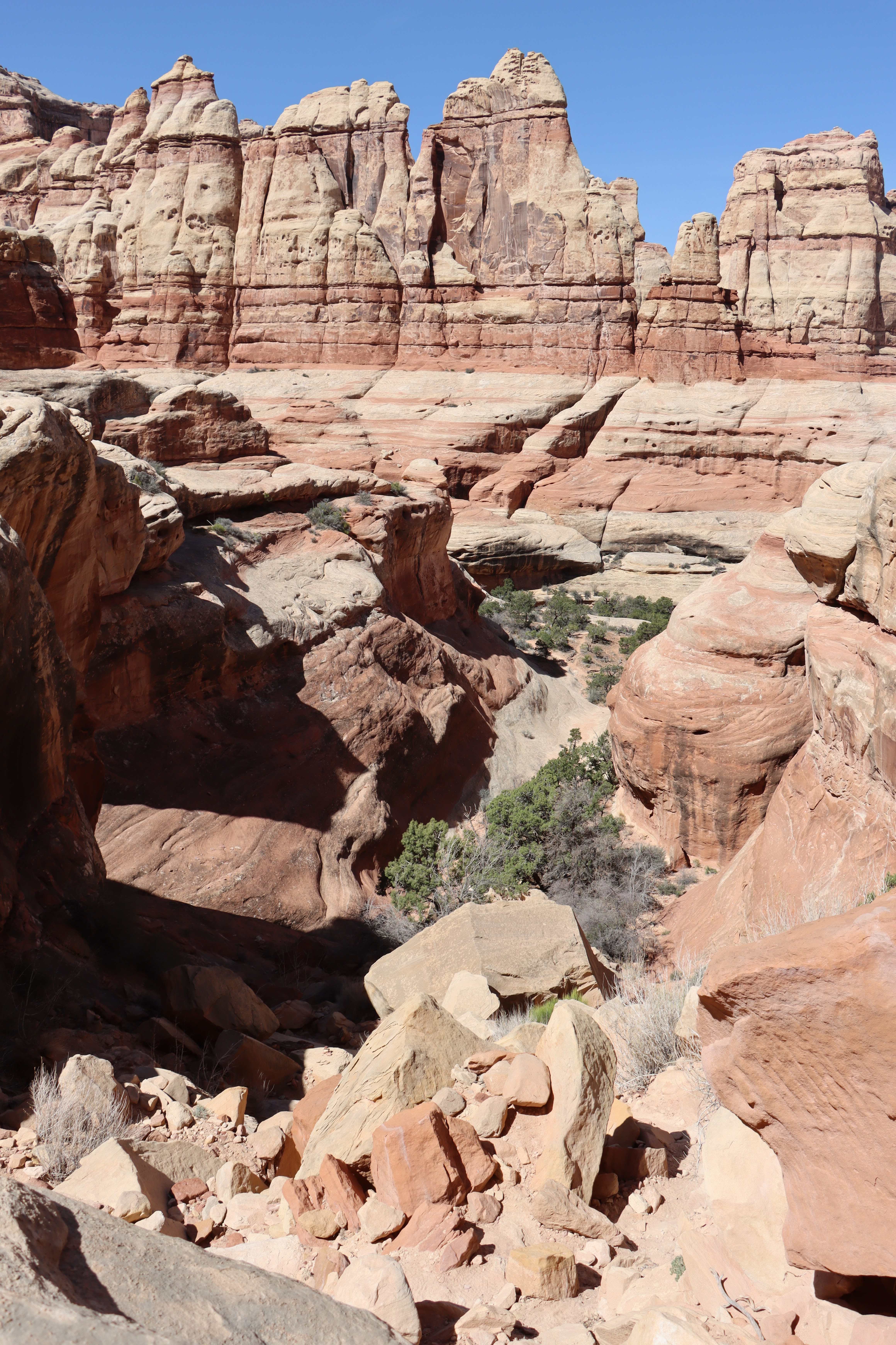
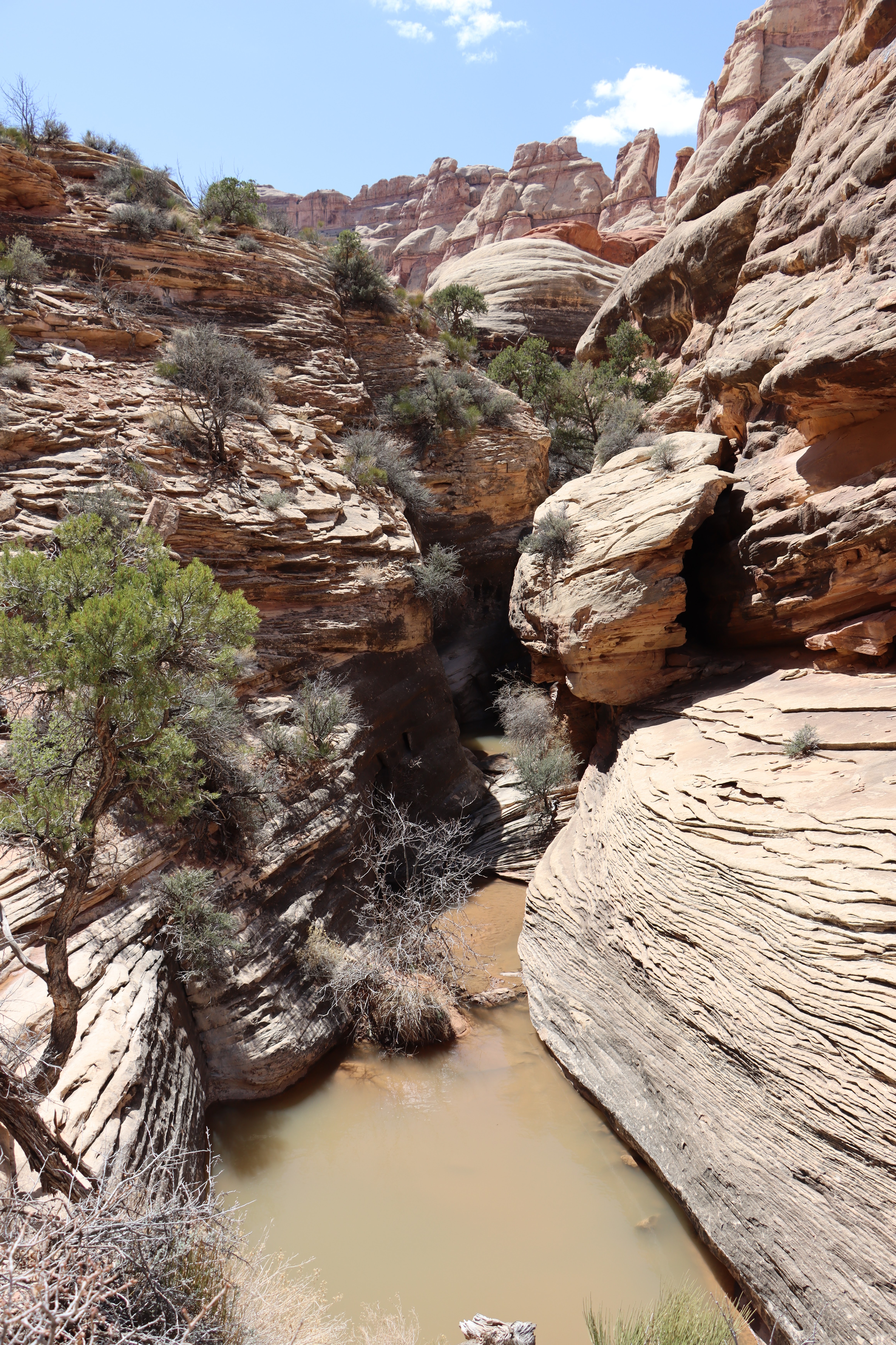
I drove into the Needles District of Canyonlands National Park, my first visit to this part of the park. I parked at the Elephant Hill trail head. From there I headed south for a 10 mile round trip hike that took me about 7 1/2 hours. It was a pleasant hike. Most of it was along the dry wash of Elephant Canyon. At the end there was a steep hike up to Druid Arch and then on the return a gradual rise out of the river bed. Otherwise it was mostly flat, which my knees appreciated. Rock cairns marked most of the way. I missed a few cairn marked turns--usually I ended up merging back onto the trail but at one point I hand to backtrack until I found where I had missed a turn up the hill. It was a beautiful, sunny and not too hot day. Perfect weather for the hike.There were about three dozen people I encountered on the trail. All were friendly and several offered to take photos of me.


Out of the parking lot.


I never was quite sure where Elephant Hill was, but this looked like a good possibility.


A long row of "needles".

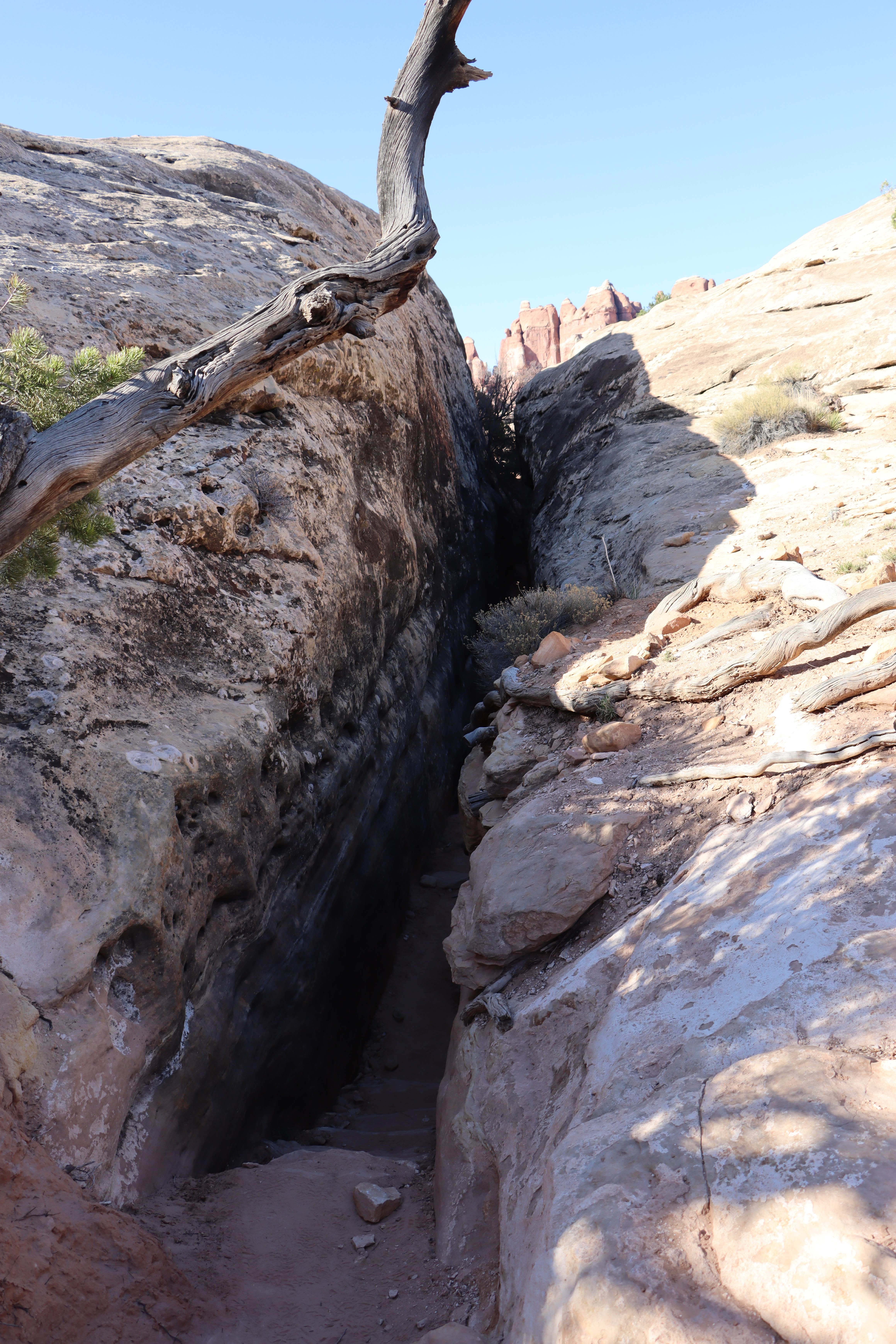
A cool slot canyon leading down into the wash.


And there it is, Druid Arch.


The rocky climb up to the arch.


It is huge and very unique. The name comes from it looking like a section of the Druid structure of Stonehenge


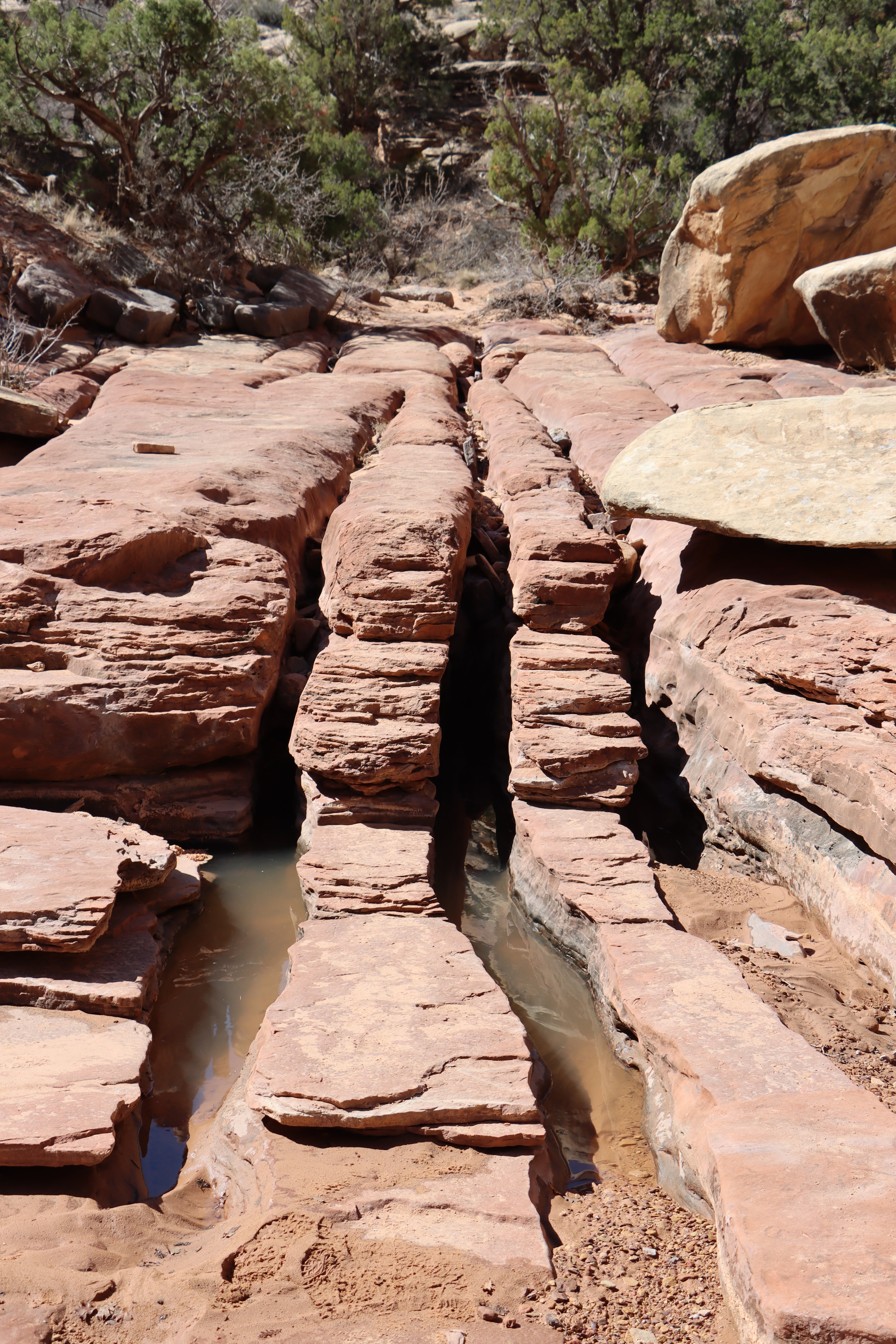
On the way to the arch I missed a cairn which meant I walked thought this pool. On the way back down I found the cairn track and by passed the pool.


The horizontal shaft of light indicates that this is a natural bridge.


On the drive out. The well named Wooden Shoe Arch.


I then decided to try a nine mile drive out to a Colorado River overlook. 4WD was recommended. The Subaru did just fine, but the last mile started to get rougher than I was comfortable with so I turned around.
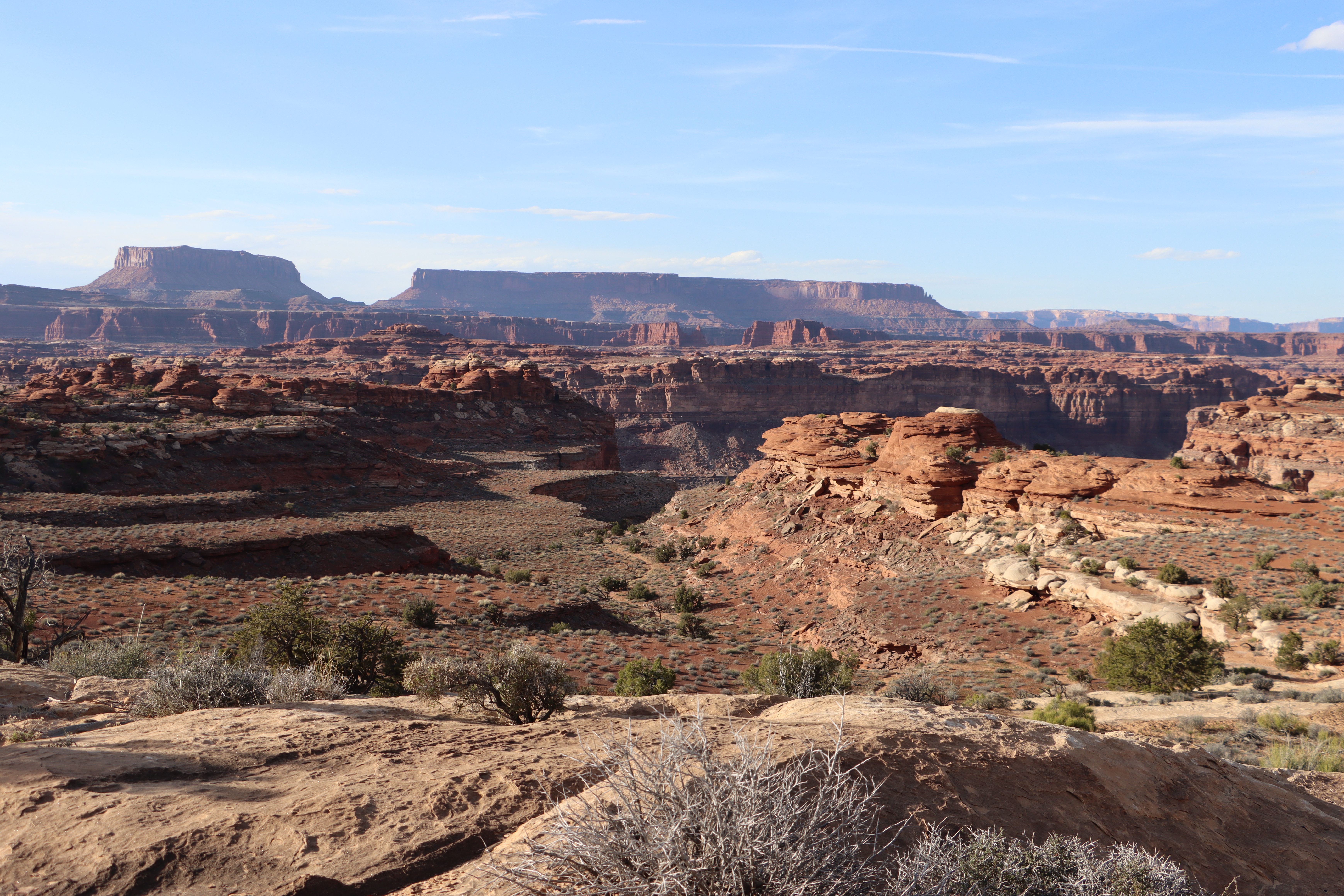
The Colorado River is out there some where.

The drive out of the park was beautiful. The dark red sandstone is my favorite.


Sunday morning I explored new territory. I headed to Moab and then down the Colorado River Canyon to Corona Arch. It is on BLM land but is an impressive arch worthy of National Park status.


It is a pleasant hike, similar in distance and elevation gain to the Delicate Arch hike.

Bow Tie Arch (left) and Corona Arch (right)


A RR cut through the red rock for potash hauling trains.


An island of green.


The hike bottle-necked at a chain assisted ascent and then a short ladder (which prevent many hikers with dogs to make it up to Corona).Some dogs were able to go up and around the ladder.

A cairn play ground.

I then hiked up to Pinto Arch. Not many hikers on that trail.


Pinto Arch


A cut for the potash RR line.

From the arches, I drove further down canyon to Potash to see if I could see the turquoise blue evaporation ponds that are easily seen from Dead Horse Point. https://beitemmett.blogspot.com/2016/05/utah-rocks-canyonlands-dead-horse-point.html

At the Potash facility with its two memorials to workers who died in mining accidents, I noticed a sign pointing towards the Shafer Trail Road that indicated that in 19 miles it ended up near the visitor Center in Canyonlnads. I checked my map and decided that this was a drive I wanted to make. It id not disappoint.


The evaporation ponds.


Dead Horse Point above.


There were cattle grazing down below. I could not figure how they or any vehicle got them there.


Delta formed by run off from Shafer Canyon. I'm sure in high water years this deposit is quickly washed away.

Panorama of the goose neck.
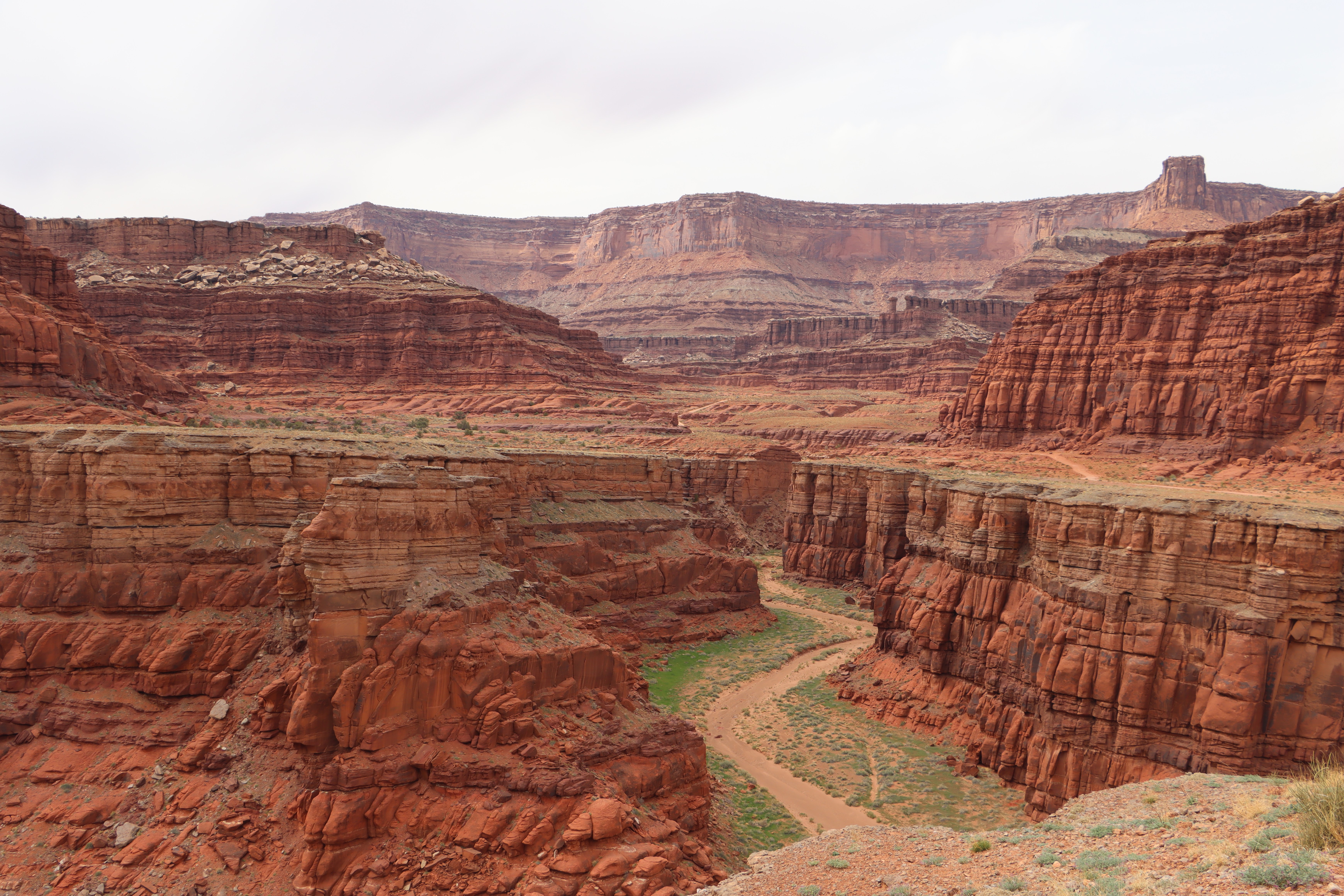
Shafer Canyon


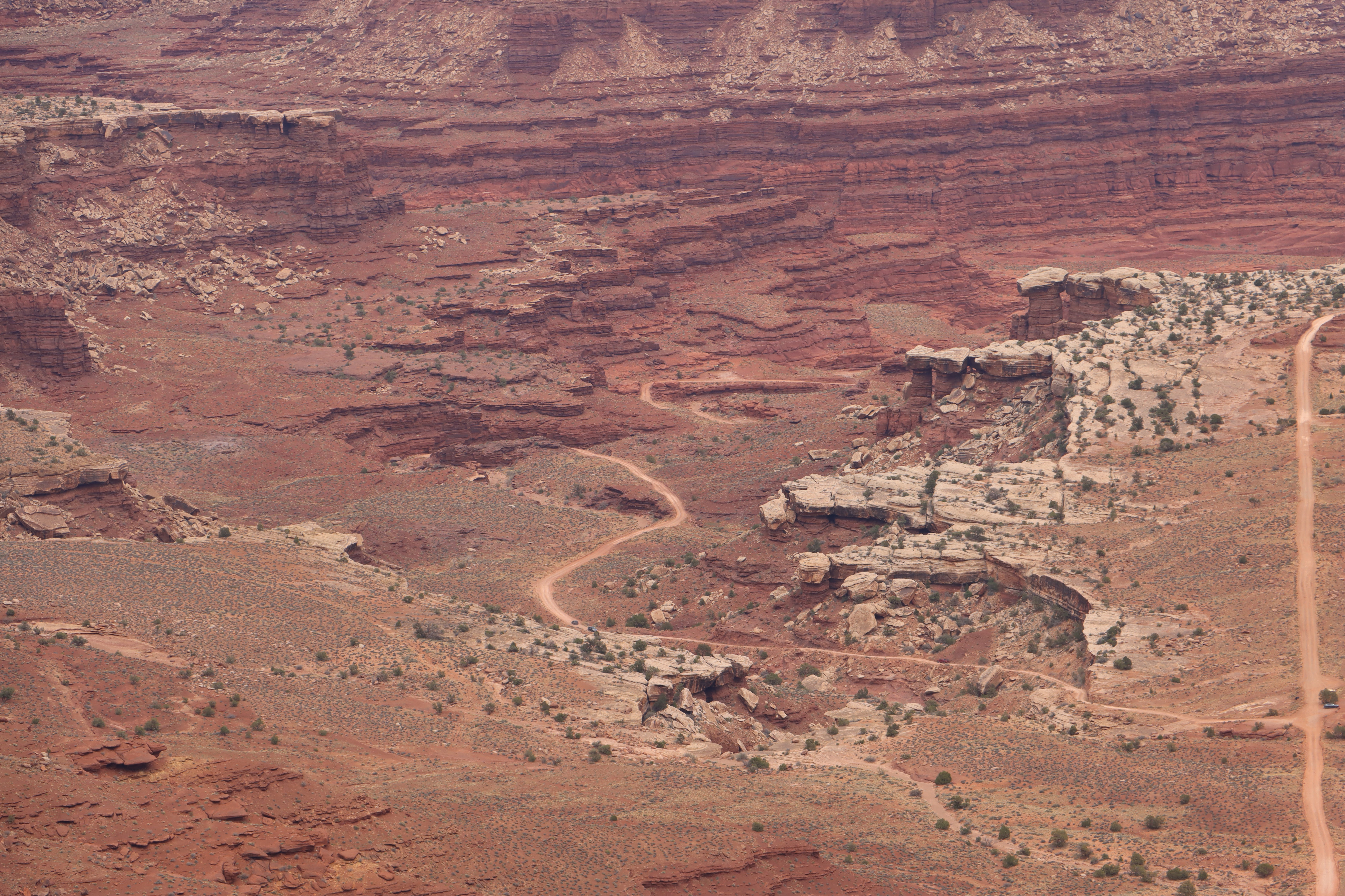
At this point I recognized what I had only seen from above, the road zig-zaging up the slope on the left.

You can barely seen the cuts across the slope.

It was a white knuckle, palm sweating drive for me. The switch backs were not that bad given that the slopes on either side of the road were not straight cliffs. I only encountered one car going up. It was going down and the driver kindly waited for me at one of the hairpin curves to let me pass.

View from the Shafer Road viewpoint in Canyonlands.


My first stop on the drive up was at the far point where the blue car is. I needed to take a breath and wipe my palms dry.
On the lower winding portion of the Shafer road in the the distance I passed a couple in a rental SUV who were stopped on the side of the road. I rolled down my window to check on them. They had a flat and had just pulled out the car manual to begin to make the tire change. They said they were fine so I rolled on.


Two other cars making the climb.

My last stop of the day was about 20 miles north of Moab on the east side of highway 191. A friend had recently shared an Arches National Park Instagram post about the Dalton Wells Site. I have visited two Japanese internment/concentration camps in the west and have even looked at maps showing them all. For some reason Dalton Wells is not included in the list of camps. From the description on the sign, this was a tragic place that seems mostly forgotten. The sign had been knocked over so I turned it upright so that others would have a easier time than me finding it.


No comments:
Post a Comment