
 From the south with Payson in the foreground.
From the southwest side of Utah Lake. Just to the left (north) of the tallest section (the highest point is the north point of that plateau looking section) is the lower lying saddle--which is the point where the two trail coming from the north and east finally reach the crest of the mountain.

Rising to 11,752 feet, Mt Timpanogos is the second highest peak of Utah's Wasatch Range. It is also a popular hike, with the Labor Day weekend being one of the busiest times. There are two trails to the top and people all have varying opinions about which route is the best and when is the best time to hike. Back in 1997, newlyweds Marie and I made the hike via the the Timpooneke trail beginning at about 3:00 AM so we could be on top for the sunrise. In 2009 I made a second assent with the Young Men in our ward. We left at about 6:00 AM in the cool of a July morning--also long the Timpooneke trail. Two years ago Sarah made her first attempt with the youth of the ward. They left early morning from the Aspen Grove base near Sundance on the Timpanogos trail. The group got started on the wrong trail and by the time they corrected and back tracked they only had time and energy to get as far as Emerald Lake. Ever since then Sarah has been wanting to give it another try. It was on her list to do this summer. Joel was also excited to give it a try. Reluctant Will decided the night before to give it a try, even though he has long protested about going on 'hikes". Marie who is a slow and steady hiker, decided to sit this one out lest she slow down the whole group.


We were out the door at 4:10 AM. Marie kindly volunteered to shuttle us there since parking is at a premium on summer weekends. Good thing she helped out, the lot at Timpooneke was full when we arrived. We set out at 5:00 AM with flash lights in hand. Early on we passed two groups of returning hikers who had gone up and back all in the dark. A nice way to avoid crowds and mid-day heat, but they missed all of the beautiful scenery.

First rest, in the dark.


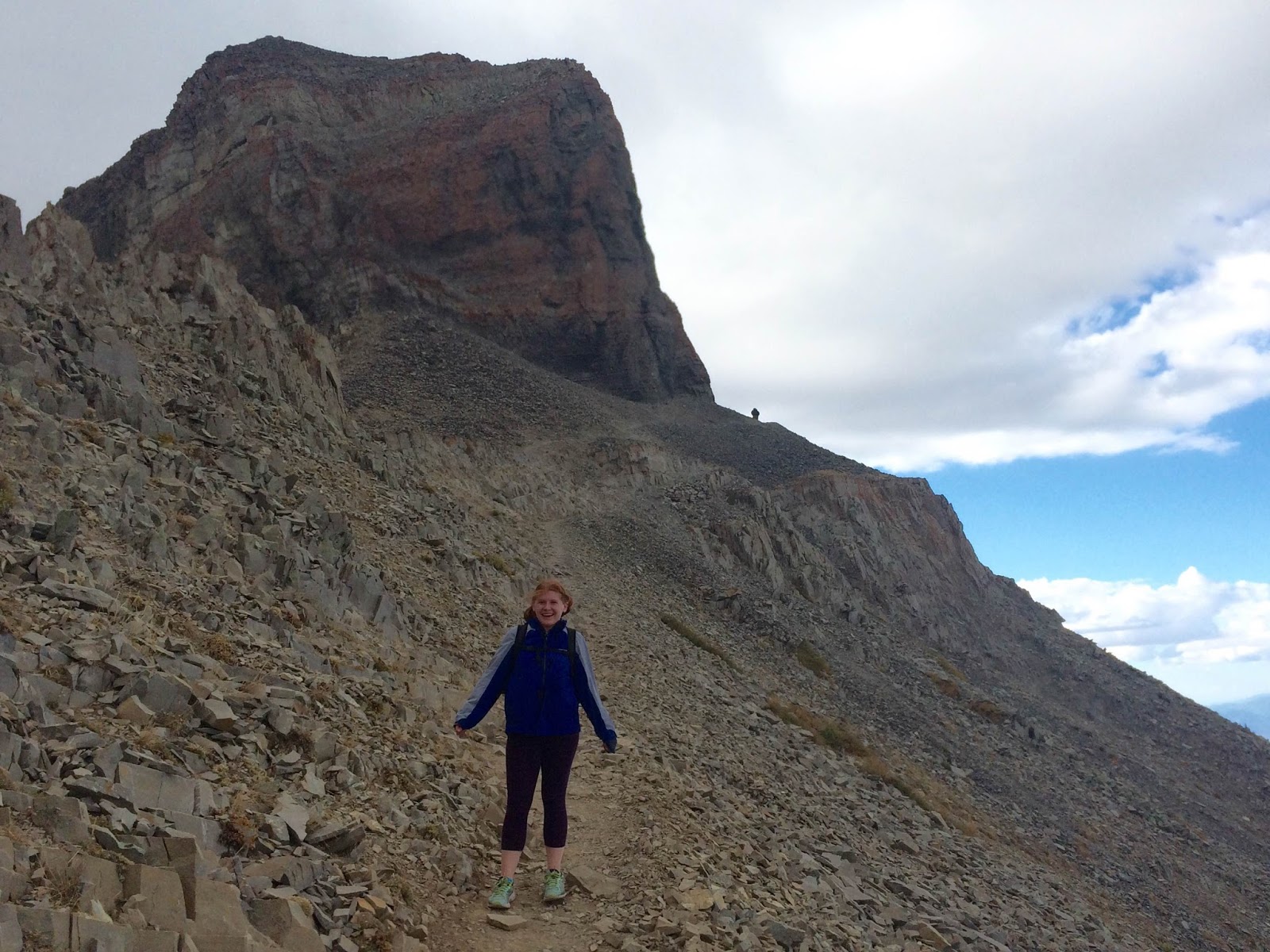
It was at about this point that Will figure out that after two hours of upward hiking there was still at least two-three hours left to go before we reached the summit. He started to grumble that he wouldn't have come had he know that it was such a LONG HIKE. I reminded him that I had explained the whole thing the night before including how long of a hike it was. I continued to patiently answer his questions every ten or so minutes about what time it was and how much longer it would take. Luckily a trip to the grocery store the night before had him well supplied with energizing snacks and food.

We had fun spotting pika in several of the large rocky slopes along the way. The non-hibernating pika harvest grass and other foods and store them in granaries in the rocks to eat during the long winters.


photo by Joel


Cold and strong westerly winds made us all glad we had brought an outer wind break layer.


Timp Summit looking South. Bishop Emmett on the right with the four leaders and four Teachers and Priests of the Spring Creek 18th ward during our high adventure. July 18th 2008.


For more photos of that climb go to this Flickr Album:
https://www.flickr.com/photos/79274436@N02/albums/72157630530343084/with/7550510702/

Unplanned, I wore this favorite shirt of mine on my last two Timp hikes--perhaps subconsciously in honor of my one great feat of mountaineer. I bought it in 1993 at the refuge shelter half way up the slope of Mt Cotopaxi in Ecuador. I was traveling in Latin America so I could be better prepared to teach my Latin American geography class. When my adventure travel group offered an add on hike up Cotopaxi, I happily decided to give it a try--even though my only other attempt at serious mountain climbing was with my brothers up through the snow field of Mt. Teewinot in the Grand Teton Range.


So cool, Chad! Thanks for sharing. Re: Cotopaxi: We didn't make it to the top, but we DROVE up the side of the volcano, which gets one pretty far! We were in Ecuador 1999-2001. Our daughter Susan graduated from, you guessed it, Cotopaxi Academy in Quito!
ReplyDelete