
For the past few years I have been wanting to climb Spanish Fork Peak.

We can see the mountain (called Maple Mountain) from our front yard so the lure was quite constant.

When we considered it as as family hike, descriptions of it being a difficult hike akin to hiking Mt. Timpanogos made us hike elsewhere. A few weeks ago, with no interest being shown from the boys, I decided to just do it on my own. I even went and bought hiking poles to aid in my descent. Then the smoke clouds from California fires rolled in again and so I waited to make the climb on a clearer day. That day was last Friday. I started the hike from Whiting Campground in Maple Canyon at 6:10 AM when the sky was just starting to show light.

I had looked at maps on line and it looked like a pretty straight shot.

It was soon light enough that I could turn off my headlamp and start to take photos. After taking the first of many photos of aspens, my favorite, I turned to head up the trail and was startled to see this bull moose 20 yards up the trail looking me over.


I hurried to take a few photos and then I stepped off the trail just in case he decided to head my way. I wasn't sure, but my memory seemed to recall that moose may charge (they do). I had read of a hiker earlier in the year who had seen a bear and cub on this hike. I wonder if the bear spray I was carrying in the outer pocket of my backpack worked on bull moose?

He had no interest in coming down towards me (hiding in the bushes from where I took this photo) and instead headed across the hillside.


Onward and upward. Upward indeed, the hike goes from an elevation of 5,612 feet to the summit of 10,192 feet


For the first three hours I hiked in the shade of the mountain among the Douglas fir, box elder and aspen trees.


It is 5.2 miles to the summit. I was surprised to see this first mile post and realize I had only gone one mile.


Here I got caught in a pine cone storm as a squirrel high up in a Douglas fir, rained down pine cones on where I was standing. I assume he was harvesting for the winter.


Perhaps my favorite photo of the day. I love how the orange berries stand out against the green and white.

Morning sun on the top of the east slope of Maple Mountain.


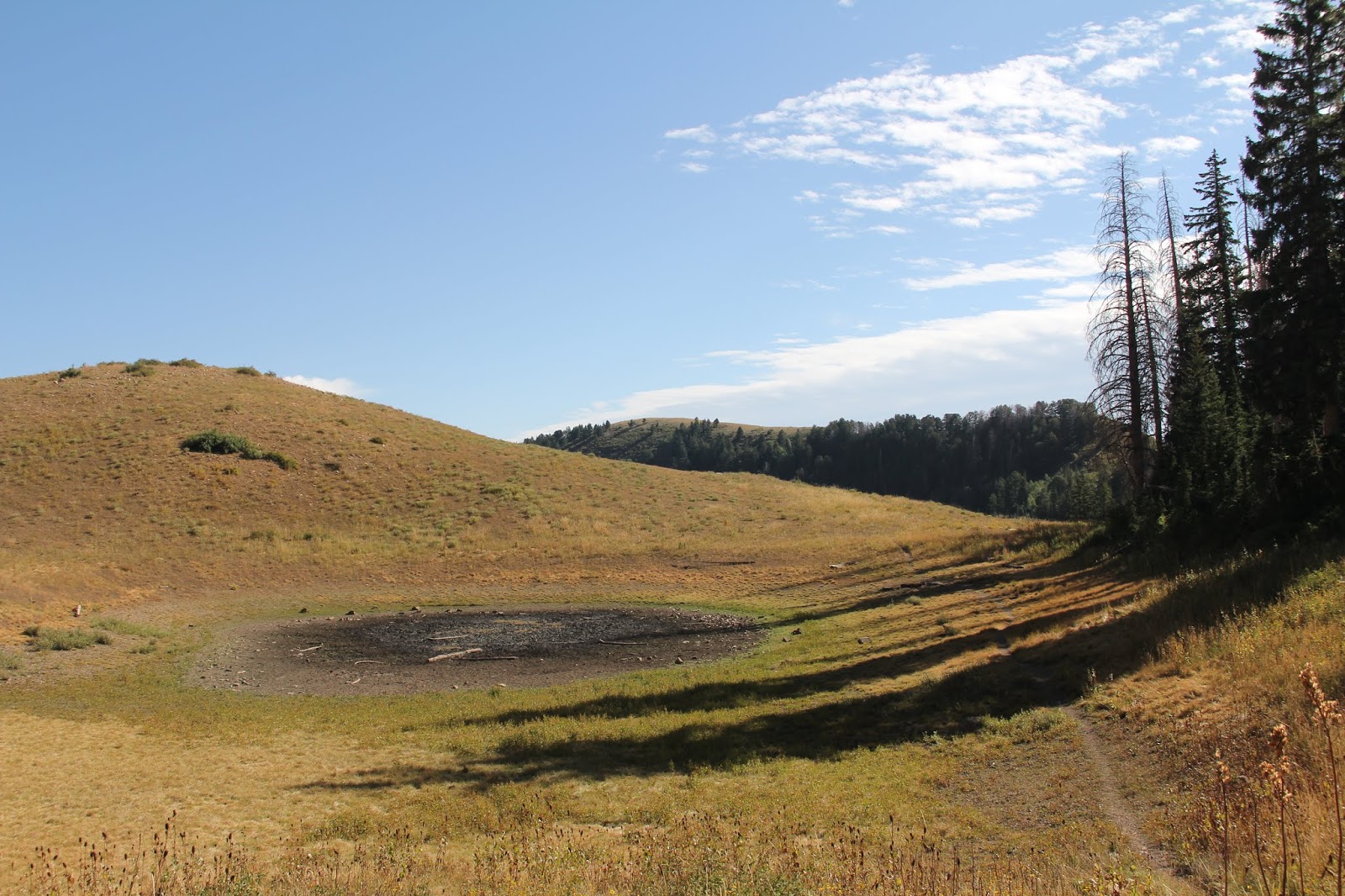
I rested in the shade by the lake and had a banana and some chocolate milk. Up to this point it had been a delightful, slow 4 1/2 hour hike with many photo stops along the way.


Sub alpine fir are hearty enough to survive at these higher elevations.

Climbing from the lake up to the crest things started to change--sun, more rocks, and steeper slopes.

First view of Utah Valley from the saddle on the crest of Maple Mountain. By now my left knee was starting to act up. My first thought was, "this is good enough, you've had a great view" no need to go any further. My second thought was "you're almost there, keep going." I kept going.


Here (where I noticed the broken base of the mile 4 marker) is where I wished I had down loaded a map on my phone. The trail diverged. I wasn't sure which was the right path.


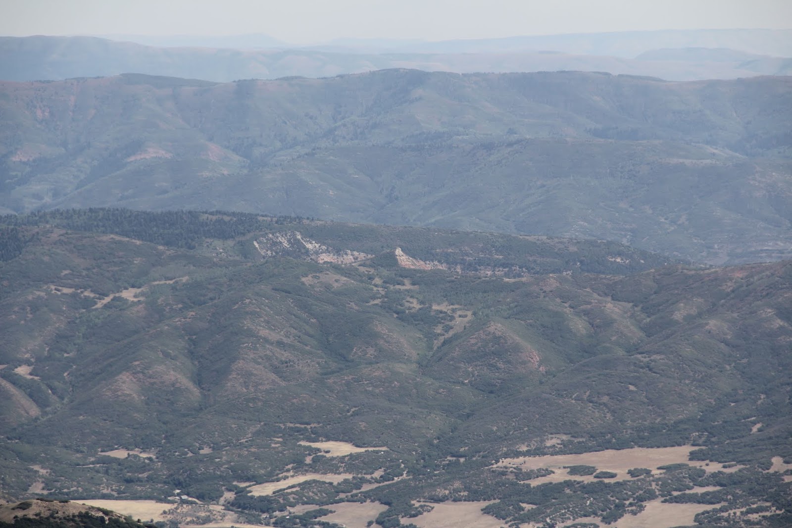
Looking southeast to Spanish Fork Canyon and US highway 6.


It was now time to descend. By now a headache was on the rise and both of my knees were revolting at having worked so hard. I always have a hard time descending after long rocky climbs like Mt Timpanogos or Mt Sinai. Luckily as I passed mile post 5 on the way down I saw a trail heading to the left. Since I now had Sprint coverage on top of the mountain, I googled a map and was able to see that the main trail did go out and around the lower peak and not down the steep rocky ridge. It was the trail that I first tried and abandoned. I was delighted. This way would be less trying on my knees.

About a half hour up the trail earlier that morning I realized I had left my new hiking poles at home. Rats. Near the saddle I found a fir branch that helped stabilize my slow painful descent down the steep trail from the saddle.

From near the lake I could now see the summit with barely visible pyramid and rock cairn, because I knew where and what to look for.

Downhill a hundred yards from the lake I met a father and his three children--the first and only hikers I encountered that day. They asked if the lake (their destination) was close. I could honestly say it was just over the nearby rise. The kids bounded off excitedly. The father looked relieved. Like me, I think he had overestimated his hiking ability and the steepness of the trail. I guess I need to hike more often and not think that climbing the stairs everyday to my 6th floor office is enough training for serious mountain climbing.

It took me over four hours to descend. I was fine on the flat sections but the slopes compounded with rocks were painful. Two Motrin didn't help at all. I had no appetite for any of my snacks. I felt nauseous. I felt tired.

Several times I just had to sit and rest (and doze). My muscles were fine. It was the tendons around the knees that didn't want to bend.

I had texted Marie to let her know I was dragging and that I would be (much) later than planned. Truth be told, back nearing the summit, when I knew I was in for a painful descent, I fantasized about finding a a stranded hiker at the top who needed immediate medical attention which meant I could call for help and then we could both get a rescue helicopter ride down. This has never been my state of mind on any hike.
The last two miles or so, I got to thinking about how enjoyable the morning hike up to the lake was--finally making this hike, the moose, the squirrels, the aspens, the cool, the chocolate milk. How things changed. Now all I could think about was how pathetic and miserable I was. I also thought about how life can be that way too. The excitement of a new school year or a new home; the fulfillment of getting a long anticipated job. Then somewhere miles along the trail or years into the journey of life things change, knees give out, headaches emerge and the joy and excitement once felt give way to thoughts of just get me off this mountain and down the trail. That's what I thought.


Then I stopped at Sodalious to get a caffeine laced Dr, Pepper with raspberry puree and cream. Then drove home to collapse on the couch to watch two episodes of Shetland on Netflix. By bedtime I was much recovered. Next day my knees were fine, but then my leg muscles started to stiffen. Tomorrow, Labor Day, we are planning a short family hike to Cecret Lake at Alta. I should be just fine by then.
No comments:
Post a Comment