
During our months couped up at home, I dreamed of post pandemic road trips. I hoped, before Joel's mission intermission was over, that all five of us could venture north to the national parks of the Dakotas or east to the national parks of Colorado. Unfortunately, with COVID19 cases still on the rise in much of the west we turned to plan B: a short road trip to the wilds of southern Utah where social distancing would be easy.

photo by Marie
Thursday July 2 we headed south on US highway 89 past the drowned town of Thistle (where a new home has finally been built), Fairview (home of governor candidate Spencer Cox), Ephraim, Manti (with a nice city park for our picnic lunch), Gunnison (home of Utah's second prison), and Salina. We then traveled Utah highway 24 past Sigurd, Utah Highway 62 via Koosharem (Piute name of the deep red clover that grows in the valley) and Grennwich (with a cute one room school), Utah 22 past Antimony (where we once took the youth of the ward for a youth conference) and through John's Valley where a new layer of loose gravel (thanks UDOT) deposited on this unpaved stretch of the road did not deter a large pickup truck towing a five wheeler from barreling towards us at 60 MPH sending a spray of gravel onto our car (I could tell it was going to happen), chipping our recently replaced windshield in two places--curses you clueless driver!, and finally Utah 12 from Bryce Canyon to Escalante where we checked in (faceless--they called and informed us that the key cards would be taped to our door for us) to the lovely Entrada Escalante Lodge.

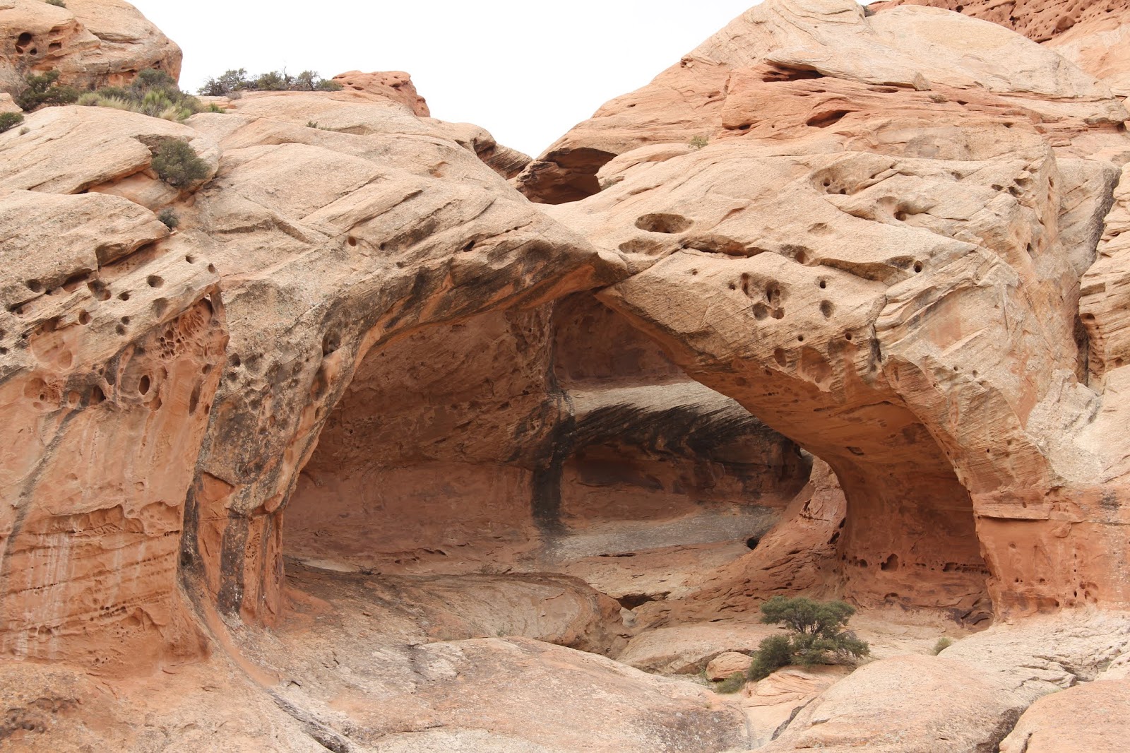
We then headed further north on Utah 12 into Grand Staircase Escalante National Monument (sadly reduced in size by the Trump Administration). Our options were to hike to either Lower Calf Creek Falls (six miles round trip, on a sandy trail to a lovely pool and water fall--but always a crowded destination) or Upper Calf Creek Falls (two miles round trip, with a water fall, three pools and cliffs for jumping on a less crowded trail but with a tough climb back out). We opted, for differing reasons, the social distancing and cliff jumping option. It was a great choice.
 |
Starting down the trail on white slick rock.
 |


Cairns of rocks marked much of the route. The cairn in the center marked the fork in the trail. To the right leads to the upper pools, to the left down to the falls. Coming back back from the upper pools we missed this turn and had to do some back tracking. We then added a second cairn on the left to indicate that there are two options.


photo by Marie


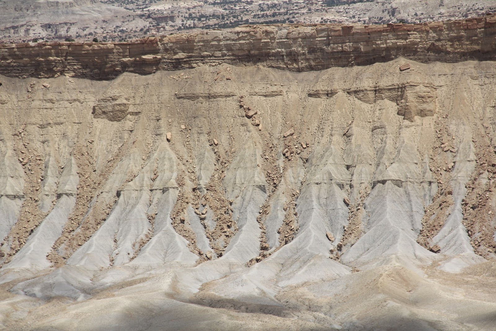
Driving back to Escalante (for take out dinner) we stopped at the Head of Rocks Overlook which looks northeastward across the Escalante portion of GSE national monument. The road from Escalante to Boulder is one of the most beautiful highways in America.


Next morning (after cold cereal for breakfast) we headed north again along amazing highway 12.


"Boulder was the last incorporated town in the continental US to receive its mail delivery via mule train." That ended in 1940 with the completion of a CCC built road linking Boulder with Escalante so that the mail could be delivered year round by automobile.


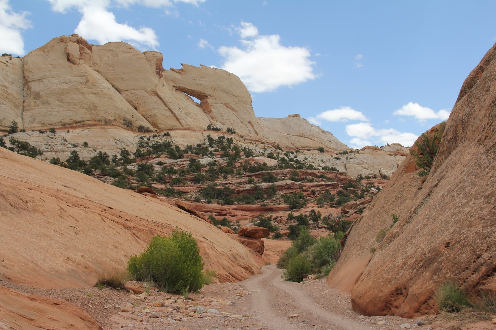
Following the Burr Trail (originally a cattle herding trail) was a first time for all of us. The mid section of the road traverses spectacular Long Canyon. It was a surprising part of the drive that I had never heard about. Its towering red walls reminded me of Lake Powell scenery, but seen while driving, not boating.


Once inside of Capitol Reef National Park we detoured off of the Burr Trail and headed north for three miles along the rough Muley Canyon Road. We parked and picnicked at the trail heads--we opted to hike the short and flat Strike Valley Overlook Trail.


Pre-hike Dr. Pepper. Photo by Will.


photo by Will


The Burr Switchbacks. Pretty cool


Switchbacks, lower center.

You can see the top three cuts across the face.

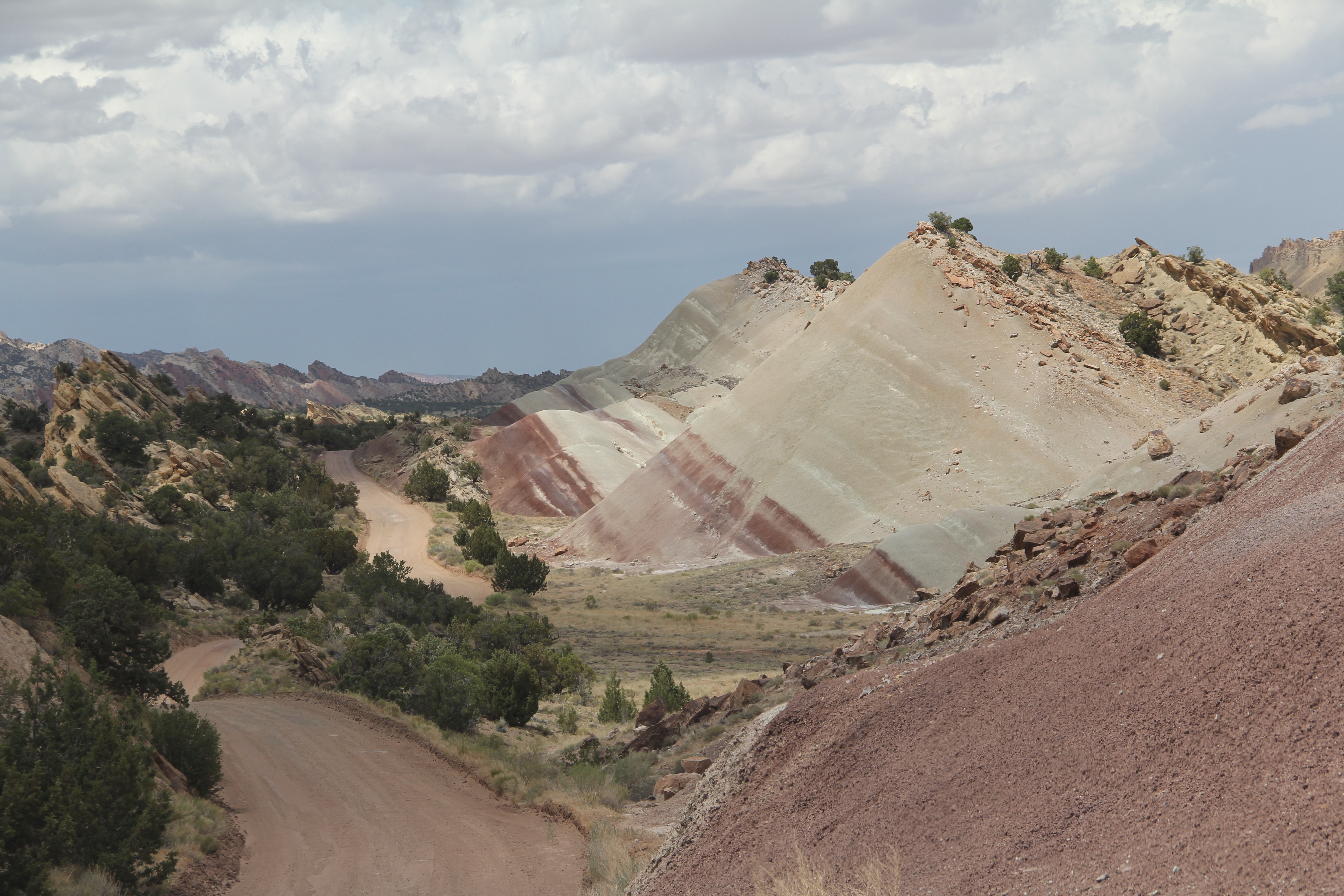

Notom Road

We have been to Capital Reef before (see more here: https://beitemmett.blogspot.com/2016/06/utah-rocks-goblin-valley-and-capitol.html ) so we chose a new hike--Grand Wash. When we arrived it was threatening rain so we decided to detour to the restrooms first. When we got back the skies were mostly clear. As we walked up the wide wash I kept pointing out high ground on the sides if we did need to hurry to high ground.

On the higher ground we noticed some desert bighorn sheep: four ewes and three lambs.

The three lambs and a ewe appeared up higher on the cliff area.


Eventually the ewe and two lambs descended down to the grassy knoll to graze leaving one lamb alone up above.


We stood and worry watched the lamb hoping that it would turn around and head back to a safe place to descend.


Down below and seemingly unaware that in the eyes of the intruding humans, a youngster up above was in a dangerous situation.

The lamb kept moving leftward to the steep cliff area.

It didn't seem bothered.

Watching the drama.

Finally the lamb started to head back the other way.

It was proving its agility.


The all at once it started down what seemed like a smooth cliff face.

Just a couple of sure footed hops


And it was down with the herd.


A few hundred meters up the wash and it started to rain.

We hoped it was just a short passing storm of sprinkles.


But it kept coming.

Soon waterfalls were streaming off of the cliffs.

I wasn't too worried, there was lots of high ground around us.

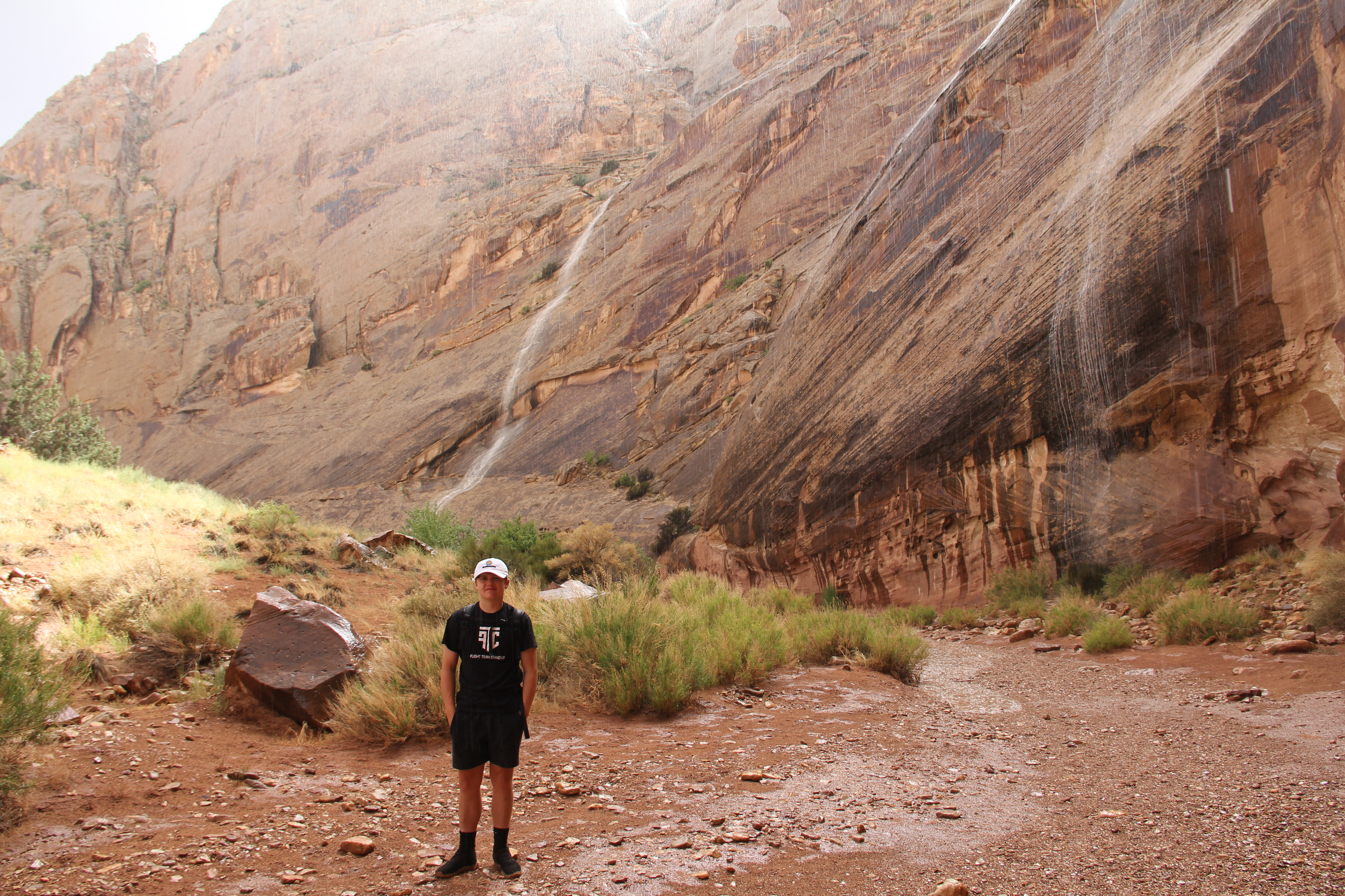
Soon a slow stream of water started to creep down the canyon.


A couple who also sought refuge under the overhang offered to take our photo. Then Marie and Sarah decided it was time to go.


It was a fickle rain storm--sprinkles, then cats and dogs, then sunshine, then repeat.


Crevice water fall.


At the entrance to Grand Wash a reminder about flash floods. Next visit we will give it another try.


That night in Torry we had takeout burgers from Sliders and then Will and I went swimming in between more rain storms.

Next morning driving towards Loa we saw this guy feasting on road kill carrion on the side of the road. I thought it might be one of the California Condors that have been released into southern Utah over the years so we swung back around to get a closer look. It left its breakfast for a safer perch.

Cool looking LDS Chapel in Loa.

From Loa we headed north on Utah highway 72. Fremont along the way was a beautiful farm town surrounded by green alfalfa fields watered with irrigation from the Fremont River. At the summit there were sage brush and aspens to the west on the windward side of the mountains.

To the east, from the desert view overlook, we could look down on the northernmost section of Capitol Reef.

Eventually 72 connected with I-70 so we used the interestate for the first time on the trip to get us across the San Rafael Swell. The kids were sleeping so we skipped two nice view points before stopping at Ghost Rock rest stop. We then took the next exit (131) and headed north into the San Rafael Swell.

The two day old chip in the wind shield is still always in the middle of my view.


The approach to the San Rafael River and the beginning of Buckhorn Draw.

Bottleneck Peak.

The green of the San Rafael river as it leaves the Little Grand Canyon. About 22 years ago faculty from the BYU geography department canoed down the river through the Little Grand Canyon finishing up at Buckhorn Draw. In some places the river was so shallow we had to get out and pull the canoes.


We all enjoyed a stop at the Buckhorn Draw Rock Art site


There were no other people around, but Will wanted to poke fun at some of us who seem to him as being overly cautious at wearing masks when people are around.


Some people.


The view of the Little Grand Canyon from the Wedge on the north rim. The boys and I camped here with the scouts about seven years ago.


The San Rafael River


The distant green patch is where we crossed the river into Buckhorn Draw.

From the Wedge we headed across the Swell on a well maintained dirt road. Stopped in Castle Dale for our final picnic lunch. Then we decided to head for home via Huntington Canyon and Fariview Canyon (Utah 31). First time for all of us. It was a pleasant surprise. Reminded me of Logan Canyon with its river, aspens and pines--a nice contrast to the sandstone, sage and cedar of the rest of the trip. It was a busy day in the Wasatch Plateau. Families were celebrating the Fourth of July paddle boarding and canoeing in the various reservoirs, riding ATVs, picnicking, camping and sight seeing (like us). It was a great trip.
No comments:
Post a Comment