
Two weeks ago while Marie was at an Indian cooking demonstration/luncheon with friends and while Sarah was swimming at a hotel in Jericho with a friend, I took Joel and Will for a repeat visit to Hezekiah's tunnel. A week later, Marie, Will and I made another visit with the BYU students. I have combined photos from those two and a few other visits to give a general overview of the City of David--a national park that includes Hezekiah's Tunnel and many other excavations from Old Testament times. The national park is run by a very nationalist/Zionist group of settlers who see this location in Jerusalem as the point "where it all began", meaning the point at which the Jewish attachment to Jerusalem began.
 This exhibit in the park shows a model of the ancient city of David surrounded on the east (right) by the Kidron Valley and on the west (left) by the Tyroppean/Central valley. The upper photo shows the modern day location of the City of David which is outside the city walls to the south of Dung Gate and the Temple Mount. It is a mostly Arab neighborhood, but in the past few years more and more Jews have moved into the area--thus making it one of the most contended and controversial areas in Jerusalem.
 The student tour began with a very nice 3-D movie (Will jumped when it looked like two doves were going to fly into his face) about David's conquest of the Jebustie city via the gutter, the building of the temple by Solomon, the building of the water conduit by Hezekiah, the Babylonian conquest etc. My only problem is the ending of the movie in which the growth of the modern day city of Jerusalem is shown via the placement of historic sites on a growing map of the city. Not one Muslim/Christian/Arab site is shown. It is as if Jerusalem's history is only about Jews.
This photo of Area G is taken from the upper level of the site where it is assumed the palace of David was located. There are some ruins of the foundations of the palace to see, but they aren't much. The interesting thing to note from this upper level is the view David would have had from his palace down on the lower levels and homes of city. Here you can see the large retaining wall (Millo) sloping down to the remains of some Israelite homes.

Bullae (wax seals) dating back to the times of Jeremiah (as determined by names on the bullae) were found in this area. The two story house on the left is called the house of Ahiel after one of the names on a potsherd found in the dig. The wall at the uppermost point is a remnant of the Wall build by Nehemiah when the Jews returned from Babylon. When enemies tried to get Nehemiah to come down from building the wall he told them "I cannot come down" for I am doing a great work (see Pres. Uchtdorf's talk from general conference priesthood session).

Next to the house of Ahiel is a stone toilet seat (with round hole) that was set over a pit. Next to it is the Burnt house where a layer of ash and cinders from the Babylonia destruction were found. Lehi and his family were able to flee the city before the Babylonian destruction, but not until Nephi sneaked into the city to get the brass plates--perhaps Laban's house was in this area.
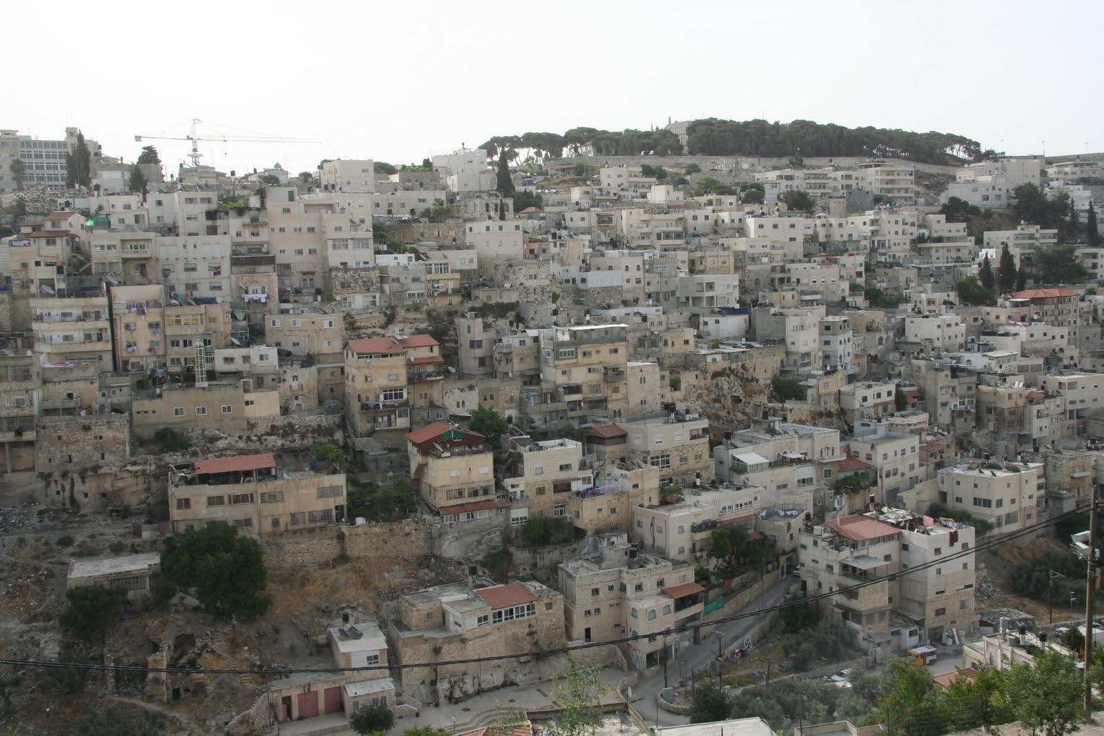
Looking across the Kidron valley to the Arab neighborhood of Silwan gives a nice visual depiction of how David's city may of looked. It is easy to see how David could have looked down on a bathing Bathsheba.
 This model shows the water system of the city. The upper gold tunnel brought city dwellers down to Warren's (the archeologist who excavated this area) shaft where they would lower down water containers into the Gihon Spring. It is easy to see why Jerusalem was located at this site--a constant source of water on a defensible hill.
Walking down the Canaanite tunnel
 Looking down Warren's Shaft--most likely the "gutter" through which David's men were able to climb up and conquer the Jebusite city. The establishment of Jerusalem as the new capital of Israel was a great geo-political move. By making the Jebusite stronghold his capital David showed no favoritism to any one tribe. It was also centrally located. This compromise capital is much like Ottawa, Canada, Canberra, Australia, Washington DC and Abuja, Nigeria--all of which were established as capitals to help unite rival regions and powers.
These recent excavations are of the water tower that was built to protect the waters of the Gihon Spring from invaders.
 This is the old entrance into Hezekiah's tunnel. It comes down from the Kidron Valley. Marie and I entered this way back in 1997 on part III of our honeymoon. It was a Friday and the tunnel had just closed. I used my limited Arabic to tell the Arab gate keeper that we were on our honeymoon and really wanted to go through the tunnel. He relented and let us in. The only problem is that he failed to tell (according to Marie's account) the man at the other end that we were coming through so when we got to the end of the tunnel we were locked in on both ends. Marie thought we would be there all night. I figured the guard was playing a joke on us so I called out and soon the smiling gate keeper came to rescue us.
 The Cannanite tunnel is currently dry--and thus used by tourists who don't want to get wet. It predates Hezekiah's tunnel which was used to channel water to agricultural plots in the Kidron Valley.
 The boys and I followed some Southern Baptist Christians through the tunnel. We were followed by a very noisy group of Israeli schoolkids on a field trip
 At some points the tunnel is low enough that I bump my head, but towards the end it is quite tall.
 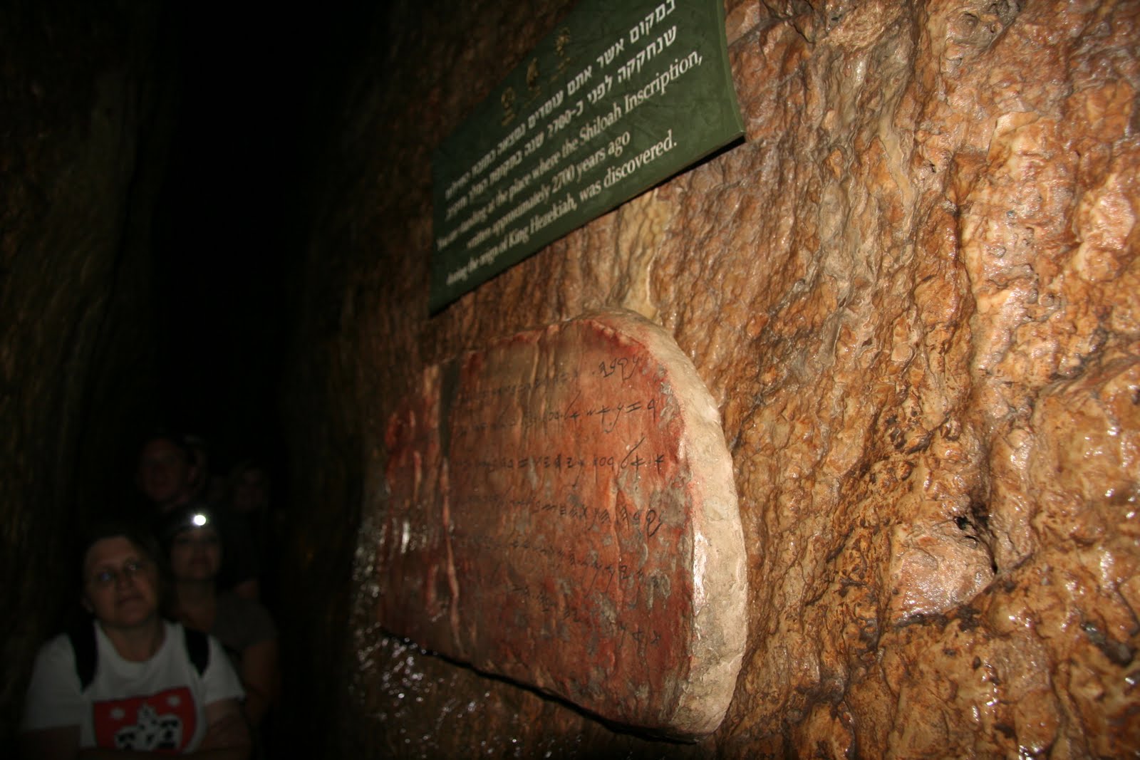 A new addition in the past few months is this replica of an inscription written by the workers, who started at both ends, in which they describe their coming together "pick against pick" and the flowing of the water from Gihon to the pool of Siloam. The original is located in an Istanbul Museum. Hezekiah had the tunnel built so that Jerusalem could withstand an Assyrian invasion and siege. By building the tunnel the waters of the vulnerable Gihon spring were brought safely within the walls of the city.
 The tunnel exits at this Byzantine Pool of Siloam. It is an Isalmic Waqf (trust). An interesting arrangement--Israelis now control the entrance but Muslims still control the exit. Arab kids from the neighborhood were enjoying a Sunday morning swim.
 Just beyond the Byzantine pool is the Roman era pool. This pool is also a fairly recent find. It is to here that the blind man came to be healed after his eyes had been anointed by Jesus further up the hill near the temple.
 A nice mural of how the pool may have looked during the time of Jesus.
 Near the pools are some more new excavations. Here are Roman era stone steps (much wider--only a small portion is exposed) that were most likely the main thoroughfare from Siloam up to the temple and thus the path trod by the blind man (most likely Jesus too)
 Further up the slope the road tunnel connects with this tunnel that was located underneath the Roman road. It was most likely used to channel run off or sewage out of the city. It may also have been used as an escape route during the Roman siege and destruction of Jerusalem.
 When I visited the city of David in 1997 the excavation of this tunnel had been halted because it passed underneath this mosque.
  Arabs had even set up a tent across the street to protest these archeological digs. Apparently the digs proceeded and now the tunnel passes under the mosque.
 Also included within the City of David is the Meyuhas house which was built in 1873 by a Yemenite Jew who wanted to escape the crowdedness and filth of the Old City. It was one of the first Jewish homes to be located outside the city walls. I like the man's description of why he moved. One of his main motives was to be able to drink of "living waters" from the Gihon spring and not from the murky water of the old city's cisterns. Jeremiah makes a similar comparison between living and cistern waters.
 Here is a view of the Meyuhas house--once again inhabited by a Jewish family--with Silwan and the Kidron Valley behind.
 The student trip to the Valley of Elah was interesting in that the green grain fields from January are now stubble.
 And the field of red, yellow and green pepper plants from last September is now newly planted with tomatoes. Notice the drip irrigation tubes.
The yellow plastic helps keep the moisture that drips in the ground from evaporating so fast in the hot summer sun.
 For a faculty field trip we went to visit Nebi Musa--where Muslims believe the Prophet Moses is buried. It is located just south of the Jerusalem to Jericho road. Its many domes are visible from the road and every time I have passed it I have wanted to visit.
 Much of the shrine is surrounded by a large Muslim cemetery. In modern times the shrine has hosted an annual Palestinian Nationalist festival.
The tomb is in the vicinity of where the Bible says Moses died, but it is on the west side of the Jordan River. Maybe Mormons should declare a spot for where Moses was translated. The cenotaph of the tomb is located in the green domed mosque.
 Notice the solar powered light.
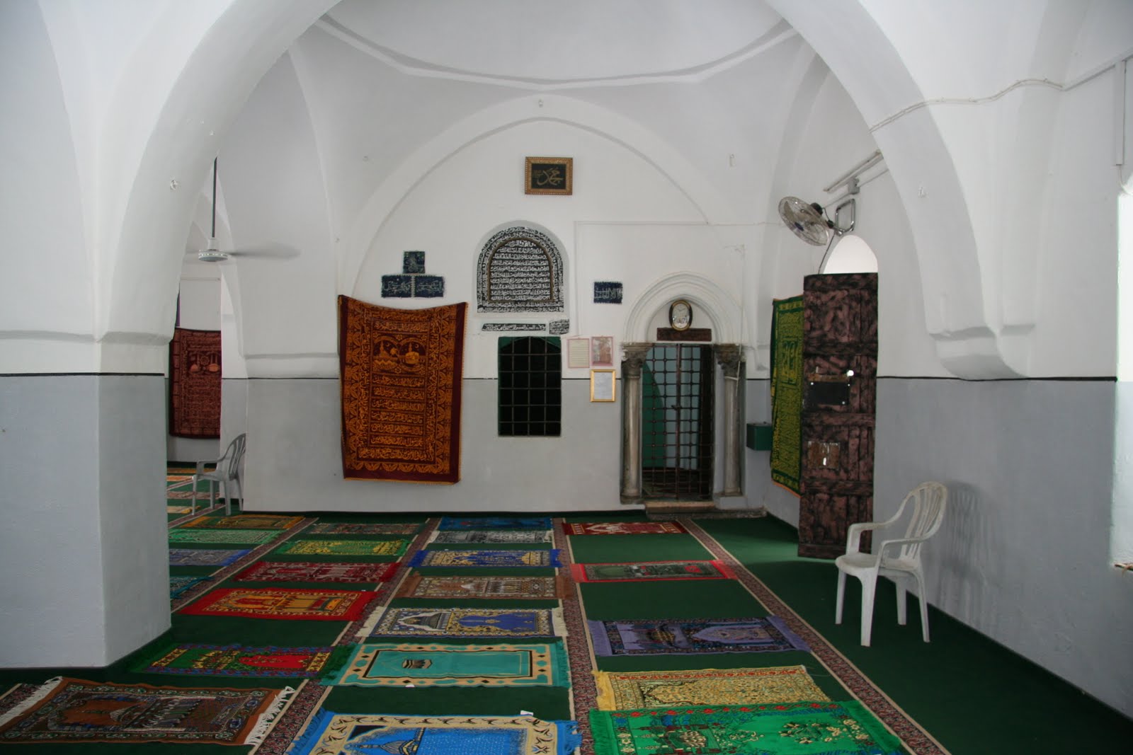
 Here lies Moses! May he rest in peace after shepherding the wandering, murmuring Israelites for 40 years.
 The Judean wilderness near the tomb.
 An Israeli military camp a few miles south of the tomb.
 The faculty then headed to Jericho to visited a few more new sites. This monument at the southern entrance to the town is in honor of the many Palestinian refugees who fled their homes during the 48 war with keys in their pockets and plans to return when the war was over. Many of the 48 refugees ended up in Jericho only to flee again in 1967.
Your US tax dollars at work. In an effort to win the hearts of Muslims, Arabs and Palestinians Pres. Bush established outreach programs in the Middle East. One USAID Program has improved the road along the southern entrance into Jericho. No need to improve the other entrances, they are all blocked by Israel. This is the only road in and out of town. Not only does it make it more difficult for locals to get around, it significantly lowers the visit of tourist buses that used to drive through town while coming and going between Jerusalem and the Galilee.
 This is the Greek Orthodox Church in Jericho. It has a large sycamore tree and a shrine around the base of another sycamore tree.
 I'm not sure but I think this is supposed to be the tree that the publican Zachaesus climbed to see Jesus as he passed through town.
 The sycamore tree of the Bible is actually a species of fig tree.
 I loved the brightly colored interior of the church.
 The hand blown glass bulbs are made in Hebron. I have always like the dark blue glass from Hebron--we have vases and Christmas tree ornaments in this dark blue.
 In another effort to stimulate tourist economy of Jericho a Norwegian entity has helped finance the re-furbishing of Elisha's spring.
 This spring in now open to the public for visits. All of the water for the oasis city of Jericho comes from this spring. This spring is the reason Jericho even exists. Elisha healed this spring by pouring salt into it.
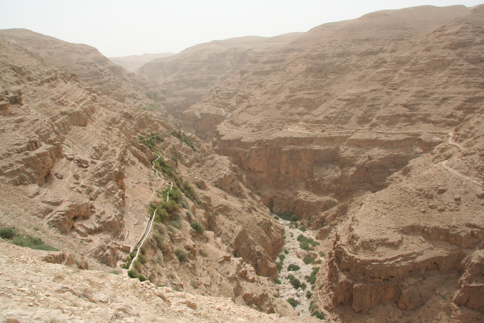 We planned to return to Jerusalem via the winding road up Wadi Qelt in hopes of seeing St. George's monastery, but half way up the canyon the road was barricaded. The water channel on the left goes back to the time of Herod who used it to bring water to his Jericho palace--complete with a swimming pool.
 On Saturday June 5th Will graduated from the Mahaba pre-school at Augusta Victoria. Marie led the children in several songs she has taught them during the year and then she played the guitar and sang "the Lord said to Noah there's gonna be a floody floody" while the kids acted out the song. Will held up a yellow ball at the end to represent the "Sunny, Sunny, Sunny". It was pretty cute.
 Will and Joel playing with some of the students in the central stairway. They were using a firing PlayMobile canon to try and knock down action figures some of which were worth more points than others. Our apartment is down the hall to the left just past the level 5 sign.
 On Sunday June 6th we walked down to the Old City to do some more exploring. We stopped at the 3rd and 4th stations of the cross.
 The third station is where Jesus fell while carrying his cross.
 In the dome above the entry is an interesting painting. It reminds me of the command to take up our cross and follow Jesus.
 The fourth station is where Jesus sees his mother. This is an Armenian Catholic church.
 We then walked to the Jewish Quarter where we tried to visit the Temple Institute which has a display of temple objects that have been readied for the one-day building of the third temple. Unfortunately groups were already scheduled for the next few hours so we opted to come back another day.
 We then visited the new Aish ha-Torah (living Torah) Center. It is in a new building with a spectacular roof top view of the Western Wall and Temple Mount/Haram al-Sharif. The large model of the Second Temple is very nice.

 The excavations in the lower left are of more Herodian/Roman pavement.
 The skyline of the Jewish quarter. Most of the quarter was destroyed during the 1948 -67 Jordanian control of the city. Since 1967 the quarter has been rebuilt.
 Inside the Torah center is a sculpture by Chihuly, the same sculptor who did some Salt Lake Olympic sculptures.
 We then tried to visit the recently open Hurva Synagogue. The original was blowup by Arabs during the 48 war. For years one remaining arch from the old synagogue stood as a memorial. The white dome is a nice addition to the sky line of Jerusalem. When the rebuilding of the synagogue was announced, the plan was to have a central synagogue in the Old City for all Jews and tourists to visit. We learned that to enter the building you need to call and make reservations for a tour. Interestingly a few days later the Jerusalem Post published an article lamenting the fact that an orthodox group of Jews has in a sense commandeered control of the synagogue and are making it very difficult for other Jews and tourists to visit.
 Leaving the quarter we climbed up to take a look at the roof top passage that Jewish residents of the Muslim quarter use to safely get to their homes.
 They climb up the stairs on the edge of the Jewish Quarter and then walk along the roof top of the suq/market below in the Muslim Quarter.
We are pretty sure we never did know much of the history that you listed and also that we have forgotten much of what we did know at one time.
ReplyDeleteThank you for all of the slides showing the area and your explanation of where they were taken. Very interesting!
So much of the City of David and the tunnel in Jericho has been built up and explored since I've been there. That was great to see the new stuff.
ReplyDeletePS - Here I am very jealous and envious that Marie was able to attend (what must have been) an amazing course on cooking Indian food/luncheon. I'm getting hungry at the thought...
I need to contact to you for a photograph i want to use in a book i´m writing.
ReplyDeletehttp://3.bp.blogspot.com/_OXnVCE6w31c/TA9TL9oiICI/AAAAAAAACl0/iyeeqcw6Bj8/s400/IMG_1544.JPG
My email: davidbodego@gmail.com
Greetings,
ReplyDeleteMay I use your photograph of looking down "Warren's Shaft" in a YouTube video and I am making on Sacred Architecture please? It is a non-profit, non-denominational Christian video designed to help people see where Solomon's Temple was built based on the location of the Gihon Spring. I am a retired teacher now sharing my research on line.
Thank you for your consideration,
Mr. Val Brinkerhoff
lostwisdomseeker@hushmail.com